Easington nr. Watlington / Esidone
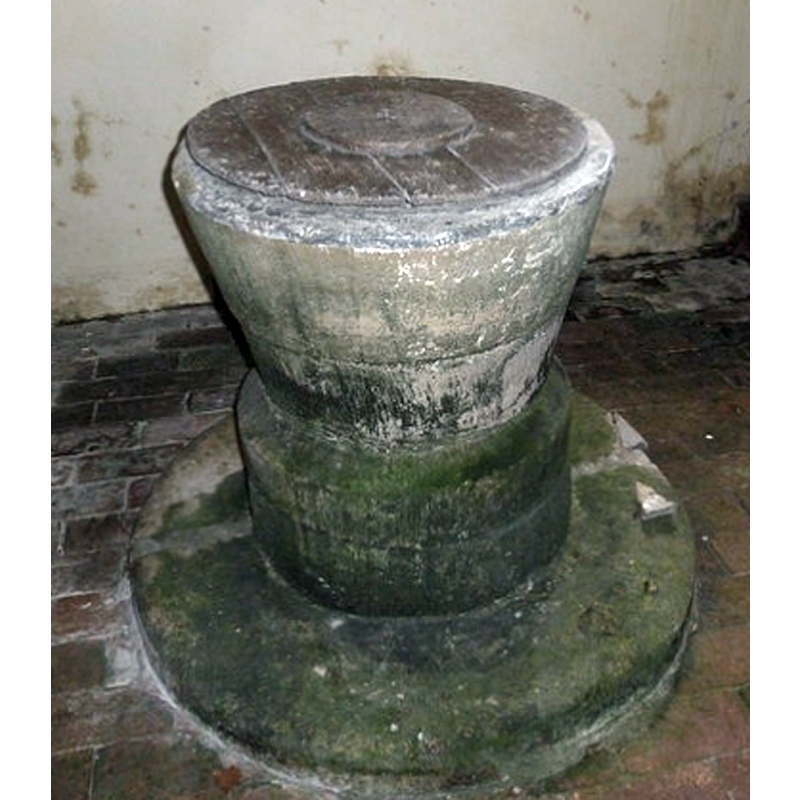
Image copyright © Basher Eyre, 2014
CC-BY-SA-2.0
Results: 7 records
view of font and cover - upper view
Copyright Statement: Image copyright © Basher Eyre, 2014
Image Source: digital photograph taken 17 April 2014 by Basher Eyre [www.geograph.org.uk/photo/3980478] [accessed 27 July 2014]
Copyright Instructions: CC-BY-SA-2.0
view of font and cover
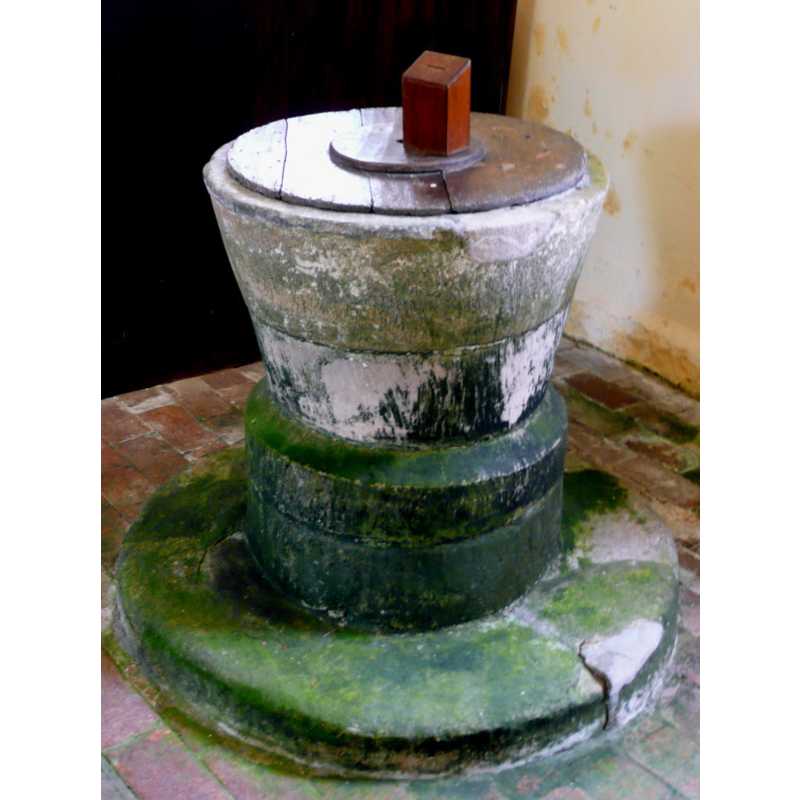
Copyright Statement: Image copyright © John Ward, 2008
Image Source: digital photograph taken 1 September 2008 by John Ward [http://www.flickr.com/photos/oxfordshirechurches/2821582889/] [acceaassed 1 May 2009]
Copyright Instructions: Standing permission
view of church exterior - northeast view
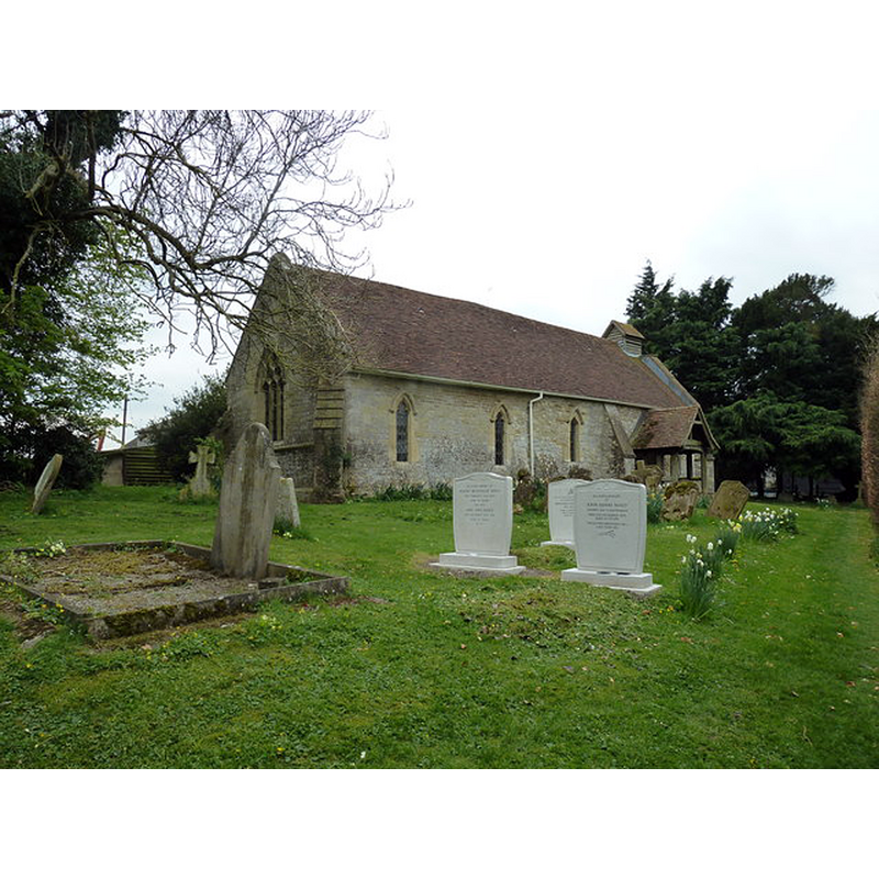
Copyright Statement: Image copyright © Basher Eyre, 2014
Image Source: digital photograph taken 17 April 2014 by Basher Eyre [www.geograph.org.uk/photo/3937713] [accessed 27 July 2014]
Copyright Instructions: CC-BY-SA-2.0
view of church exterior - southeast view
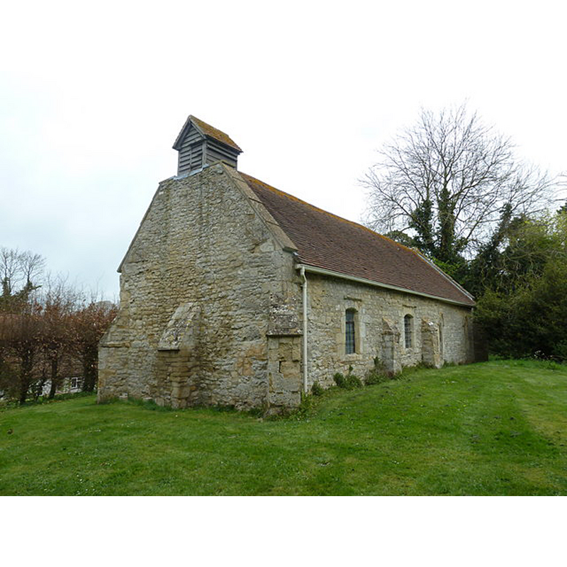
Copyright Statement: Image copyright © Basher Eyre, 2014
Image Source: digital photograph taken 17 April 2014 by Basher Eyre [www.geograph.org.uk/photo/3980464] [accessed 27 July 2014]
Copyright Instructions: CC-BY-SA-2.0
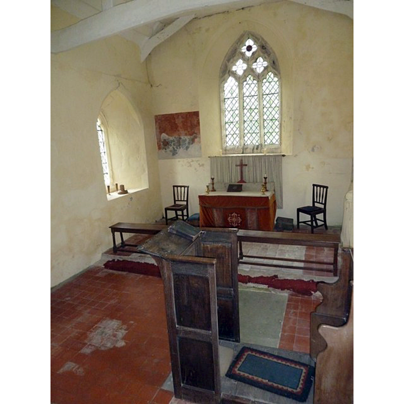
view of church interior - nave - looking west
![the font is partially visible on the left [south] side, behind the third pew](/static-50478a99ec6f36a15d6234548c59f63da52304e5/compressed/1140727019_compressed.png)
Scene Description: the font is partially visible on the left [south] side, behind the third pew
Copyright Statement: Image copyright © Basher Eyre, 2014
Image Source: digital photograph taken 17 April 2014 by Basher Eyre [www.geograph.org.uk/photo/3980498] [accessed 27 July 2014]
Copyright Instructions: CC-BY-SA-2.0
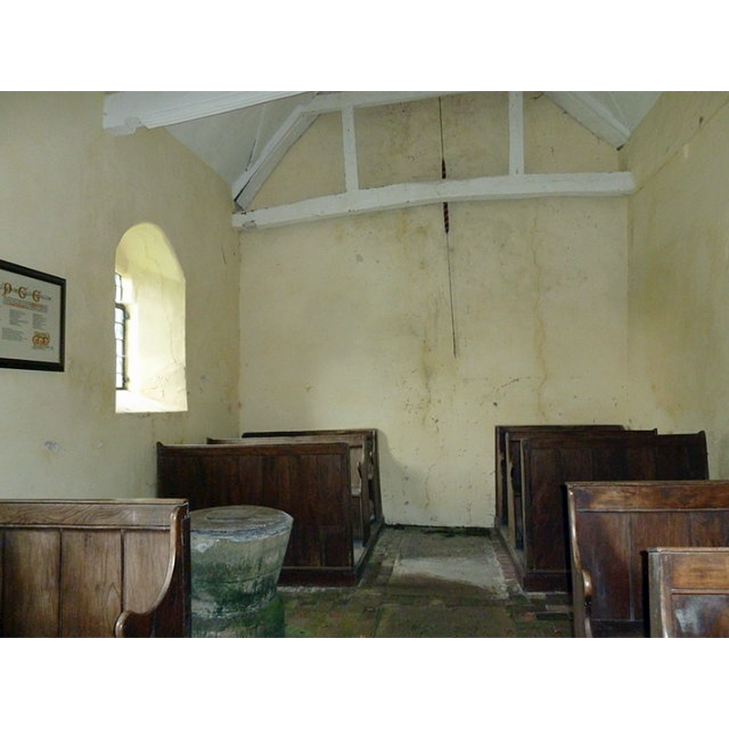
view of church interior - nave - looking east
Copyright Statement: Image copyright © Basher Eyre, 2014
Image Source: digital photograph taken 17 April 2014 by Basher Eyre [www.geograph.org.uk/photo/3980502] [accessed 27 July 2014]
Copyright Instructions: CC-BY-SA-2.0
view of font and cover in context
Copyright Statement: Image copyright © Basher Eyre, 2014
Image Source: digital photograph taken 17 April 2014 by Basher Eyre [www.geograph.org.uk/photo/3980489] [accessed 27 July 2014]
Copyright Instructions: CC-BY-SA-2.0
INFORMATION
Font ID: 13018EAS
Object Type: Baptismal Font1
Font Century and Period/Style: 12th century, Late Norman
Church / Chapel Name: Parish Church of St. Peter
Font Location in Church: Inside the church, towards the W end of the nave, S side
Church Patron Saint(s): St. Peter
Church Address: Easington, Oxfordshire, OX49 5AZ, UK
Site Location: Oxfordshire, South East, England, United Kingdom
Directions to Site: Located 6 km NW of Watlington, 6 km SW of Tetsworth
Ecclesiastic Region: Diocese of Oxford
Historical Region: Hundred of Ewelme -- Hundred of Benson [in Domesday]
Font Notes:
Click to view
There is an entry for this Easington [variant spelling] in the Domesday survey [http://domesdaymap.co.uk/place/SU6697/easington/] [accessed 27 July 2014], but it mentions neither cleric nor church in it. The Ecclesiastical and Architectural Topography of England: Oxfordshire (1850) notes: "The font is plain N[orman], round." Noted in Kelly's Oxford Directory of 1911: "a plain cylindrical Norman font". Not mentioned in Sherwood & Pevsner (1974). Not cylindrical, contrary to Kelly's description [cf. supra], but a bucket-shaped basin raised on a wide cylindrical base with a chamfered top; some damage to the upper rim sides; the inner basin lead-lined; on a round plinth. The wooden cover is flat and round, plain; it may have had a finial or handle of some sort, now missing. The entry for this parish in the Victoria County History (Oxford, vol. 18, 2016) notes: "In the later Anglo-Saxon period Easington (as part of the Readanora estate) was apparently dependent on the mother church at Pyrton. [...] A church was built in Easington before 1148, possibly with its own burial ground and, judging by the Norman tub font, with baptismal rights. [...] The earliest surviving features are 12th-century [...] The church appears to have been rebuilt or much altered in the early 14th century;" the VCH entry footnotes "font illustrated in Bodl. MS Top. Oxon. a 66, no. 229." The entry for this church in the CRSBI (2019) notes: "The tub-shaped font dates also to the 12thc. [...] Situated at the W end of the nave opposite the N door, the font is a plain, cylindrical, lead-lined tub with a broad brim, tapering inwards towards the bottom. A shallow runnel encircles the outside of the bowl, approximately half way down. The font is supported by a short, squat, circular pedestal with a broad chamfer round the top edge and a similar, shallow runnel around the outside, again half way down. Beneath is a large, shallow step in the form of a wheel. The lead lining of the tub extends to cover the inner half of the rim, ending in a dark-coloured seam. A further strip of lead covers the outer half of the rim and is worn away in places. [...] The runnel encircling the font at its mid point may be a shallow decoration or, if it runs right through, a join mark. If so, the bowl was made in two halves."
Credit and Acknowledgements: We are grateful to John Ward, of Oxfordshire Churches [http://homepage.mac.com/john.ward/oxfordshirechurches], for his photograph of this font
COORDINATES
UTM: 30U 635153 5725910
Latitude & Longitude (Decimal): 51.667897, -1.045625
Latitude & Longitude (DMS): 51° 40′ 4.43″ N, 1° 2′ 44.25″ W
MEDIUM AND MEASUREMENTS
Material: stone
Font Shape: bucket-shaped, mounted
Basin Interior Shape: round
Basin Exterior Shape: round
Rim Thickness: 10 cm [calculated]
Diameter (inside rim): 47 cm*
Diameter (includes rim): 67 cm*
Basin Total Height: 43 cm*
Notes on Measurements: * CRSBI (2019)
LID INFORMATION
Material: wood
Apparatus: no
Notes: [cf. FontNotes]
REFERENCES
- Victoria County History [online], University of London, 1993-. URL: https://www.british-history.ac.uk.
- Corpus of Romanesque Sculpture in Britain and Ireland, The Corpus of Romanesque Sculpture in Britain and Ireland, The Corpus of Romanesque Sculpture in Britain and Ireland. URL: http://www.crsbi.ac.uk.
- Kelly, Kelly's Directory of Oxfordshire, London: Kelly's Directories Ltd., 1911, p. 99
- Parker, John Henry, The Ecclesiastical and architectural topography of England: Oxfordshire, Oxford, London: Published under the sanction of the Central Commitee of the Archaeological Institute of Great Britain and Ireland [by] John Henry Parker, 1850, [unpaged -- entry 11]