North Aston / Estone
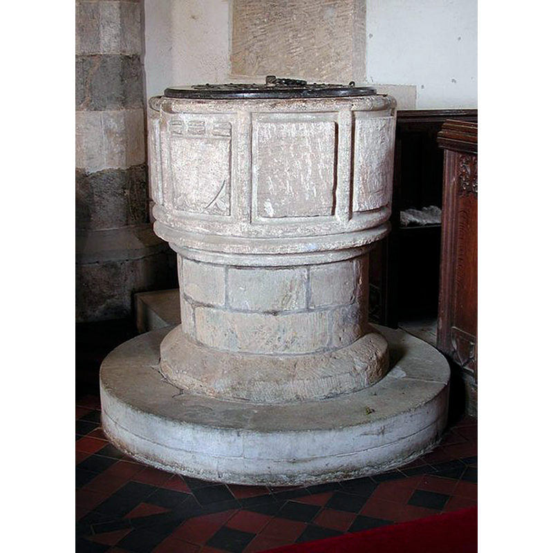
Image copyright © John Salmon, 2009
CC-BY-SA-2.0
Results: 6 records
view of font and cover
Copyright Statement: Image copyright © John Salmon, 2009
Image Source: digital photograph taken 31 May 2003 by John Salmon [www.geograph.org.uk/photo/1614977] [accessed 15 November 2017]
Copyright Instructions: CC-BY-SA-2.0
symbol - shield
Scene Description: [cf. Font notes]
Copyright Statement: Image copyright © John Salmon, 2009
Image Source: digital photograph taken 31 May 2003 by John Salmon [www.geograph.org.uk/photo/1614977] [accessed 15 November 2017]
Copyright Instructions: CC-BY-SA-2.0
design element - motifs - panel
Copyright Statement: Image copyright © John Salmon, 2009
Image Source: digital photograph taken 31 May 2003 by John Salmon [www.geograph.org.uk/photo/1614977] [accessed 15 November 2017]
Copyright Instructions: CC-BY-SA-2.0
design element - motifs - roll moulding
Copyright Statement: Image copyright © John Salmon, 2009
Image Source: digital photograph taken 31 May 2003 by John Salmon [www.geograph.org.uk/photo/1614977] [accessed 15 November 2017]
Copyright Instructions: CC-BY-SA-2.0
view of church exterior - south view
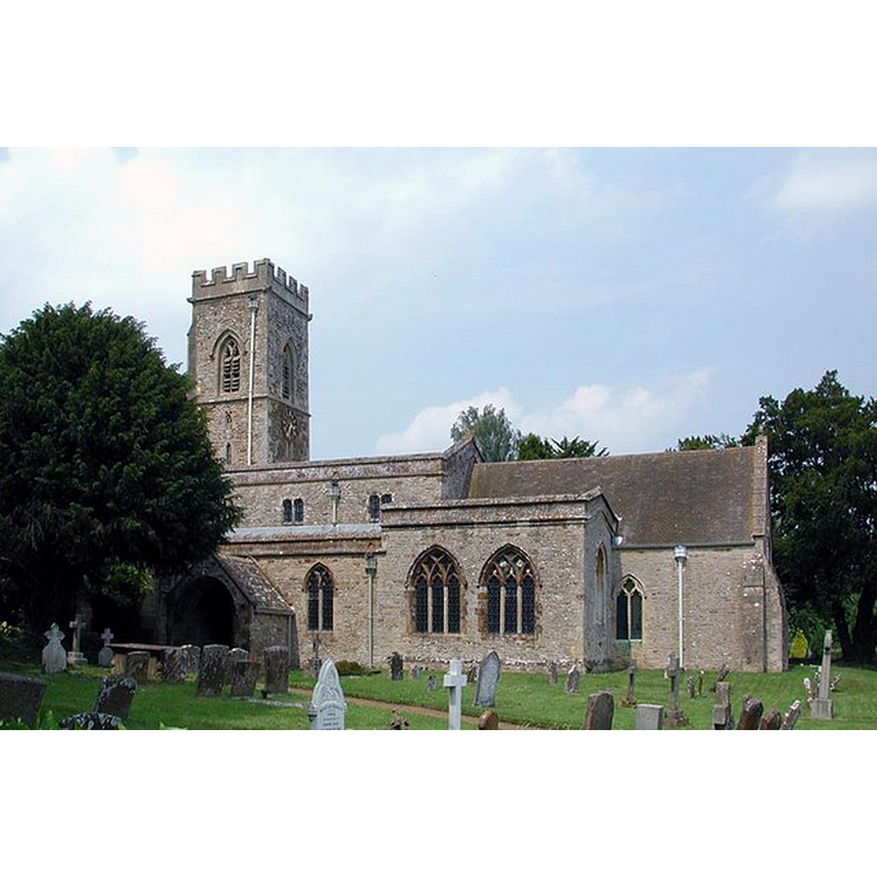
Scene Description: The tree on the left conveniently hides the east wall of the Hall which abuts the church on the west side.
Copyright Statement: Image copyright © John Salmon, 2009
Image Source: digital photograph taken 31 May 2003 by John Salmon [www.geograph.org.uk/photo/1614955] [accessed 15 November 2017]
Copyright Instructions: CC-BY-SA-2.0
view of church interior - nave - looking east
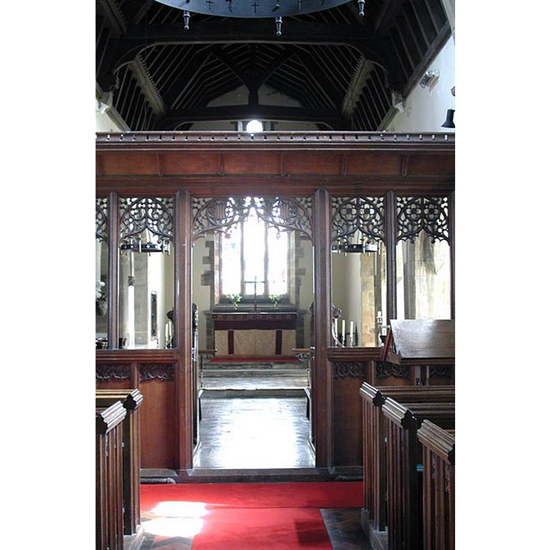
Copyright Statement: Image copyright © John Salmon, 2009
Image Source: digital photograph taken 31 May 2003 by John Salmon [www.geograph.org.uk/photo/1614978] [accessed 15 November 2017]
Copyright Instructions: CC-BY-SA-2.0
INFORMATION
Font ID: 13013AST
Object Type: Baptismal Font1
Font Century and Period/Style: 14th century / 17th century(late?), Decorated? / Restoration?
Workshop/Group/Artisan: heraldic font
Church / Chapel Name: Parish Church of St. Mary the Virgin
Font Location in Church: Inside the church
Church Patron Saint(s): St. Mary the Virgin
Church Address: St Mary's Walk, North Aston, Oxfordshire, OX25 6JA, UK
Site Location: Oxfordshire, South East, England, United Kingdom
Directions to Site: Located off (E) the A4260, 3 km S of Deddington, 12 S of Banbury, 13 NE of Woodstock, 17 km N of Oxford
Ecclesiastic Region: Diocese of Oxford
Historical Region: Hundred of Wootton
Additional Comments: unfinished font? (the present font) -- disappeared font? (the one from the mid-12thC church here)
Font Notes:
Click to view
There is an entry for [North] Aston [variant spelling] in the Domesday survey [http://opendomesday.org/place/SP4729/north-aston/] [accessed 15 November 2017], but it mentions neither priest nor church in it. Parker (1846) reports a late-17th century font here. Kelly's Oxford Directory of 1911 notes: "the font dates from the reign of Charles II" [i.e., 1680-1685]. Sherwood & Pevsner (1974), however, write: "Font. Round bowl with panelled sides, one carved with a shield, the rest unfinished. C14?" The Victoria County History (Oxford, vol. 11, 1983) notes: "The church was first mentioned in the mid 12th century, but the present building dates from the 14th [...] There is a 14th-century piscina in the south chapel. The font is possibly also of the same period." The VCH (ibid.) footnotes "A late-17th-century date for the font is suggested by Parker, Guide, 86." [cf. supra].
COORDINATES
UTM: 30U 616655 5757573
Latitude & Longitude (Decimal): 51.956609, -1.302325
Latitude & Longitude (DMS): 51° 57′ 23.79″ N, 1° 18′ 8.37″ W
MEDIUM AND MEASUREMENTS
Material: stone
Font Shape: round, mounted
Basin Interior Shape: round
Basin Exterior Shape: round
REFERENCES
- Victoria County History [online], University of London, 1993-. URL: https://www.british-history.ac.uk.
- Kelly, Kelly's Directory of Oxfordshire, London: Kelly's Directories Ltd., 1911, p. 22 / [http://www.historicaldirectories.org/hd/d.asp] [accessed 30 June 2007]
- Oxford Society for Promoting the Study of Gothic Architecture, Guide to the Architectural Antiquities in the Neighbourhood of Oxford, A, Oxford: John Henry Parker [for the Society], 1846, p. 86 [reference not found]
- Pevsner, Nikolaus, Oxfordshire, Harmondsworth: Penguin Books, 1974, p. 718