Wilcote / Widelicote / Wilcott / Wivelicota
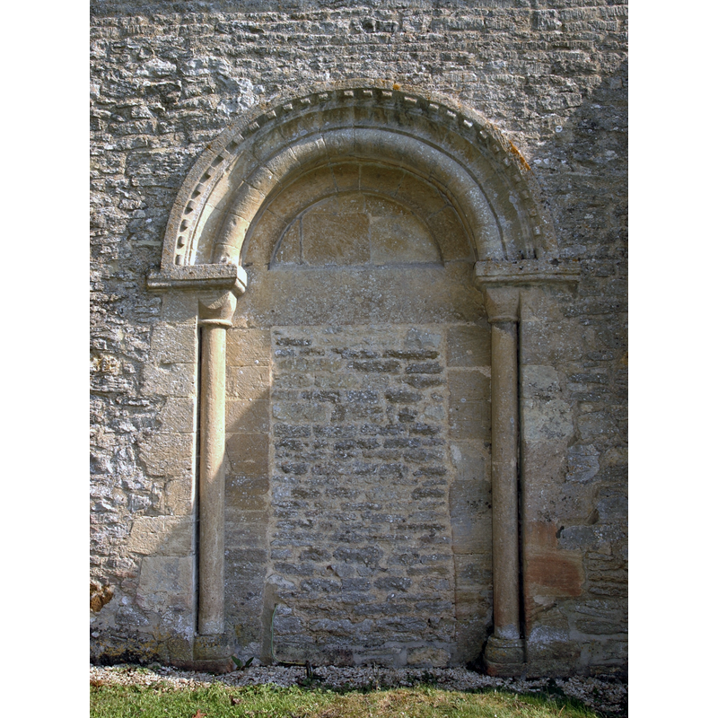
Image copyright © Motacilla, 2011
CC-BY-SA-3.0
Results: 5 records
view of church exterior - south portal
Scene Description: Source caption: "Blocked south doorway of St Peter's parish church, Wilcote, Oxfordshire, viewed from the outside."
Copyright Statement: Image copyright © Motacilla, 2011
Image Source: digital photograph taken 1 May 2011 by Motacilla [https://commons.wikimedia.org/wiki/File:Wilcote_StPeter_SouthDoorway_outside.JPG] [accessed 29 November 2017]
Copyright Instructions: CC-BY-SA-3.0
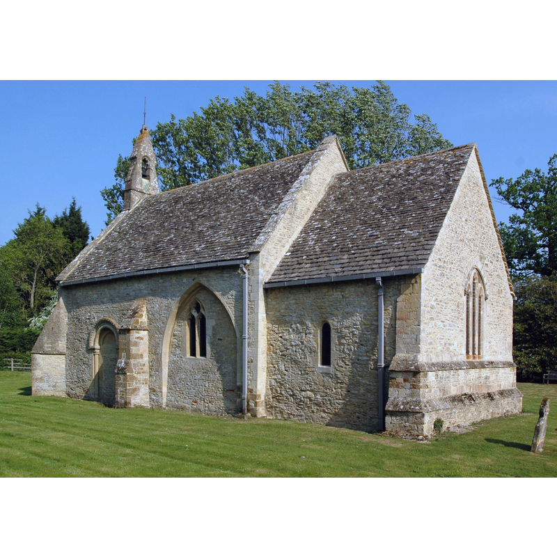
view of church exterior - west view
Copyright Statement: Image copyright © Motacilla, 2011
Image Source: digital photograph taken 30 April 2011 by Motacilla [https://commons.wikimedia.org/wiki/File:Wilcote_StPeter_west.JPG] [accessed 29 November 2017]
Copyright Instructions: CC-BY-SA-3.0
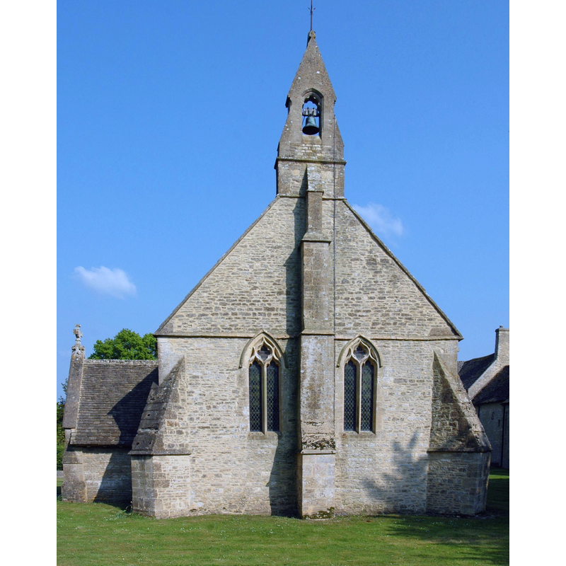
view of church exterior - northeast view
Copyright Statement: Image copyright © Motacilla, 2011
Image Source: digital photograph taken 2 May 2011 by Motacilla [https://commons.wikimedia.org/wiki/File:Wilcote_StPeter_northeast.JPG] [accessed 29 November 2017]
Copyright Instructions: CC-BY-SA-3.0
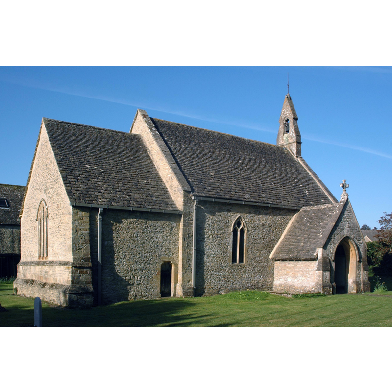
view of church exterior - southeast view
Copyright Statement: Image copyright © Motacilla, 2011
Image Source: digital photograph taken 1 May 2011 by Motacilla [https://commons.wikimedia.org/wiki/File:Wilcote_StPeter_southeast.JPG] [accessed 29 November 2017]
Copyright Instructions: CC-BY-SA-3.0
view of church interior - nave - looking east
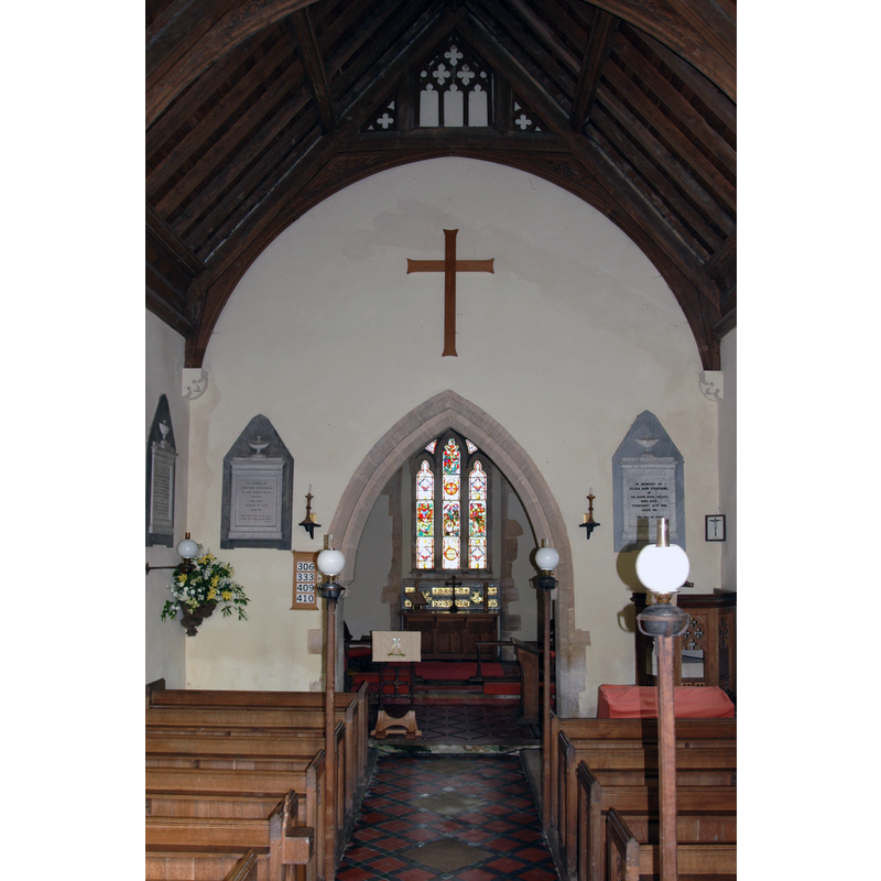
Copyright Statement: Image copyright © Motacilla, 2011
Image Source: digital photograph taken 30 April 2011 by Motacilla [https://commons.wikimedia.org/wiki/File:Wilcote_StPeter_interior.JPG] [accessed 29 November 2017]
Copyright Instructions: CC-BY-SA-3.0
INFORMATION
Font ID: 13010WIL
Object Type: Baptismal Font1?
Font Century and Period/Style: 12th century, Late Norman
Church / Chapel Name: Parish Church olf St. Peter
Church Patron Saint(s): St. Peter
Church Address: Wilcote Grange, Oxfordshire, OX7 3EA, UK
Site Location: Oxfordshire, South East, England, United Kingdom
Directions to Site: Located off (N) the A40, 6 km NE of Witney
Ecclesiastic Region: Diocese of Oxford
Historical Region: Hundred of Wootton
Additional Comments: disappeared font? (the one from the Norman-period church here)
Font Notes:
Click to view
There is an entry for Wilcote [variant spelling] in the Domesday survey [http://opendomesday.org/place/SP3715/wilcote/] [accessed 29 November 2017], but it mentions neither priest nor church in it. Gardner's Gazetteer (1852) [www.historicaldirectories.org/hd/d.asp] [accessed 30 June 2007] reports: "a neat marble font", which probably means Georgian or later [NB: Gardner (ibid.) reports that the south doorway appears "Saxon or early Norman", but we have no information on the earlier font of this church]. The Victoria County History (Oxford, vol. 12, 1990) notes: "The church of 'Wivelicota', granted to Oseney abbey in 1151 by Ralph Basset, son of the justiciar, may have been Wilcote, although Ralph is not otherwise recorded as having any connexion with the place. That church was subsequently lost by the abbey. [...] The earliest incontrovertible evidence of a church at Wilcote lies in the fabric, part of which is of the later 12th century [...] The nave and chancel are of the later 12th century", and refers to the the former source and font, but adds that, in the renovations of 1868, "a carved stone font" was added. [NB: we have no information on the font of the medieval church, or on the whereabouts of the font reported in Gardner]
COORDINATES
UTM: 30U 606102 5744030
Latitude & Longitude (Decimal): 51.837, -1.46
Latitude & Longitude (DMS): 51° 50′ 13.2″ N, 1° 27′ 36″ W
REFERENCES
- Victoria County History [online], University of London, 1993-. URL: https://www.british-history.ac.uk.
- Gardner, Robert, History, gazetteer and directory of the County of Oxford, comprising [...], Peterborough: Printed and published by Robert Gardner, 1852, p. 696 / [www.historicaldirectories.org/hd/d.asp] [accessed 30 June 2007]: "