Rousham / Rouesham / Rowesham
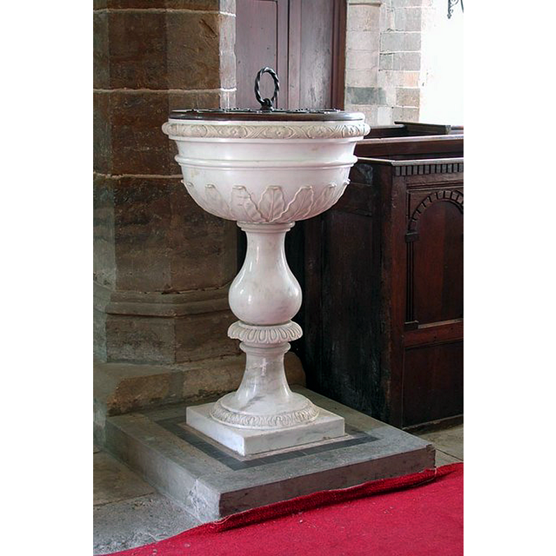
Image copyright © John Salmon, 2009
CC-BY-SA-2.0
Results: 6 records
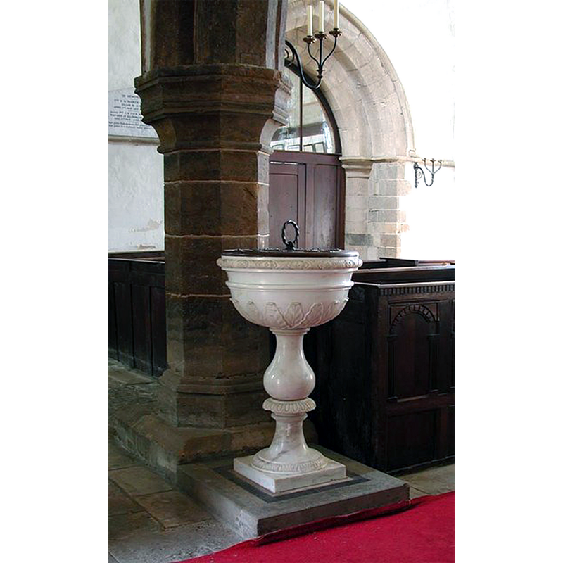
view of font and cover
Scene Description: the modern font of 1753
Copyright Statement: Image copyright © John Salmon, 2009
Image Source: digital photograph taken 6 September 2002 by John Salmon [www.geograph.org.uk/photo/1608994] [accessed 15 November 2017]
Copyright Instructions: CC-BY-SA-2.0
view of church exterior - northeast view
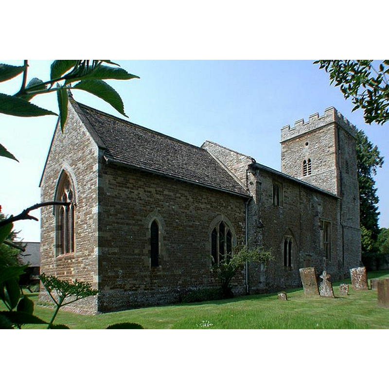
Copyright Statement: Image copyright © John Salmon, 2009
Image Source: digital photograph taken 6 September 2002 by John Salmon [www.geograph.org.uk/photo/1609065] [accessed 15 November 2017]
Copyright Instructions: CC-BY-SA-2.0
view of church exterior - south view
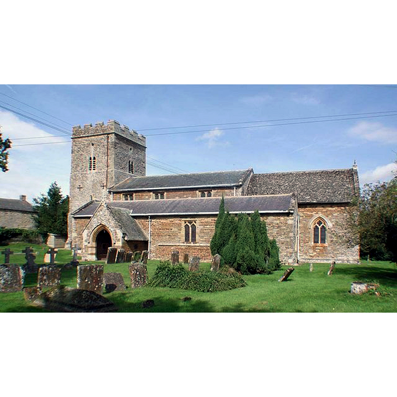
Copyright Statement: Image copyright © John Salmon, 2009
Image Source: digital photograph taken 6 September 2002 by John Salmon [www.geograph.org.uk/photo/1608991] [accessed 15 November 2017]
Copyright Instructions: CC-BY-SA-2.0
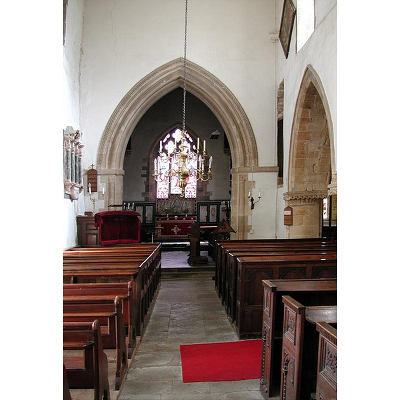
view of church interior - nave - looking west
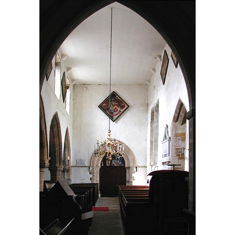
Copyright Statement: Image copyright © John Salmon, 2009
Image Source: digital photograph taken 6 September 2002 by John Salmon [www.geograph.org.uk/photo/1609000] [accessed 15 November 2017]
Copyright Instructions: CC-BY-SA-2.0
view of font and cover in context
Scene Description: the modern font of 1753
Copyright Statement: Image copyright © John Salmon, 2009
Image Source: digital photograph taken 6 September 2002 by John Salmon [www.geograph.org.uk/photo/1608992] [accessed 15 November 2017]
Copyright Instructions: CC-BY-SA-2.0
view of church interior - nave - looking east
Copyright Statement: Image copyright © John Salmon, 2009
Image Source: digital photograph taken 6 September 2002 by John Salmon [www.geograph.org.uk/photo/1608995] [accessed 15 November 2017]
Copyright Instructions: CC-BY-SA-2.0
INFORMATION
Font ID: 13009ROU
Object Type: Baptismal Font1?
Font Century and Period/Style: 12th century, Late Norman
Church / Chapel Name: Parish Church of St. Leonard and St. James
Church Patron Saint(s): St. Leonard & St. James [originally St. Germanus; later St. Mary; later still St. James and finally St. Leonard & St. James]
Church Address: Rousham, Oxfordshire, OX25 4QX, UK
Site Location: Oxfordshire, South East, England, United Kingdom
Directions to Site: Located just off (SE) the crossroads of the A4260-B4030, 8 km NNE of Woodstock, 18 km from Oxford and Banbury
Ecclesiastic Region: Diocese of Oxford
Historical Region: Hundred of Wootton
Additional Comments: disappeared font: the original font of the Norman church
Font Notes:
Click to view
There are two entries for Rousham [variant spelling] in the Domesday survey [http://opendomesday.org/place/SP4724/rousham/] [accessed 15 November 2017], neither of which mentions priest or church in it. Gardner's Gazetteer (1852) notes: "The font of white marble is of elegant design", which probably means Georgian or later. Noted in Sherwood and Pevsner (1974): "Font. Early C18. Marble, with a baluster stem and a cup-shaped bowl carved with palm fronds." [NB: Gardner (ibid.) reports that the building "exhibits vestiges of the Norman style of architecture", but we have no information of the earlier font of this church]. The Victoria County History (Oxon., vol. 11, 1983) notes: "The earliest church presumably comprised a nave and chancel. In the late 12th century the first bay of a south arcade was begun at the eastern end of the nave, and in the early 13th century the west tower was built [...] The reading desk and pulpit were replaced in 1744, and the font in 1753 [...] The church was restored in 1867 and 1868. The chancel was entirely rebuilt and refitted and heightened, the south aisle was extensively repaired and the south porch rebuilt, and the nave and aisles were reroofed. In the course of the work the chancel arch was rebuilt using some late 12th-century material
COORDINATES
UTM: 30U 616650 5752802
Latitude & Longitude (Decimal): 51.913732, -1.304007
Latitude & Longitude (DMS): 51° 54′ 49.43″ N, 1° 18′ 14.42″ W
REFERENCES
- Victoria County History [online], University of London, 1993-. URL: https://www.british-history.ac.uk.
- Gardner, Robert, History, gazetteer and directory of the County of Oxford, comprising [...], Peterborough: Printed and published by Robert Gardner, 1852, p. 686 / [www.historicaldirectories.org/hd/d.asp] [accessed 30 June 2007]