Oxford No. 14 / Oxeneford
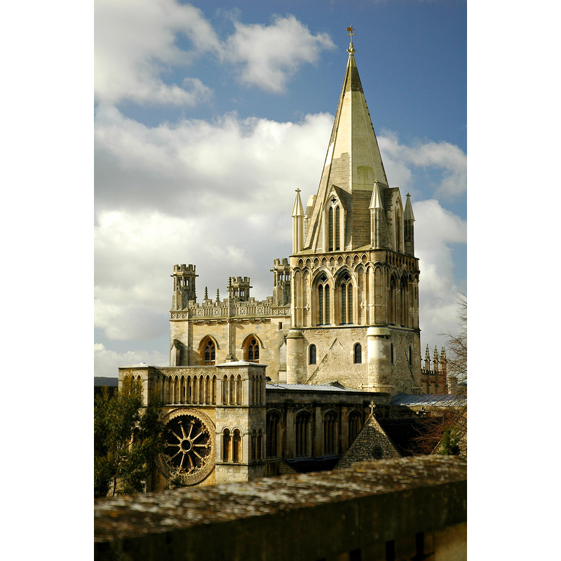
Image copyright © Newton2, 2007
CC-BY-SA-3.0
Results: 2 records
view of church exterior
Copyright Statement: Image copyright © Newton2, 2007
Image Source: digital photograph taken 7 March 2007 by Newton2 [http://en.wikipedia.org/wiki/File:Cathedral_oxford.jpg] [accessed 19 June 2012]
Copyright Instructions: CC-BY-SA-3.0
view of church interior - nave - looking east
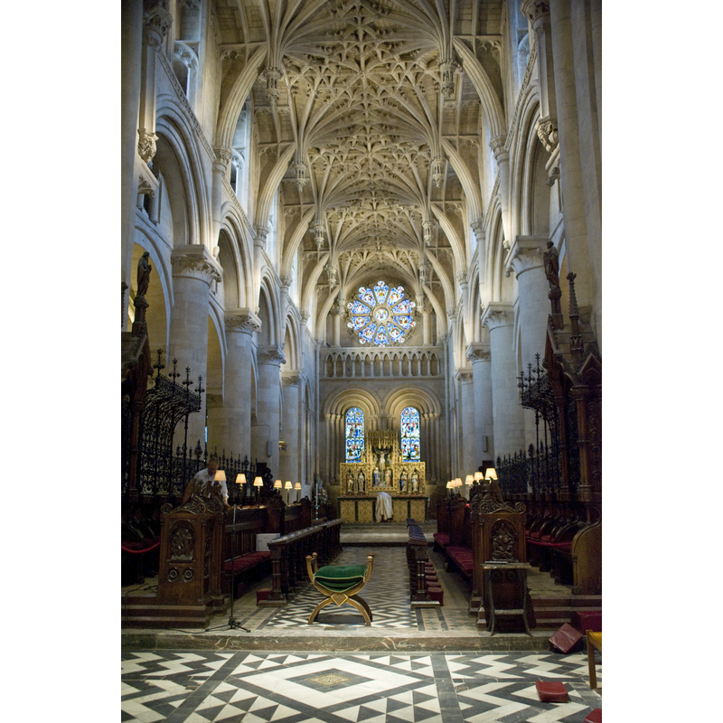
Copyright Statement: Image copyright © Algy3289, 2011
Image Source: digital photograh taken 2 July 2011 by Algy3289 [http://en.wikipedia.org/wiki/File:OxfordCathederal.jpg] [accessed 19 June 2012]
Copyright Instructions: CC-BY-SA-3.0
INFORMATION
Font ID: 13003OXF
Object Type: Baptismal Font1?
Church / Chapel Name: Cathedral Church of Oxford and Christ Church College Chapel [originally St. Frideswide's priory of 8thC?]
Font Location in Church: [cf. FontNotes]
Church Patron Saint(s): [originally St. Frideswide's priory?]
Church Address: St Aldate's, Oxford OX1
Site Location: Oxfordshire, South East, England, United Kingdom
Directions to Site: Located off St. Aldates
Ecclesiastic Region: Diocese of Oxford
Historical Region: Hundred of Headington [Domesday]
Additional Comments: disappeared font? (the one from the early-12thC church here)
Font Notes:
Click to view
There are thirteen entries for Oxford [variant spelling] in the Domesday survey [http://opendomesday.org/place/SP5106/oxford/] [accessed 9 November 2016], two of which mention a church in each. Gardner's Gazetteer (1852) [www.historicaldirectories.org/hd/d.asp] [accessed 30 June 2007] quote Dr. Ingram's reference to "a curious piece of ancient sculpture" discovered "a few years since" which "some persons have supposed it to be the ancient font of St. Frideswide's church, which was certainly parochial as well as conventual"; Dr. Ingram, however -reports Gardner (ibid.)- concluded that the said stone was not the old baptismal font but "the celebrated altar [...] or reliquary of St. Frideswide". [NB: Gardner (ibid.) notes that the original parish/conventual church dates back to the 8th century, but we have no information on the earlier font of that church]. The Victoria County History (Oxford, vol. 4, 1979) notes: "The early minster church on the site [...] was presumably rebuilt by the Augustinian canons after their possession was confirmed in 1122 and before the translation of St. Frideswide in 1180. Slight traces of a 12th-century church, the tower of which had been built by 1172 [...] survive in the south transept and south wall of the nave. [...] In 1190, however, fire destroyed the church [...] Rebuilding had begun before 1194" [there is no mention of a font in this church in the VCH entry -- the excavated altar is believed to be 17th-century].
COORDINATES
UTM: 30U 620476 5734674
Latitude & Longitude (Decimal): 51.75, -1.254722
Latitude & Longitude (DMS): 51° 45′ 0″ N, 1° 15′ 17″ W
REFERENCES
- Victoria County History [online], University of London, 1993-. URL: https://www.british-history.ac.uk.
- Gardner, Robert, History, gazetteer and directory of the County of Oxford, comprising [...], Peterborough: Printed and published by Robert Gardner, 1852, p. 179