Chastleton
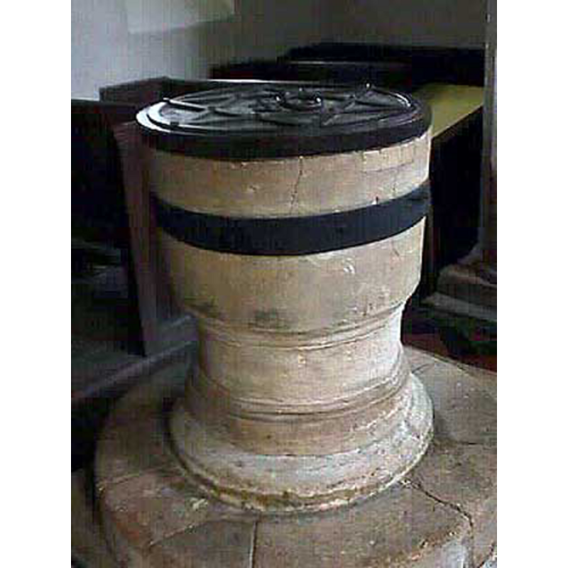
Image copyright © John Wilkes, 2006
Standing permission
Results: 2 records
view of font and cover
Copyright Statement: Image copyright © John Wilkes, 2006
Image Source: digital photograph by John Wilkes, 2006 [www.allthecotswolds.com]
Copyright Instructions: Standing permission
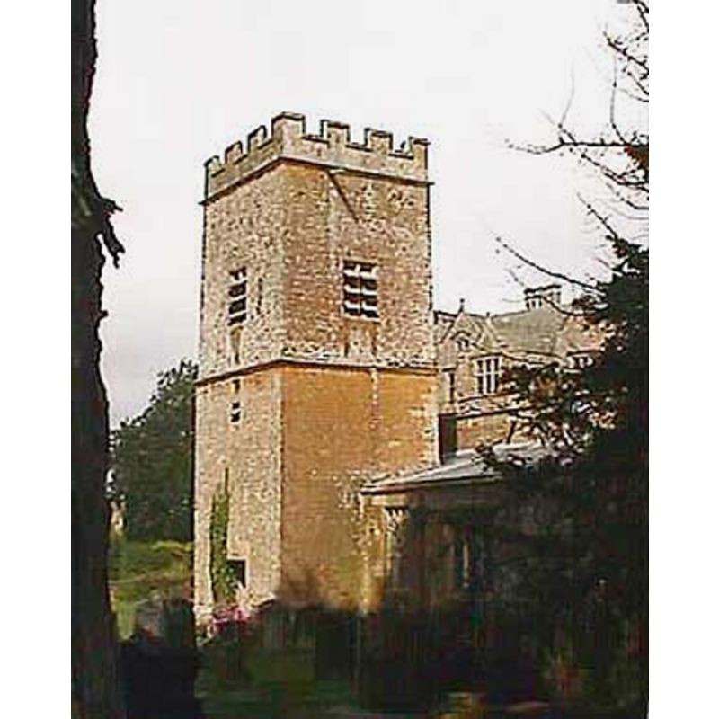
view of church exterior
Copyright Statement: Image copyright © John Wilkes, 2006
Image Source: digital photograph by John Wilkes, 2006 [www.allthecotswolds.com]
Copyright Instructions: Standing permission
INFORMATION
Font ID: 12998CHA
Object Type: Baptismal Font1
Font Century and Period/Style: 13th century, Early English
Church / Chapel Name: Parish Church of St. Mary the Virgin
Font Location in Church: Inside the church, between two of the pillars of the arcade
Church Patron Saint(s): St. Mary the Virgin
Church Notes: The
Site Location: Oxfordshire, South East, England, United Kingdom
Directions to Site: Located off (S) the A44, half way between Chipping Norton (SE) and Moreton on Marsh (NW), in the Cotswolds, near the borders with Gloucs. and Warwks.
Additional Comments: damaged font / repaired font (band of metal around the basin)
Font Notes:
Click to view
The Ecclesiastical and Architectural Topography of England: Oxfordshire (1850) notes: "The font is plain round, cup-shaped, D[ecorated]". Lewis' Dictionary of 1848 notes that the church is Early English with the lower part of the tower dating earlier to the Norman period, but makes no mention of the font, which consists of a plain bucked-shaped basin raised on a round pedestal base decorated with thin mouldings; round plinth; on a seconf plinth, quadrangular, with kneeling stone. Round flat cover with metal decoration and ring handle. Noted in Sherwood & Pevsner (1974): "Font. C13. Tub-shaped, with a moulded base." [NB: the basin is now reinforced with a broad iron band all around; it appears to have at least one large crack and may have been so bound to prevent further damage].
Credit and Acknowledgements: We are grateful to John Wilkes, of www.allthecotswolds.com, for the photographs of this church and font.
COORDINATES
UTM: 30U 593302 5757794
MEDIUM AND MEASUREMENTS
Material: stone
Font Shape: bucket-shaped, mounted
Basin Interior Shape: round
Basin Exterior Shape: round
LID INFORMATION
Material: wood
Apparatus: no
Notes: [cf. FontNotes]
REFERENCES
- Lewis, Samuel, A Topographical Dictionary of England, Comprising the Several Counties, Cities, Boroughs, Corporate and Market Towns, Parishes, Chapelries, and Townships, and the Islands of Guernsy, Jersey, and Man, with Historical and Statistical Descriptions [...], London: S. Lewis, 1831, [http://www.british-history.ac.uk/report.asp?compid=50867#s23] [accessed 28 June 2007]
- Parker, John Henry, The Ecclesiastical and architectural topography of England: Oxfordshire, Oxford, London: Published under the sanction of the Central Commitee of the Archaeological Institute of Great Britain and Ireland [by] John Henry Parker, 1850, [unpaged -- entry 68] / [http://books.google.ca/books?id=maikb1i3wSUC&pg=PT144&lpg=PT144&dq=longcot+church+font&source=web&ots=p3k5tJJE6J&sig=KYjkm8H5wOoAuH7BvnLp7JqMPus&hl=en&sa=X&oi=book_result&resnum=6&ct=result#PPA17,M1] [accessed 31 December 2008]
- Pevsner, Nikolaus, Oxfordshire, Harmondsworth: Penguin Books, 1974, p. 531