Oxford No. 12 / Oxeneford
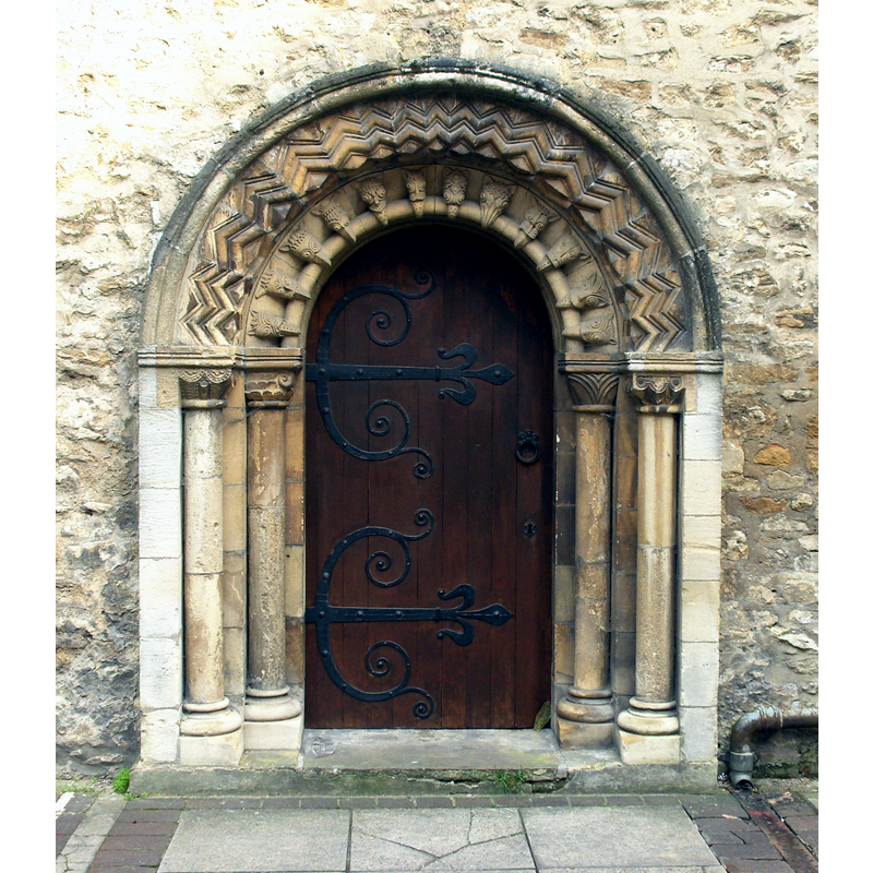
Image copyright © Stemonitis, 2011
CC-BY-SA-3.0
Results: 1 records
view of church exterior - west portal
Copyright Statement: Image copyright © Stemonitis, 2011
Image Source: digital photograph taken 12 March 2011 by Stemonitis [http://en.wikipedia.org/wiki/File:St_Ebbes_west_door.jpg] [accessed 19 June 2012]
Copyright Instructions: CC-BY-SA-3.0
INFORMATION
Font ID: 12995OXF
Object Type: Baptismal Font1
Font Date: ca. 1005?
Font Century and Period/Style: 11th century (early?), Pre-Conquest
Church / Chapel Name: Parish Church of St. Ebbe
Church Patron Saint(s): St. Ebbe [aka Æbbe, Æbbe of Oxford, Ebbes] [cf. Church Notes]
Church Address: 2 Roger Bacon Ln. / Pennyfarthing Place, Oxford OX1 1QE
Site Location: Oxfordshire, South East, England, United Kingdom
Directions to Site: Located in Oxford city centre, across from the Westgate Shopping Centre
Ecclesiastic Region: Diocese of Oxford
Historical Region: Hundred of Headington
Additional Comments: disappeared font? (the earlier font(s) of this church)
Font Notes:
Click to view
There are thirteen entries for Oxford [variant spelling] in the Domesday survey [http://opendomesday.org/place/SP5106/oxford/] [accessed 9 November 2016], two of which mention a church in each. Noted in Gardner's Gazetteer (1852): "the font was given by the late Dr. Griffith, master of University college." The Victoria County History (Oxford, vol. 4, 1979) notes that the parish church of St. Ebbe's was "recorded between 1005 and 1013" in the Eynsham Cartulary (I, p. viii), but by 1813 the much repaired church "was in a dangerous condition" and most of it, except for the lower part of the tower and southwest corner of the wall was demolished. "A new church was built on the same site, but extending further north to include the site of the rectory-house on the corner of St. Ebbe's Street and Church Street [...] completed in 1816", but underwent many expansions soon thereafter. The VCH (ibid) adds "The font is early 19th-century". [NB: we have no information on the earlier font here].
COORDINATES
UTM: 30U 620130 5734728
Latitude & Longitude (Decimal): 51.750556, -1.259722
Latitude & Longitude (DMS): 51° 45′ 2″ N, 1° 15′ 35″ W
REFERENCES
- Victoria County History [online], University of London, 1993-. URL: https://www.british-history.ac.uk.
- Gardner, Robert, History, gazetteer and directory of the County of Oxford, comprising [...], Peterborough: Printed and published by Robert Gardner, 1852, p. 300