Charlbury
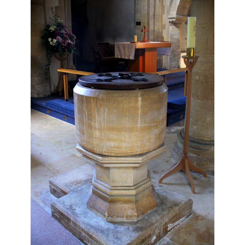
Image copyright © Colin Smith, 2011
Image and permission received (email of 11 September 2011)
Results: 4 records
view of font and cover in context
Copyright Statement: Image copyright © Colin Smith, 2011
Image Source: digital photograph taken 21 August 2011 by Colin Smith
Copyright Instructions: Image and permission received (email of 11 September 2011)
view of font and cover
![the modern [cf. Font notes] font](/static-50478a99ec6f36a15d6234548c59f63da52304e5/compressed/1070624010_compressed.png)
Scene Description: the modern [cf. Font notes] font
Copyright Statement: Image copyright © John Wilkes, 2006
Image Source: digital photograph by John Wilkes [www.allthecotswolds.com]
Copyright Instructions: Standing permission
view of church exterior - southeast view
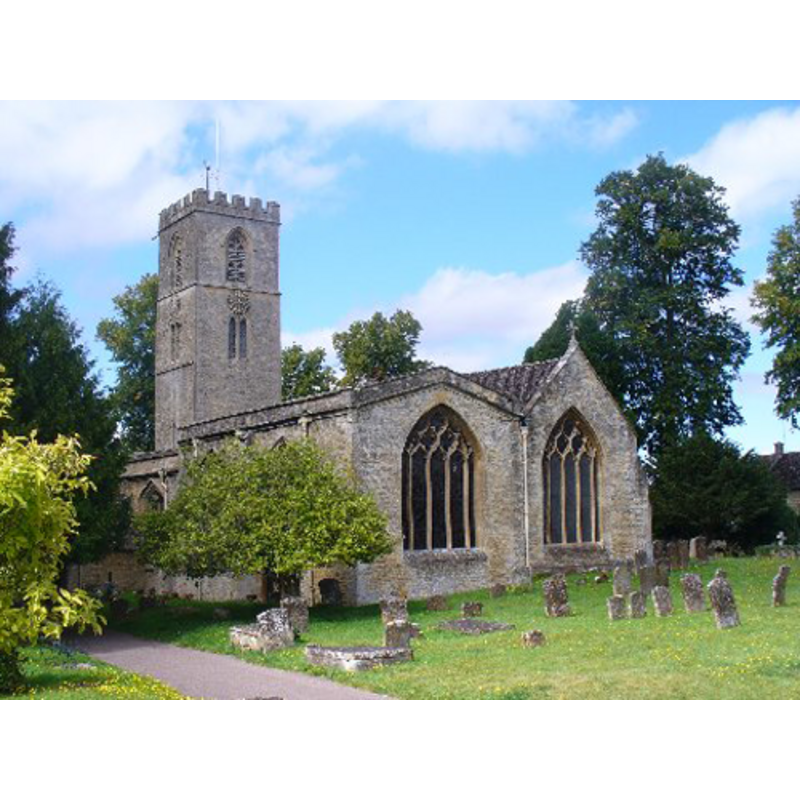
Copyright Statement: Image copyright © Colin Smith, 2011
Image Source: digital photograph taken 21 August 2011 by Colin Smith
Copyright Instructions: Image and permission received (email of 11 September 2011)
view of church interior - plan

Scene Description: showing the modern font in the south aisle
Copyright Statement: Image copyright © University of London & History of Parliament Trust, 2008
Image Source: digital image of a drawing in the VCH [http://www.british-history.ac.uk/report.aspx?compid=63798] [accessed 16 January 2009]
Copyright Instructions: PERMISSION NOT AVAILABLE -- IMAGE NOT FOR PUBLIC USE
INFORMATION
Font ID: 12991CHA
Object Type: Baptismal Font1
Font Century and Period/Style: [composite font?] [re-cut basin?] / 19th century, [composite] / Modern?
Church / Chapel Name: Parish Church of St. Mary the Virgin
Font Location in Church: Inside the church, in the W end of the S aisle
Church Patron Saint(s): St. Mary the Virgin
Church Address: Church Street, Charlbury, Oxfordshire, OX7 3PS
Site Location: Oxfordshire, South East, England, United Kingdom
Directions to Site: Located on B4022-B4026, about 20 km WNW of Oxford
Ecclesiastic Region: Diocese of Oxford
Historical Region: Hundred of Banbury
Additional Comments: composite font? is the basin a re-cut from a medieval font? [cf. FontNotes]
Font Notes:
Click to view
No entry found for Charlbury in the Domesday survey. The Victoria County History (Oxford, vol. 10, 1972) notes: "Charlbury church was among the possessions of Eynsham Abbey in 1197/8, having probably passed to the abbey with Charlbury manor in 1094 [...] There are some indications that in the 12th century the church was cruciform. The earliest surviving part of the building is a 12thcentury arcade of three arches on the north side of the nave [...] In 1856 the church was repaired and refitted in accordance with the designs of G. E. Street. The high box pews and the pulpit and font were replaced, and the galleries were removed". The baptismal font at Charlbury St. Mary's consists of a plain cylindrical basin raised on an moulded octagonal base; the two pieces that make up the font are totally at odds with each other, which may perhaps indicate that the basin is a re-tooled earlier piece; it is located in the south aisle across from the south doorway.
Credit and Acknowledgements: We are grateful to John Wilkes, of www.allthecotswolds.com, and to Colin Smith for their photographs of church and font
COORDINATES
UTM: 30U 604325 5747912
Latitude & Longitude (Decimal): 51.872224, -1.484612
Latitude & Longitude (DMS): 51° 52′ 20″ N, 1° 29′ 4.6″ W
MEDIUM AND MEASUREMENTS
Material: stone
Font Shape: cylindrical, mounted
Basin Interior Shape: round
Basin Exterior Shape: round
LID INFORMATION
Date: modern
Material: wood
Apparatus: no
Notes: round and flat, with metal ornamentation and ring handle
REFERENCES
- Victoria County History [online], University of London, 1993-. URL: https://www.british-history.ac.uk.