Eastleach Turville / East Leach Turville / Lecce
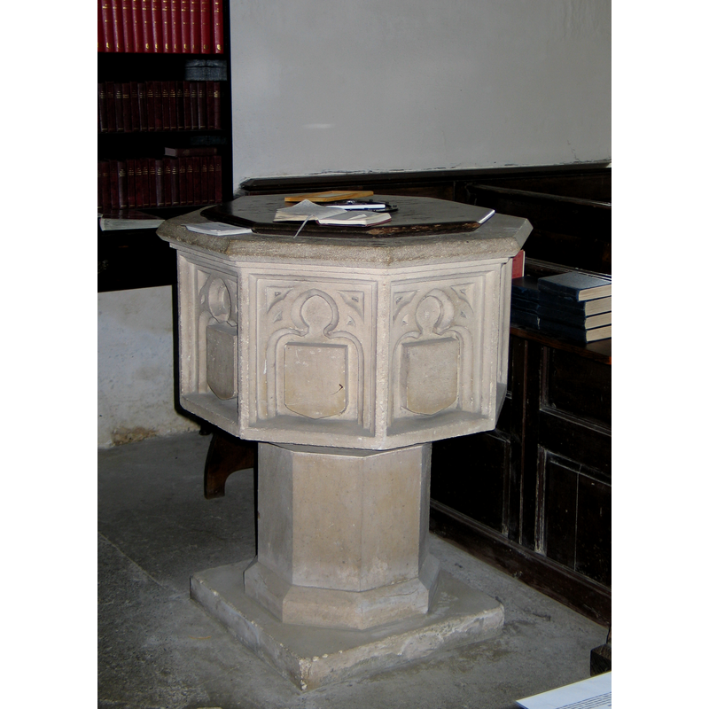
Image copyright © Baptisteria Sacra Index, 2023
CC-BY-NC-ND-4.0
Results: 8 records
view of font and cover
Copyright Statement: Image copyright © Baptisteria Sacra Index, 2023
Image Source: BSI - Photographed June 2, 2007
Copyright Instructions: CC-BY-NC-ND-4.0
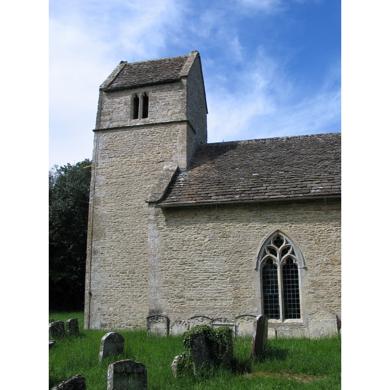
view of church exterior - south view
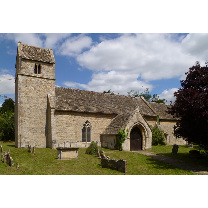
Copyright Statement: Image copyright © John Wilkes, 2014
Image Source: digital photograph taken 14 July 2014 by John Wilkes for BSI
Copyright Instructions: Standing permission
view of church exterior - south portal - tympanum - detail
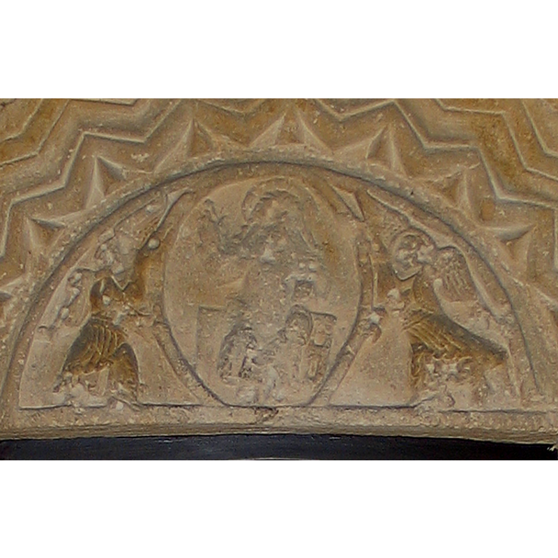
Copyright Statement: Image copyright © Baptisteria Sacra Index, 2023
Image Source: BSI - Photographed June 2, 2007
Copyright Instructions: CC-BY-NC-ND-4.0
view of church exterior - south portal - tympanum
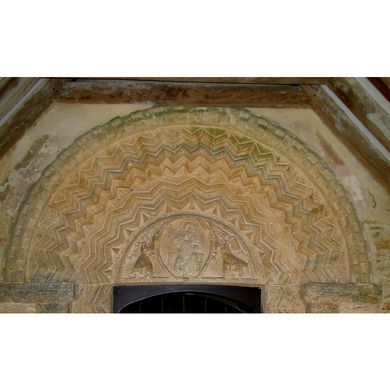
Copyright Statement: Image copyright © Baptisteria Sacra Index, 2023
Image Source: BSI - Photographed June 2, 2007
Copyright Instructions: CC-BY-NC-ND-4.0
view of church exterior - south portal
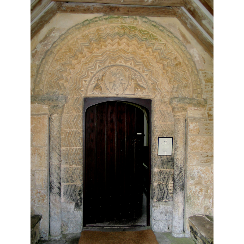
Copyright Statement: Image copyright © Baptisteria Sacra Index, 2023
Image Source: BSI - Photographed June 2, 2007
Copyright Instructions: CC-BY-NC-ND-4.0
view of church exterior - west tower
Copyright Statement: Image copyright © Baptisteria Sacra Index, 2023
Image Source: BSI - Photographed June 2, 2007
Copyright Instructions: CC-BY-NC-ND-4.0
view of church exterior - south porch
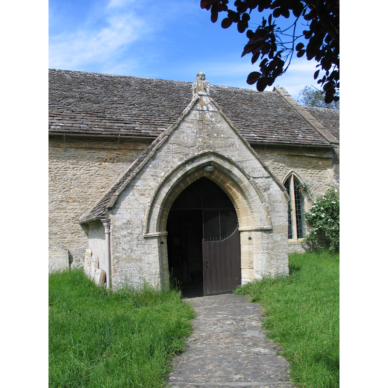
Copyright Statement: Image copyright © Baptisteria Sacra Index, 2023
Image Source: BSI - Photographed June 2, 2007
Copyright Instructions: CC-BY-NC-ND-4.0
view of church interior - looking east
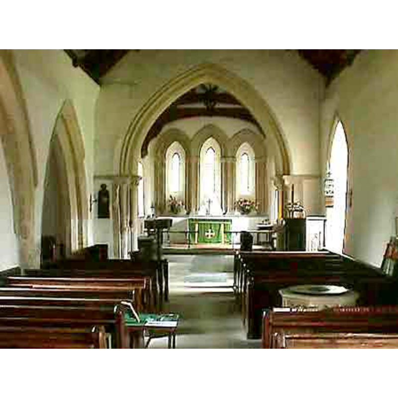
Scene Description: the new font visible on the right
Copyright Statement: Image copyright © John Wilkes, 2007
Image Source: digital photograph by John Wilkes [www.allthecotswolds.com]
Copyright Instructions: Standing permission
INFORMATION
Font ID: 12978EAS
Object Type: Baptismal Font1?
Date Visited: 2007-06-02
Font Date: ca. 1114?
Font Century and Period/Style: 12th century, Norman
Church / Chapel Name: Parish Church of St. Andrew
Church Patron Saint(s): St. Andrew
Church Address: Eastleach, Gloucestershire, GL7 3NH
Site Location: Gloucestershire, South West, England, United Kingdom
Directions to Site: Located just across Eastleach St. Martin, 7 km N of Lechlade, near the county border with Oxfordshire
Ecclesiastic Region: Diocese of Gloucester
Historical Region: Hundred of Brightwells-Barrow
Additional Comments: disappeared font? (the one from the original Norman church here)
Font Notes:
Click to view
There is an entry for Eastleach [variant spelling] in the Domesday survey [http://domesdaymap.co.uk/place/SP1905/eastleach-turville/] [accessed 18 July 2014], but it mentions neither church nor priest in it. The entry for this parish in the Victoria County History (Gloucester, vol. 7, 1981) notes: "Eastleach Turville had a church by 1114 when Henry I confirmed it to Tewkesbury Abbey"; there is no mention of a font in the VCH entry. The modern font is noted in Verey & Brooks (1999-2002): "Font. Probably early C19." Baptismal font of late construction, probably Victorian, consisting of an octagonal basin the sides of which are decorated with blank shields inscribed in trefoil arches, raised on a plain octagonal stem and a plain quadrangular lower base. The wooden cover is octagonal and flat, probably of the same date as the font itself. [NB: there is a Norman tympanum with a 'Maiestas domini' over the south door of the original church, but we have no information on the original font of this church].
Credit and Acknowledgements: We are grateful to John Wilkes, of www.allthecotswolds.com, for his photographs and help in documenting this font.
COORDINATES
UTM: 30U 589041 5733480
Latitude & Longitude (Decimal): 51.745143, -1.710272
Latitude & Longitude (DMS): 51° 44′ 42.52″ N, 1° 42′ 36.98″ W
LID INFORMATION
Date: 19th century?
Material: wood
Apparatus: no
Notes: [cf. Font notes]
REFERENCES
- Victoria County History [online], University of London, 1993-. URL: https://www.british-history.ac.uk.
- Verey, David, Gloucestershire, London: Penguin Books, 1999-2002, vol. 1: 350