Westcote
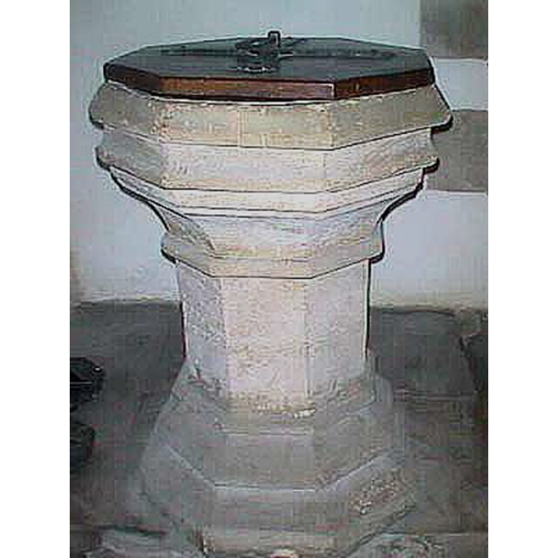
Image copyright © John Wilkes, 2007
Standing permission
Results: 4 records
view of font and cover
Copyright Statement: Image copyright © John Wilkes, 2007
Image Source: digital photograph by John Wilkes, 2007 [www.allthecotswolds.com]
Copyright Instructions: Standing permission
design element - motifs - moulding
Copyright Statement: Image copyright © John Wilkes, 2007
Image Source: digital photograph by John Wilkes, 2007 [www.allthecotswolds.com]
Copyright Instructions: Standing permission
view of church exterior - south view
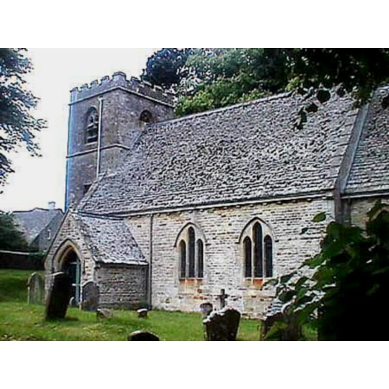
Copyright Statement: Image copyright © John Wilkes, 2007
Image Source: digital photograph by John Wilkes, 2007 [www.allthecotswolds.com]
Copyright Instructions: Standing permission
design element - motifs - moulding
Copyright Statement: Image copyright © John Wilkes, 2007
Image Source: digital photograph by John Wilkes, 2007 [www.allthecotswolds.com]
Copyright Instructions: Standing permission
INFORMATION
Font ID: 12969WES
Object Type: Baptismal Font1
Font Century and Period/Style: 15th century, Perpendicular
Church / Chapel Name: Parish Church of St. Mary
Font Location in Church: Inside the church, by the S entranceway
Church Patron Saint(s): St. Mary the Virgin
Church Address: Westcote, Gloucestershire OX7 6SH, UK
Site Location: Gloucestershire, South West, England, United Kingdom
Directions to Site: Located 2 km ENE of Upper Rissington, 6 km SSE of Stow-on-the-Wold, 10 km NNE of Burford (Oxon.)
Ecclesiastic Region: Diocese of Gloucester
Historical Region: Hundred of Slaughter
Additional Comments: disappeared font? (the one from the 13thC church here)
Font Notes:
Click to view
No individual entry found for this Westcote in the Domesday survey. The entry for this parish in the Victoria County History (Gloucester, vol. 6, 1965) notes: "The earliest documentary evidence of a church is in 1268 when the Rector of 'Combe' (i.e. Westcote) was licensed to be absent from his cure. [...] The church of St. Mary in Church Westcote [...] was almost entirely rebuilt from 1876 onwards. [...] The former building had a chancel and nave built in the 13th century [...] and a tower added in the 15th century. [...] The 15th-century font has an octagonal moulded bowl and a plain octagonal stem." Noted in Verey & Brooks (1999-2002): "Font. C15th, octagonal, with moulded bowl and plain stem.." [NB: we have no information on the font from the 13th-century church here].
Credit and Acknowledgements: We are grateful to John Wilkes, of www.allthecotswolds.com, for the photographs of this church and font.
COORDINATES
UTM: 30U 590693 5748910
Latitude & Longitude (Decimal): 51.88358, -1.6823
Latitude & Longitude (DMS): 51° 53′ 0.89″ N, 1° 40′ 56.28″ W
MEDIUM AND MEASUREMENTS
Material: stone
Font Shape: octagonal, mounted
Basin Interior Shape: round
Basin Exterior Shape: octagonal
LID INFORMATION
Material: wood
Apparatus: no
Notes: octagonal and flat, with ring handle
REFERENCES
- Victoria County History [online], University of London, 1993-. URL: https://www.british-history.ac.uk.
- Verey, David, Gloucestershire, London: Penguin Books, 1999-2002, vol. 1: 713