Coln St. Dennis / Colne [Domesday]
![Main image for Coln St. Dennis / Colne [Domesday]](/static-50478a99ec6f36a15d6234548c59f63da52304e5/compressed/1070526013_compressed.png)
Image copyright © John Wilkes, 2007
Standing permission
Results: 2 records
view of font and cover
Copyright Statement: Image copyright © John Wilkes, 2007
Image Source: digital photograph by John Wilkes, 2007 [www.allthecotswolds.com]
Copyright Instructions: Standing permission
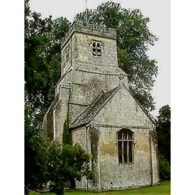
view of church exterior
Copyright Statement: Image copyright © John Wilkes, 2007
Image Source: digital photograph by John Wilkes, 2007 [www.allthecotswolds.com]
Copyright Instructions: Standing permission
INFORMATION
Font ID: 12967COL
Object Type: Baptismal Font1
Font Century and Period/Style: 12th century [re-cut -- 15th-century base] [composite font], Medieval [composite]
Church / Chapel Name: Parish Church of St. James the Great
Font Location in Church: Inside the church
Church Patron Saint(s): St. James the Greater [aka James the Great, James the Elder] [St. Katherine's in the 13thC]
Church Notes: The VCH notes: "The church of ST. JAMES THE GREAT (fn. 178) was called St. Katherine's in the late 13th century, (fn. 179) St. Dennis's in the 18th, (fn. 180) and was thought to have once borne an invocation to St. Kenelm." [cf. VCH entry in FontNotes]
Church Address: Coln St Dennis, Gloucestershire GL54 3JU
Site Location: Gloucestershire, South West, England, United Kingdom
Directions to Site: Located off the A429, 5 km SW of Northleach, 11 km NE of Cirencester
Ecclesiastic Region: Diocese of Gloucester
Historical Region: Hundred of Deerhurst
Additional Comments: altered font / re-cut font / on a later [15thC] base / composite font
Font Notes:
Click to view
There is an an entry for Coln [St Dennis] [variant spelling] in the Domesday survey [https://opendomesday.org/place/SP0810/coln-st-dennis/] [accessed 31 January 2019] but it mentions neither cleric nor church in it. The entry for this parish in the Victoria County History (Gloucester, vol. 8, 1968) notes: "Architectural evidence shows that there was a church at Coln St. Dennis by the early 12th century, and perhaps earlier. [...] The older features of the church are characteristic of the earlier 12th century. [...] The font, which in 1891 was outside the church, [...] has a tub-shaped 12th-century bowl, chamfered into scallops to fit an octagonal pedestal"; this latter reference is footnoted: "'Glos. fonts', Trans. B.G.A.S. xxxvi. 176." Noted in Verey & Brooks (1999-2002): "Font. Plain Norman tub-shaped bowl, later chamfered into eight roughly shaped scallops to fit the 15th C octagonal pedestal." The wooden cover is octagonal and modern.
Credit and Acknowledgements: We are grateful to John Wilkes, of www.allthecotswolds.com, for the photographs of this church and font.
COORDINATES
UTM: 30U 577463 5739042
Latitude & Longitude (Decimal): 51.796864, -1.876698
Latitude & Longitude (DMS): 51° 47′ 48.71″ N, 1° 52′ 36.11″ W
MEDIUM AND MEASUREMENTS
Material: stone
Font Shape: tub-shaped, re-cut
Basin Interior Shape: round
Basin Exterior Shape: round [re-cut at undebowl]
LID INFORMATION
Date: modern
Material: wood
Apparatus: no
Notes: [cf. FontNotes]
REFERENCES
- Victoria County History [online], University of London, 1993-. URL: https://www.british-history.ac.uk.
- Verey, David, Gloucestershire, London: Penguin Books, 1999-2002, vol. 1: 300