Guisborough No. 1 / Chigesborg / Chigesburg / Ghigesborc / Ghigesborg / Ghigesburg / Gigesburg / Gyghesborc / Gyseburne
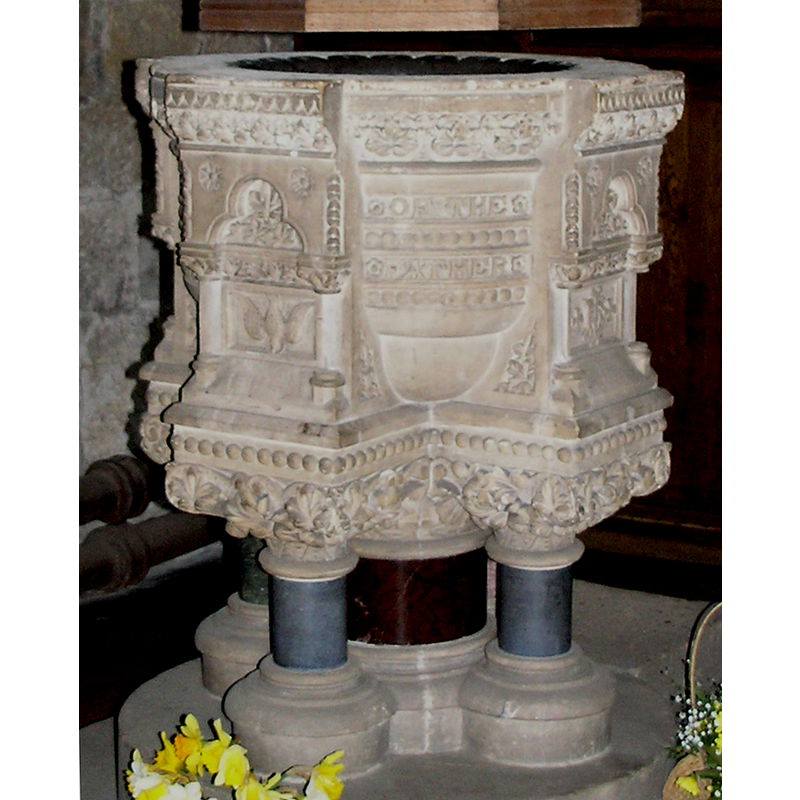
Image copyright © Colin Hinson, 2008
Standing permission
Results: 6 records
view of font
Copyright Statement: Image copyright © Colin Hinson, 2008
Image Source: digital photograph taken 2007 by Colin Hinson [www.yorkshireCDbooks.com]
Copyright Instructions: Standing permission
view of font and cover
Copyright Statement: Image copyright © Colin Hinson, 2008
Image Source: digital photograph taken 2007 by Colin Hinson [www.yorkshireCDbooks.com]
Copyright Instructions: Standing permission
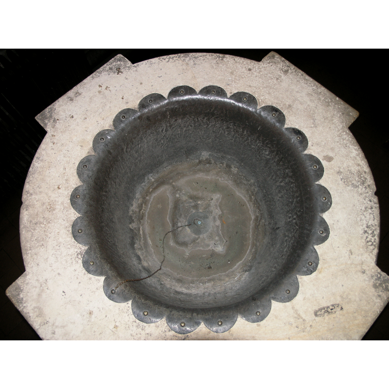
view of basin - interior
Copyright Statement: Image copyright © Colin Hinson, 2008
Image Source: digital photograph taken 2007 by Colin Hinson [www.yorkshireCDbooks.com]
Copyright Instructions: Standing permission
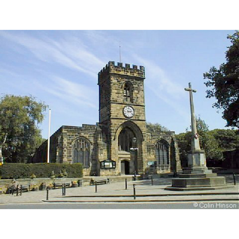
view of church exterior
Copyright Statement: Image copyright © Colin Hinson, 2008
Image Source: digital photograph taken 2007 by Colin Hinson [www.yorkshireCDbooks.com]
Copyright Instructions: Standing permission
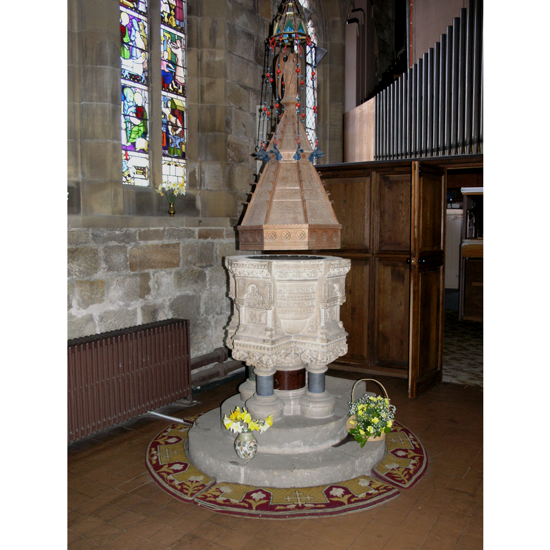
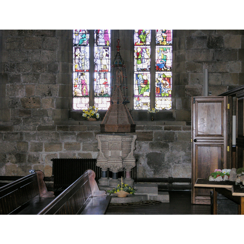
view of font and cover in context
Copyright Statement: Image copyright © Colin Hinson, 2008
Image Source: digital photograph taken 2007 by Colin Hinson [www.yorkshireCDbooks.com]
Copyright Instructions: Standing permission
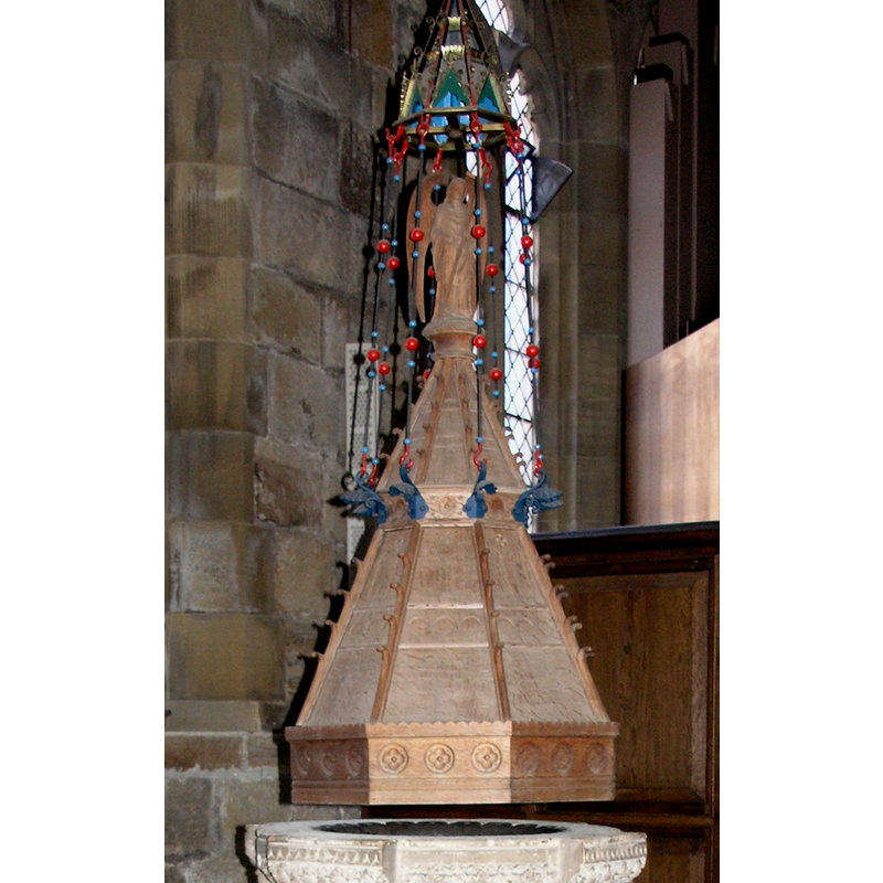
view of font cover
Copyright Statement: Image copyright © Colin Hinson, 2008
Image Source: digital photograph taken 2007 by Colin Hinson [www.yorkshireCDbooks.com]
Copyright Instructions: Standing permission
INFORMATION
Font ID: 12952GUI
Object Type: Baptismal Font1?
Font Century and Period/Style: 13th century (late?), Medieval
Church / Chapel Name: Parish Church of St. Nicholas
Church Patron Saint(s): St. Nicholas of Myra
Church Address: Church St, Guisborough TS14 6BS, UK -- Tel.: +44 1287 632588
Site Location: North Yorkshire, Yorkshire and the Humber, England, United Kingdom
Directions to Site: Located on the A171, 10 km ESE of Middlesborough
Ecclesiastic Region: Diocese of York
Historical Region: Hundred of Langbaurgh
Additional Comments: disappeared font? (the one from the original Domesday-time church here)
Font Notes:
Click to view
There are four entries for Guisborough [variant spellings] in the Domesday survey [https://opendomesday.org/place/NZ6116/guisborough/] [accessed 30 September 2019], two of which report a church in each. The entry for this parish in the Victoria County History (York North Riding, vol. 2, 1923) notes: "Domesday Book records that in the Count of Mortain's holding at Guisborough, Middleton and Hutton there was a church with a priest. [...] Not until 1426, however, is the church of St. Nicholas [...] mentioned. The church was presumably included, though it is not named, in the grant of Guisborough made about 1119–24 by Robert de Brus to the priory of St. Mary [...] The building has but little ancient work [...] except in the chancel, nave arcades and tower, having been almost entirely rebuilt or restored at the close of the 18th century and again in 1903–8. The older parts just named are of late 15th or early 16th-century date and are of no great architectural interest, though the design of the tower with its lofty external arch and recessed entrance is unusual. [...] The font dates from 1872." The entry for this church in Historic England [Listing NGR: NZ6165016118] notes: "Church, c.1500, on pre-1086 foundation. Aisle walls rebuilt 1790 and largely again during restoration of 1904-8 by Temple Moore. North extensions of 1889"; no font mentioned.
Although the church of St. Nicholas is old, earlier parts dating to the late-13th and 15th centuries; it was rebuilt at the end of the 18th century, the font itself is Victorian, consisting of a round tub with protrusions at the four cardinal points, an awkward design resting on five squat marble colums and a two-step plinth. The wooden cover is a tall octagonal construct with an angel (?) finial; the upper part is decorated with what appears to be a mobile of sorts. [NB: we have no information on the earlier font here].
Although the church of St. Nicholas is old, earlier parts dating to the late-13th and 15th centuries; it was rebuilt at the end of the 18th century, the font itself is Victorian, consisting of a round tub with protrusions at the four cardinal points, an awkward design resting on five squat marble colums and a two-step plinth. The wooden cover is a tall octagonal construct with an angel (?) finial; the upper part is decorated with what appears to be a mobile of sorts. [NB: we have no information on the earlier font here].
Credit and Acknowledgements: We are grateful to Colin Hinson, of www.yorkshireCDbooks.com, for the photographs of church and font.
COORDINATES
UTM: 30U 626222 6045003
Latitude & Longitude (Decimal): 54.53683, -1.0491
Latitude & Longitude (DMS): 54° 32′ 12.59″ N, 1° 2′ 56.76″ W
LID INFORMATION
Material: wood
Apparatus: yes
Notes: [cf. FontNotes]
REFERENCES
- Victoria County History [online], University of London, 1993-. URL: https://www.british-history.ac.uk.