Brumstead / Brumestada / Brunestada / Brunstead / Brunstede
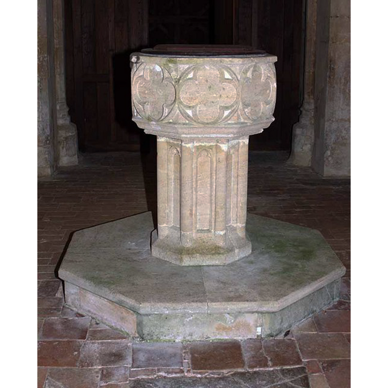
Image copyright © John Salmon, 2008
CC-BY-SA-3.0
Results: 9 records
view of font and cover
Copyright Statement: Image copyright © John Salmon, 2008
Image Source: digital photograph taken 27 August 2008 by John Salmon [www.geograph.org.uk/photo/966504] [accessed 13 December 2013]
Copyright Instructions: CC-BY-SA-3.0
design element - motifs - quatrefoil - in a circle - 8
Scene Description: [cf. Font notes]
Copyright Statement: Image copyright © John Salmon, 2008
Image Source: digital photograph taken 27 August 2008 by John Salmon [www.geograph.org.uk/photo/966504] [accessed 13 December 2013]
Copyright Instructions: CC-BY-SA-3.0
design element - architectural - column - engaged column - 8
Copyright Statement: Image copyright © John Salmon, 2008
Image Source: digital photograph taken 27 August 2008 by John Salmon [www.geograph.org.uk/photo/966504] [accessed 13 December 2013]
Copyright Instructions: CC-BY-SA-3.0
view of church exterior - southwest view
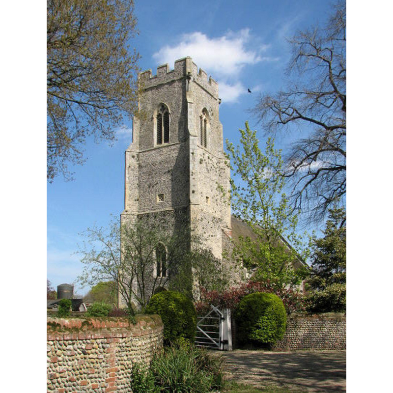
Copyright Statement: Image copyright © Evelyn Simak, 2007
Image Source: digital photograph taken May 2007 by Evelyn Simak [www.geograph.org.uk/photo/564095] [accessed 13 December 2013]
Copyright Instructions: CC-BY-SA-3.0
view of church exterior - southeast view
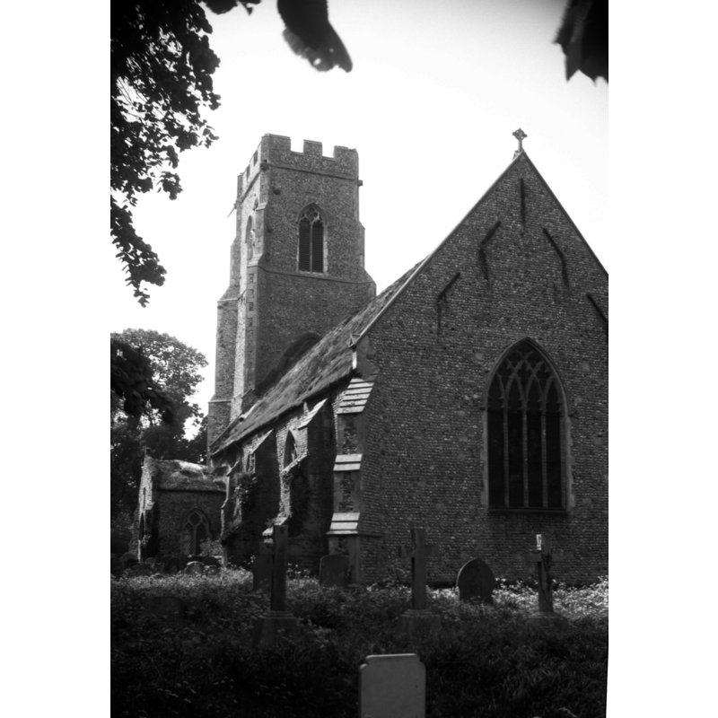
Scene Description: Photo caption: "Early 14c nave. The chancel cut short and rebuilt in 1827"
Copyright Statement: Image copyright © George Plunkett, 2013
Image Source: B&W photograph taken 23 May 1993 by George Plunkett [www.georgeplunkett.co.uk/Norfolk/B/Brumstead St Peter's church from SE [6987] 1993-05-23.jpg] [accessed 13 December 2013]
Copyright Instructions: Standing permission by Jonathan Plunkett
view of church interior - nave - looking west
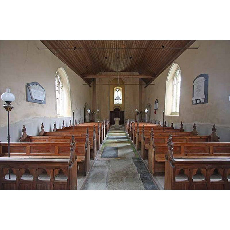
Scene Description: the baptismal font at the west end
Copyright Statement: Image copyright © John Salmon, 2008
Image Source: digital photograph taken 27 August 2008 by John Salmon [www.geograph.org.uk/photo/966491] [accessed 13 December 2013]
Copyright Instructions: CC-BY-SA-3.0
view of church interior - nave - looking east
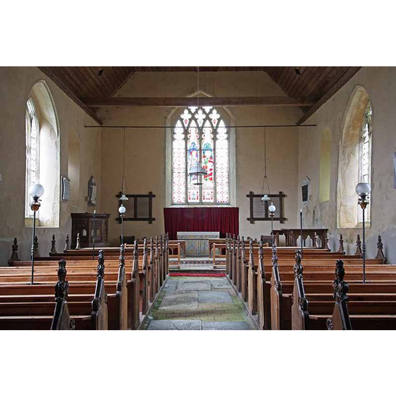
Copyright Statement: Image copyright © John Salmon, 2008
Image Source: digital photograph taken 27 August 2008 by John Salmon [www.geograph.org.uk/photo/966490] [accessed 13 December 2013]
Copyright Instructions: CC-BY-SA-3.0
design element - motifs - panel - trefoiled - 8
Scene Description: [cf. Font notes]
Copyright Statement: Image copyright © John Salmon, 2008
Image Source: digital photograph taken 27 August 2008 by John Salmon [www.geograph.org.uk/photo/966504] [accessed 13 December 2013]
Copyright Instructions: CC-BY-SA-3.0
design element - architectural - column - constructional - 8
Copyright Statement: Image copyright © John Salmon, 2008
Image Source: digital photograph taken 27 August 2008 by John Salmon [www.geograph.org.uk/photo/966504] [accessed 13 December 2013]
Copyright Instructions: CC-BY-SA-3.0
INFORMATION
Font ID: 12939BRU
Object Type: Baptismal Font1
Font Century and Period/Style: 14th century, Decorated
Church / Chapel Name: Parish Church of St. Peter
Font Location in Church: Inside the church, at the W end of the nave
Church Patron Saint(s): St. Peter
Church Address: The Avenue, Brunstead, Norfolk NR12 9EZ
Site Location: Norfolk, East Anglia, England, United Kingdom
Directions to Site: Located 25 km NE of Norwich, 30 km SSE of Cromer
Ecclesiastic Region: Diocese of Norwich
Historical Region: Hundred of Happing
Additional Comments: disappeared font? (the one from the Domesday-time church here)
Font Notes:
Click to view
There are two entries for Brumstead [variant spelling] in the Domesday survey [http://domesdaymap.co.uk/place/TG3626/brumstead/] [accessed 13 December 2013], the one for the Sutton manor reports three churches in it, one of which in Brumstead. Blomefield (1805-1810) writes: "B[runstead] Was a beruite to Roger Bigot's great lordship of Sutton, at the survey [...] a church endowed with 9 acres, &c. 8 acres of meadow [...] The Church is a rectory, dedicated to St. Peter. William Lord Montchensy was lord and patron in the reign of Edward I [i.e., 1272-1307]. The rector had a manse with 30 acres of land". Blomefield (ibid.) names "William de Lavenham" as the first recorded rector here, "presented by Sir Hugh de Veer", in 1306. The present font in this church is noted in Pevsner & Wilson (1997): "Font. C14. Octagonal; panelled stem, bowl with quatrefoils".
Credit and Acknowledgements: We are grateful to Jonathan Plunkett for the photograph of this church taken by his father, George Plunkett, 23 May 1993
COORDINATES
UTM: 31U 399718 5849610
Latitude & Longitude (Decimal): 52.786974, 1.512973
Latitude & Longitude (DMS): 52° 47′ 13.1″ N, 1° 30′ 46.7″ E
MEDIUM AND MEASUREMENTS
Material: stone
Number of Pieces: three?
Font Shape: octagonal, mounted
Basin Interior Shape: round
Basin Exterior Shape: octagonal
LID INFORMATION
Material: wood
Apparatus: no
Notes: flat, plain and round; apears modern
REFERENCES
- Blomefield, Francis, An essay towards a topographical history of Norfolk, 1805-1810, vol. 9: 287-290 / [www.british-history.ac.uk/report.aspx?compid=78544] [accessed 13 December 2013]
- Pevsner, Nikolaus, Norfolk 1: Norwich and North-East [2nd ed.], Harmondsworth: Penguin Books, 1997, p. 415