Braydeston / Bradeston / Bregestuna / Breideston
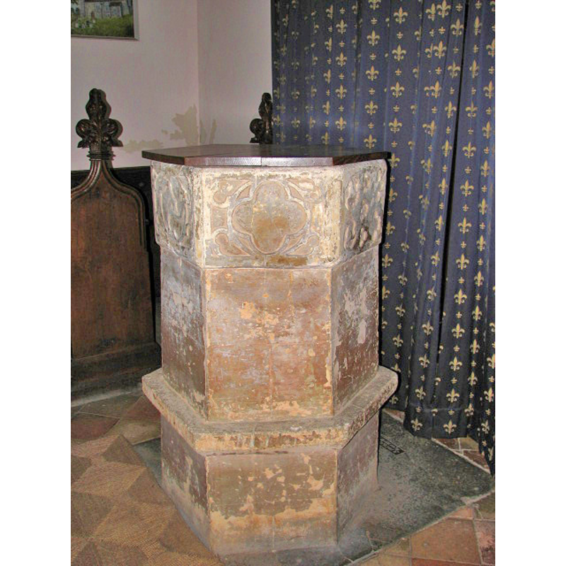
Image copyright © Evelyn Simak, 2007
CC-BY-SA-3.0 Attribution 3.0 Unported
Results: 5 records
view of font and cover
Copyright Statement: Image copyright © Evelyn Simak, 2007
Image Source: digital photograph taken 6 July 2007 by Evelyn Simak [www.geograph.org.uk/photo/857840] [accessed 7 August 2013]
Copyright Instructions: CC-BY-SA-3.0 Attribution 3.0 Unported
design element - patterns - tracery
Scene Description: contatining trefoils, quatrefoils, etc. [cf. Font notes]
EXT SE digital photograph taken 6 July 2007 by Evelyn Simak [www.geograph.org.uk/photo/857872] [accessed 7 August 2013]
INT E digital photograph taken 6 July 2007 by Evelyn Simak [www.geograph.org.uk/photo/857873] [accessed 7 August 2013]
INT W digital photograph taken 6 July 2007 by Evelyn Simak [www.geograph.org.uk/photo/857877] [accessed 7 August 2013]
FONT digital photograph taken 6 July 2007 by Evelyn Simak [www.geograph.org.uk/photo/857840] [accessed 7 August 2013]
Copyright Statement: Image copyright © Evelyn Simak, 2007
Image Source: digital photograph taken 6 July 2007 by Evelyn Simak [www.geograph.org.uk/photo/857840] [accessed 7 August 2013]
Copyright Instructions: CC-BY-SA-3.0 Attribution 3.0 Unported
view of church exterior - southeast view
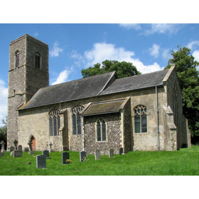
Copyright Statement: Image copyright © Evelyn Simak, 2007
Image Source: digital photograph taken 6 July 2007 by Evelyn Simak [www.geograph.org.uk/photo/857872] [accessed 7 August 2013]
Copyright Instructions: CC-BY-SA-3.0 Attribution 3.0 Unported
view of church interior - nave - looking west
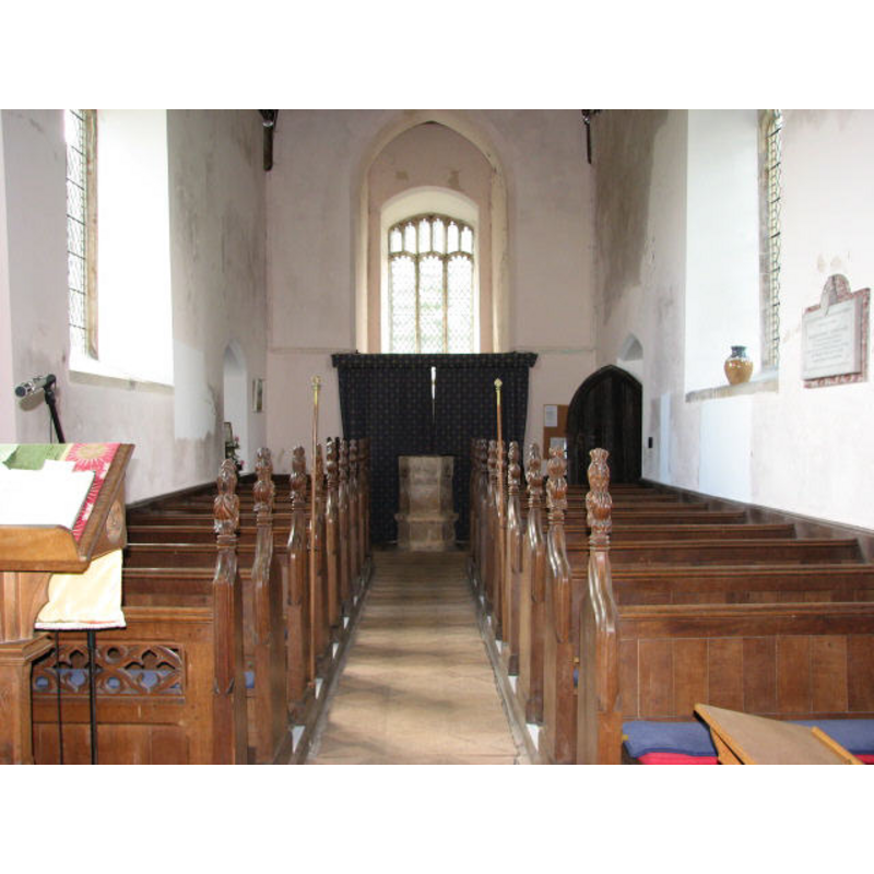
Scene Description: the font is visible at the back
Copyright Statement: Image copyright © Evelyn Simak, 2007
Image Source: digital photograph taken 6 July 2007 by Evelyn Simak [www.geograph.org.uk/photo/857877] [accessed 7 August 2013]
Copyright Instructions: CC-BY-SA-3.0 Attribution 3.0 Unported
view of church interior - nave - looking east
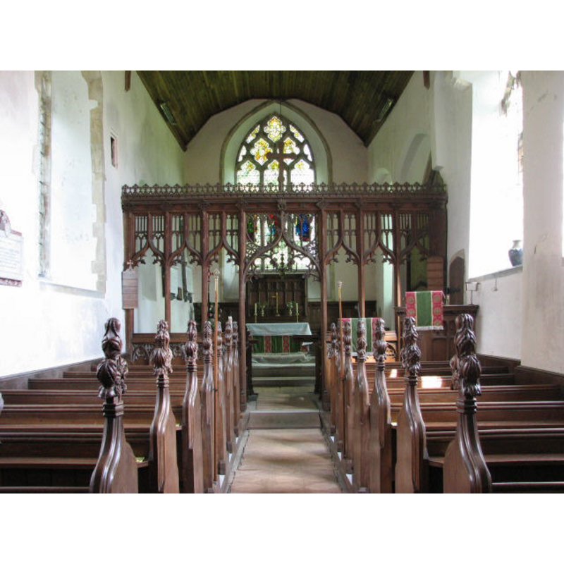
Copyright Statement: Image copyright © Evelyn Simak, 2007
Image Source: digital photograph taken 6 July 2007 by Evelyn Simak [www.geograph.org.uk/photo/857873] [accessed 7 August 2013]
Copyright Instructions: CC-BY-SA-3.0 Attribution 3.0 Unported
INFORMATION
Font ID: 12938BRA
Object Type: Baptismal Font1
Font Date: ca. 1340?
Font Century and Period/Style: 14th century (mid?), Decorated
Church / Chapel Name: Parish Church of St. Michael and All Angels
Font Location in Church: Inside the church
Church Patron Saint(s): St. Michael & All Angels
Church Address: Church Road, Braydeston, nr. Brundall, Norfolk NR13 4LD
Site Location: Norfolk, East Anglia, England, United Kingdom
Directions to Site: Located just NE of Brundall
Ecclesiastic Region: Diocese of Norwich
Historical Region: Hundred of Blofield
Additional Comments: disappeared font? (the one from the original pre-Conquest church here)
Font Notes:
Click to view
The Domesday entry for 'Bregestuna' cited in Blomefield (1805-1810) informs that at the time of Edward the Confessor this land was held by one Cedric, and the land included "a church endowed with 10 acres" [="i. ecclia. de x. ac."], but the town went to "William de Beaufoe Bishop of Thetford" after the Conquest. Blomefield (ibid.) further notes: "The Church is a rectory [...] dedicated to St. Michael. The length of the church is about 22 yards, the breadth 7 yards, is a single pile, has a little square tower about 45 feet high, with 3 bells, also a chancel, which with the church is covered with lead." The present font is noted in Persner & Wilson (1997): "Font. Coarse octagonal bowl with elementary tracery patterns, c.1340." Knott (2007) writes: "There was quite an early 19th century restoration here, and it is a restrained one, most fitting in this quiet place. The most unusual feature is the stumpy font; the top part is an octagonal bowl in the Decorated style, probably on the eve of the Black Death, but the pedestal is a huge thing, as wide as the bowl. I couldn't make out if they were two separate pieces of stone. Is it original, or was it added later to replace a collonade [i.e., colonnade]?" [NB: we have no information on the font of the pre-Conquest church here].
COORDINATES
UTM: 31U 395216 5831700
Latitude & Longitude (Decimal): 52.625166, 1.451953
Latitude & Longitude (DMS): 52° 37′ 30.6″ N, 1° 27′ 7.03″ E
MEDIUM AND MEASUREMENTS
Material: stone
Font Shape: octagonal, mounted
Basin Interior Shape: round
Basin Exterior Shape: octagonal
REFERENCES
- Blomefield, Francis, An essay towards a topographical history of Norfolk, 1805-1810, vol. 7: 216-218 / [www.british-history.ac.uk/report.aspx?compid=78336] [accessed 7 August 2013]
- Pevsner, Nikolaus, Norfolk 1: Norwich and North-East [2nd ed.], Harmondsworth: Penguin Books, 1997, p. 412