Hatherop / Etherope / Hetrope
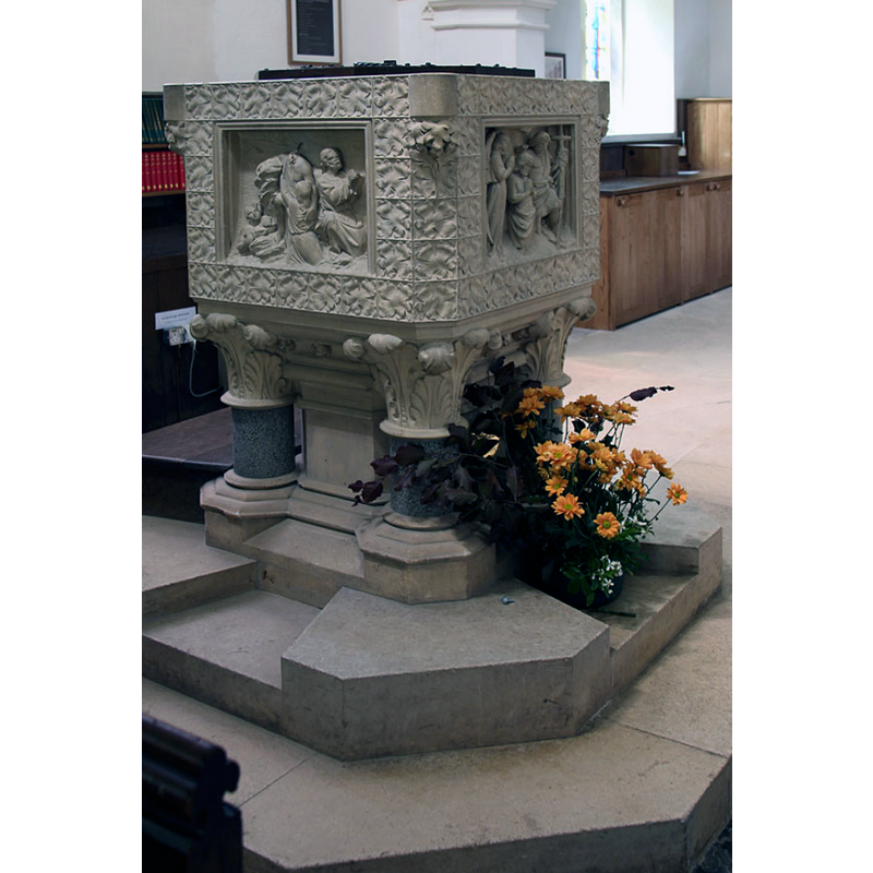
Image copyright © John Salmon, 2013
CC-BY-SA-2.0
Results: 3 records
view of font and cover in context
Scene Description: the mid-19thC font
Copyright Statement: Image copyright © John Salmon, 2013
Image Source: digital photograph taken 8 June 2013 by John Salmon [www.geograph.org.uk/photo/3514997] [accessed 21 December 2018]
Copyright Instructions: CC-BY-SA-2.0
view of font and cover
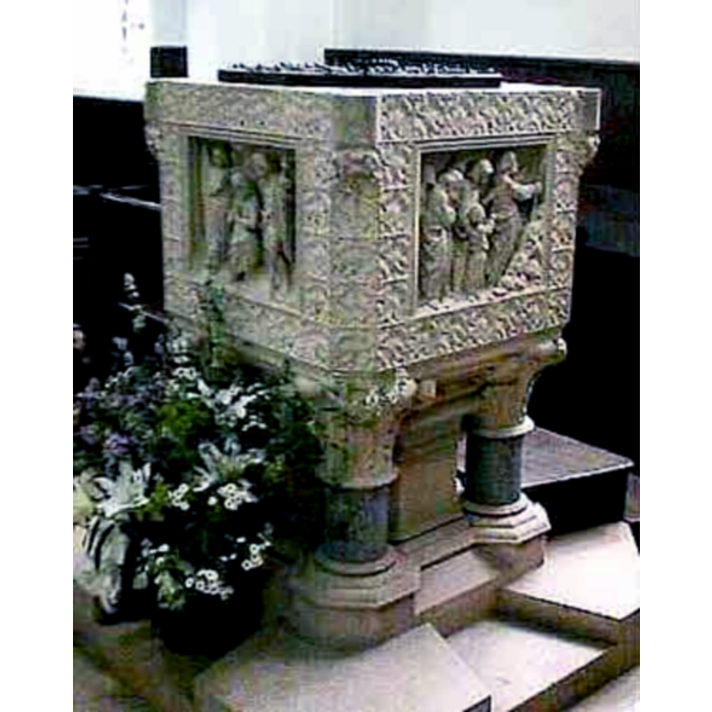
Scene Description: the mid-19thC font
Copyright Statement: Image copyright © John Wilkes, 2007
Image Source: digital photograph by John Wilkes April 2007
Copyright Instructions: Standing permission
view of church exterior - northeast view
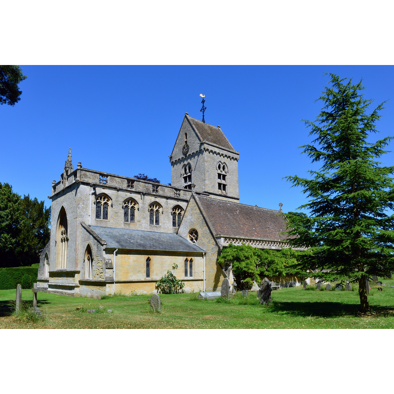
Copyright Statement: Image copyright © Oswald Bertram, 2015
Image Source: digital photograph taken 30 June 2015 by Oswald Bertram [www.geograph.org.uk/photo/4630682] [accessed 21 December 2018]
Copyright Instructions: CC-BY-SA-2.0
INFORMATION
Font ID: 12935HAT
Object Type: Baptismal Font1
Font Date: ca. 1096?
Font Century and Period/Style: 11th century (late?), Norman
Church / Chapel Name: Parish Church of St. Nicholas [aka St Matthew's]
Church Patron Saint(s): St. Nicholas of Myra
Church Address: Hatherop, Cirencester GL7 3NB, UK -- Tel.: 01285 750402
Site Location: Gloucestershire, South West, England, United Kingdom
Directions to Site: Located 3 km ESE of Bibury, 4 km N of Fairford, 15 km E of Cirencester
Ecclesiastic Region: Diocese of Cirencester
Historical Region: Hundred of Brightwells Barrow
Additional Comments: disappeared font? (the one from the ca. 1096 church here)
Font Notes:
Click to view
There are two entries for Hatherop [variant spellings] in the Domesday survey [http://opendomesday.org/place/SP1505/hatherop/] [accessed 21 December 2018] neither of which mentions cleric or church in it. The entry for this parish in the Victoria County History (Gloucester, vol. 7, 1981) notes: "The church at Hatherop was granted by Ernulf of Hesdin to Gloucester Abbey before 1096. [...] dedicated to ST. NICHOLAS by 1545 [...] but in the 18th and 19th centuries sometimes known as St. Matthew's [...] The font was given in 1858 as a memorial to Lord de Mauley." Verey and Brooks (1999-2002) write: "the font, square, on marble columns, with good sculptured panels, is a memorial to Lord de Mauley +1855." Baptismal font consisting of a square basin, each side decorated with a biblical scene [one appears to be the Baptism of Christ] framed in foliage panels; the base is made of a central shaft and four outer colonnettes, the capitals of the latter foliated, the bases moulded. Octagonal plinth. Round wooden cover with metal decoration and ring handle. [NB: Verey & Brooks (ibid.) inform that this church, "rebuilt in 1854-5 by Henry Clutton for Lord de Mauley" replaced an earlier Perpendicular building, but we have no information on the original font of that church]
Credit and Acknowledgements: We are grateful to John Wilkes, of www.allthecotswolds.com, for the photographs of this church and font.
COORDINATES
UTM: 30U 584326 5733310
Latitude & Longitude (Decimal): 51.744348, -1.778583
Latitude & Longitude (DMS): 51° 44′ 39.65″ N, 1° 46′ 42.9″ W
REFERENCES
- Victoria County History [online], University of London, 1993-. URL: https://www.british-history.ac.uk.
- Verey, David, Gloucestershire, London: Penguin Books, 1999-2002, vol. 1: 406