Alderley / Alrelie
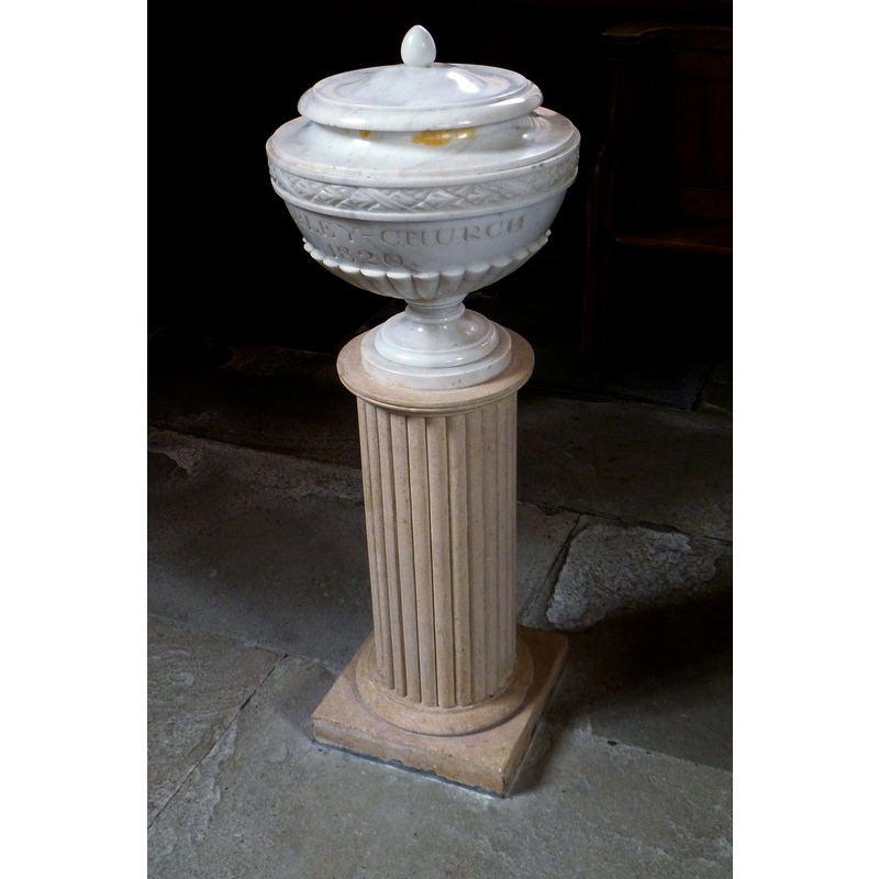
Image copyright © John Wilkes, 2018
Standing permission
Results: 3 records
view of font and cover
Scene Description: the modern font
Copyright Statement: Image copyright © John Wilkes, 2018
Image Source: digital photograph taken 17 April 2018 by John Wilkes
Copyright Instructions: Standing permission
view of church exterior - north view
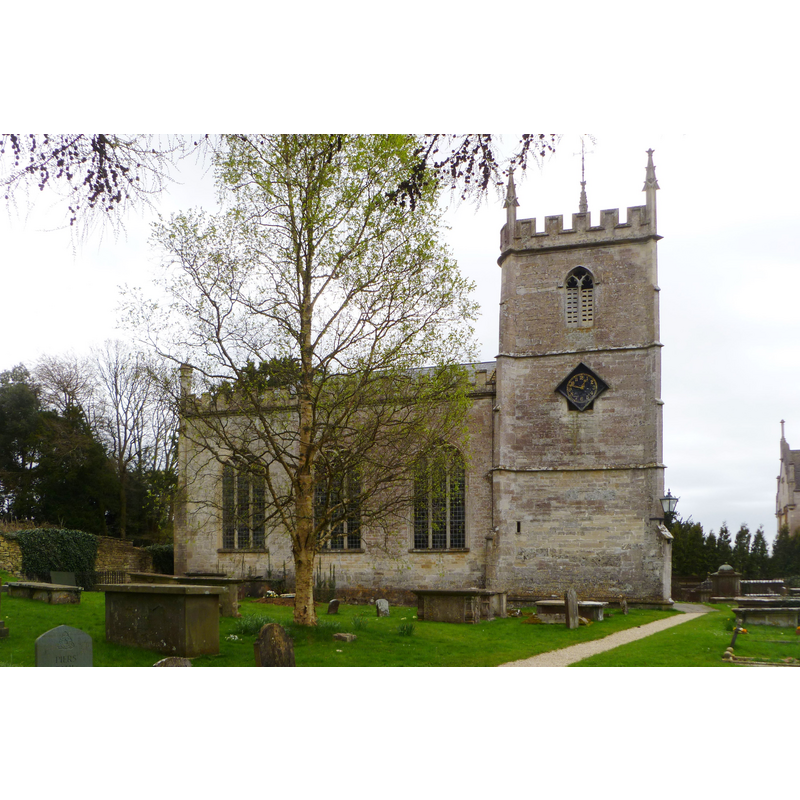
Copyright Statement: Image copyright © John Wilkes, 2018
Image Source: digital photograph taken 17 April 2018 by John Wilkes
Copyright Instructions: Standing permission
view of church interior - chancel
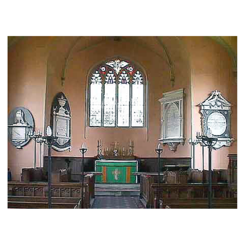
Copyright Statement: Image copyright © John Wilkes, 2007
Image Source: digital photograph by John Wilkes April 2007
Copyright Instructions: Standing permission
INFORMATION
Font ID: 12933ALD
Object Type: Baptismal Font1
Font Century and Period/Style: 12th - 13th century [re-cut in 19th century?], Medieval [altered]
Church / Chapel Name: Parish Church of St. Kenelm
Font Location in Church: Inside the church
Church Patron Saint(s): St. Kenelm [aka Cynehelm, Cynhelm, Kenelme]
Church Notes: Church re-built in 1802 but remaining tower from earlier medieval building is mid-15th century
Church Address: Alderley, Glocester GL12 7QT, UK -- Tel.: (01453) 842175
Site Location: Gloucestershire, South West, England, United Kingdom
Directions to Site: Located between the M5 (W) and the A433 (SE), just SE of Wotton-under-Edge, 10 km NE of Chipping Sudbury, 22 km from Stroud
Ecclesiastic Region: Dioxcese of Gloucester
Historical Region: Hundred of Grimboldestou
Additional Comments: altered font? / re-cut font? [NB: haven't been able to find a photo of the old re-cut font yet -- Dec 2008//mt]
Font Notes:
Click to view
There is an entry for this Alderley [variant spelling] in the Domesday survey [https://opendomesday.org/place/ST7690/alderley/] [accessed 19 April 2018], but it mntions neither cleric nor church in it. The basin of the older of two fonts has now a quasi-octagonal appearance, although it must have been square originally, like several others in the area, with scalloped lower sides; the basin is raised on a cluster of a central shaft and four angle colonnettes, raised on a square lower base, and a [later?] quadrangular plinth. Wooden cover, flat and shaped to match the chamfered angles of the altered basin, with metal decorations and ring handle. The entry for this church in Historic England [Listing NGR: ST7685090802] reports the modern font in it, a "white marble font of 1820". The object is descibed in John Wilkes as a "white marble urn on a fluted column". This same modern font is noted in Verey & Brooks (1999-2002) with date 1820].
Credit and Acknowledgements: We are grateful to John Wilkes, of www.allthecotswolds.com, for his photographs of this site
COORDINATES
UTM: 30U 545987 5718533
Latitude & Longitude (Decimal): 51.61595, -2.3358
Latitude & Longitude (DMS): 51° 36′ 57.42″ N, 2° 20′ 8.88″ W
MEDIUM AND MEASUREMENTS
Material: stone
Font Shape: square, mounted
Basin Interior Shape: round
Basin Exterior Shape: square [cf. FontNotes]
LID INFORMATION
Date: modern?
Material: wood
Apparatus: no
Notes: [cf. FontNotes]
REFERENCES
- Verey, David, Gloucestershire, London: Penguin Books, 1999-2002, vol. 1: 133