Birdlip
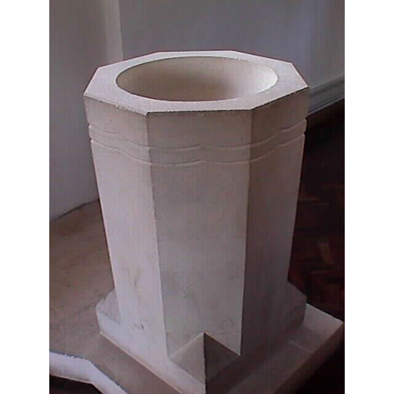
Image copyright © John Wilkes, 2007
Standing permission
Results: 2 records
view of font
Copyright Statement: Image copyright © John Wilkes, 2007
Image Source: digital photograph by John Wilkes 9 April 2007 [www.allthecotswolds.com]
Copyright Instructions: Standing permission
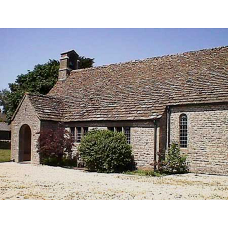
view of church exterior - south view
Copyright Statement: Image copyright © John Wilkes, 2007
Image Source: digital photograph by John Wilkes 9 April 2007 [www.allthecotswolds.com]
Copyright Instructions: Standing permission
INFORMATION
Font ID: 12930BIR
Object Type: Baptismal Font1?
Font Date: ca. 1287?
Font Century and Period/Style: 13th century (late?), Medieval
Church / Chapel Name: Parish Church of St. Mary [new church]
Church Patron Saint(s): St. Mary the Virgin
Site Location: Gloucestershire, South West, England, United Kingdom
Directions to Site: Located off the A417, 8 km SE of Gloucester, 10 km S of Cheltenham
Historical Region: Hundred of Rapsgate
Additional Comments: disappeared font? [cf. FontNotes]
Font Notes:
Click to view
No individual entry found for Birdlip in the Domesday survey. The entry for the parish of Brimpfield in the Victoria County History (Gloucester, vol. 7, 1981) notes: "A church mentioned in Birdlip in 1287 has not been traced. [...] An iron mission church, dedicated to ST. MARY, opened there in 1897. The church, built by subscription on land next to the Black Horse provided by W. F. Hicks Beach, [...] was served by the rector of Great Witcombe or lay readers. [...] After the First World War the rector of Brimpsfield took the services [...] and in 1928 the church was included in Brimpsfield ecclesiastical parish. [...] The church was destroyed by fire in 1954, and in 1958 a new church of St. Mary opened by the Brimpsfield road. (fn. 336) That church, built of coursed rubble with ashlar dressings, comprises chancel with north vestry, nave, and south porch." The one-piece octagonal font is modern, as is the church itself, from 1957, but the inspiration for the font design is back in Norman times. The earlier [Victorian?] church was destroyed in a fire [NB: we do not have any information on the earlier font].
Credit and Acknowledgements: We are grateful to John Wilkes, of www.allthecotswolds.com, for the photographs of this church and font.
COORDINATES
UTM: 30U 562037 5741068
REFERENCES
- Victoria County History [online], University of London, 1993-. URL: https://www.british-history.ac.uk.