Bastwick / Repps cum Bastwick
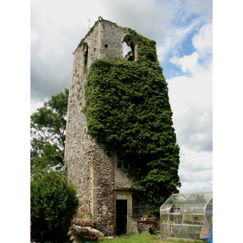
Image copyright © Evelyn Simak, 2007
CC-BY-SA-3.0
Results: 2 records
view of church exterior - tower
Scene Description: in 2006
Copyright Statement: Image copyright © Evelyn Simak, 2007
Image Source: digital photograph taken 28 June 2007 by Evelyn Simak [www.geograph.org.uk/photo/479521] [accessed 24 September 2013]
Copyright Instructions: CC-BY-SA-3.0
view of church exterior - tower
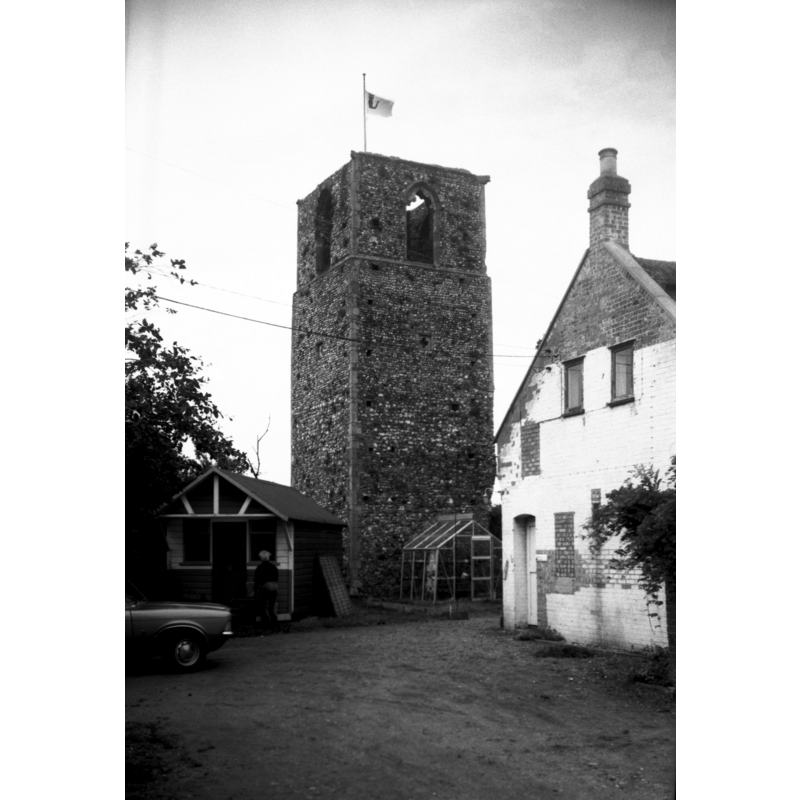
Scene Description: Photo caption: "The ruined tower of this long-dilapidated church dates from the 15c"
Copyright Statement: Image copyright © George Plunkett, 2013
Image Source: B&W photograph taken 14 August 1978 by George Plunkett [www.georgeplunkett.co.uk/Norfolk/R/Repps cum Bastwick St Peter's church ruin [5955] 1978-08-14.jpg] [accessed 24 September 2013]
Copyright Instructions: Standing permission
INFORMATION
Font ID: 12921BAS
Object Type: Baptismal Font1, basin only?
Font Century and Period/Style: 14th century [basin only] [composite font], Medieval [composite]
Church / Chapel Name: Parish Church of St. Peter [in ruins]
Font Location in Church: [cf. FontNotes]
Church Patron Saint(s): St. Peter
Church Address: Tower Road, Repps, Norfolk NR29 5JW
Site Location: Norfolk, East Anglia, England, United Kingdom
Directions to Site: Located near Repps, with which it forms a civil parish ("Repps cum Bastwick"), 16 km NE of Gt. Yarmout, 22 km NE of Norwich
Ecclesiastic Region: [Diocese of Norwich]
Historical Region: Hundred of North Erpibgham
Additional Comments: abandoned font / disused font / missing base? [NB: we have not been able to ascertain the survival of the font after 1997]
Font Notes:
Click to view
There is no mention of this hamlet in Blomefield's (1805-1810) chapter on the Hundred of North Erpingham. Wilson's Imperial Gazetteer (1870-1872) reports "a ruined church" in the hamlet of Repp. Pevsner & Wilson (1997) report: "In the garden [...] is the octagonal font bowl, supported on various fragments of masonry from the church." [cf. Index entry for Repps for the active church serving both Repps and Bastwick].
COORDINATES
UTM: 31U 404735 5840525
Latitude & Longitude (Decimal): 52.706236, 1.589993
Latitude & Longitude (DMS): 52° 42′ 22.45″ N, 1° 35′ 23.98″ E
MEDIUM AND MEASUREMENTS
Material: stone
Font Shape: octagonal, mounted
Basin Interior Shape: round
Basin Exterior Shape: octagonal
REFERENCES
- Blomefield, Francis, An essay towards a topographical history of Norfolk, 1805-1810, vol. 8: 148-155 / [www.british-history.ac.uk/report.aspx?compid=78430] [accessed 24 September 2013]
- Pevsner, Nikolaus, Norfolk 1: Norwich and North-East [2nd ed.], Harmondsworth: Penguin Books, 1997, p. 381
- Wilson, John Marius, Imperial Gazetteer of England and Wales: embracing recent changes in counties, dioceses, parishes, and boroughs [...], Edinburgh: A. Fullarton & Co., 1870-1872, [transcribed in www.visionofbritain.org.uk/place/25080 [accessed 24 August 2013]]