Barningham / Barningham Magna / Barningham Winter / Barningham Town / Berningham Winter / Great Barningham / Ton Berningham / Tun Berningham
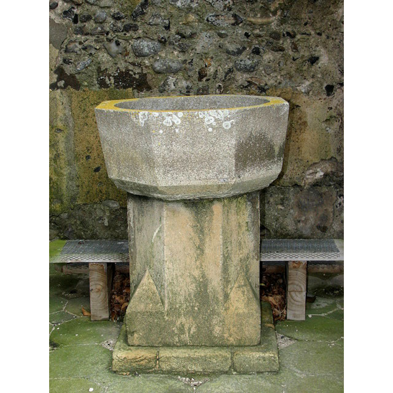
Image copyright © Evelyn Simak, 2007
CC-BY-SA-3.0
Results: 6 records
view of font
Copyright Statement: Image copyright © Evelyn Simak, 2007
Image Source: digital photograph taken 4 July 2007 by Evelyn Simak [www.geograph.org.uk/photo/831174] [accessed 18 September 2013]
Copyright Instructions: CC-BY-SA-3.0
view of font
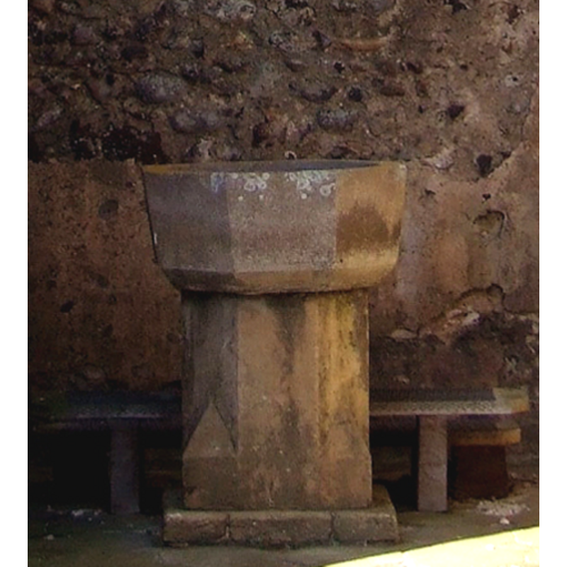
Copyright Statement: Image copyright © Simon Knott, 2008
Image Source: detail of a digital photograph taken 4 April 2008 by Simon Knott [http://www.flickr.com/photos/norfolkodyssey/2387489864/] [accessed 24 March 2009]
Copyright Instructions: Standing permission
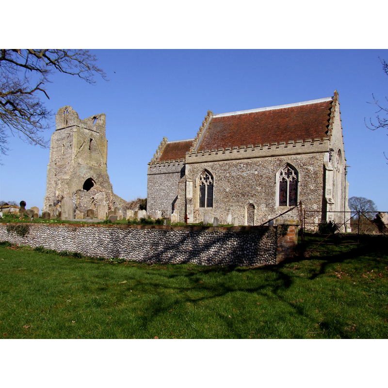
view of church exterior - southwest view
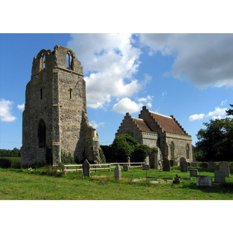
Copyright Statement: Image copyright © John Salmon, 2005
Image Source: digital photograph taken 3 August 2005 by John Salmon [www.geograph.org.uk/photo/318224] [accessed 18 September 2013]
Copyright Instructions: CC-BY-SA-3.0
view of church exterior - southwest view
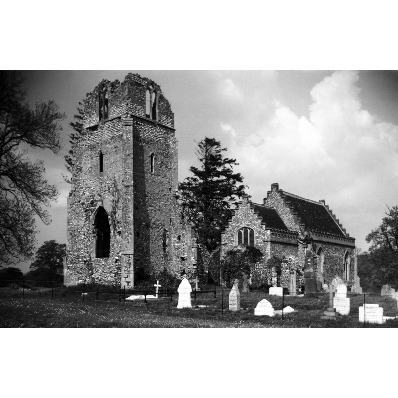
Scene Description: Photo caption: "In ruins except for 14c chancel"
Copyright Statement: Image copyright © George Plunkett, 2013
Image Source: B&W photograph taken 28 May 1950 by George Plunkett [www.georgeplunkett.co.uk/Norfolk/B/Barningham Winter St Peter's church from SW [3865] 1950-05-28.jpg] [accessed 18 September 2013]
Copyright Instructions: Standing permission by Jonathan Plunkett
view of font in context
![the font is beneath the tower [cf. Font notes]](/static-50478a99ec6f36a15d6234548c59f63da52304e5/compressed/1090324006_compressed.png)
Scene Description: the font is beneath the tower [cf. Font notes]
Copyright Statement: Image copyright © Simon Knott, 2008
Image Source: digital photograph taken 4 April 2008 by Simon Knott [http://www.flickr.com/photos/norfolkodyssey/2387489864/] [accessed 24 March 2009]
Copyright Instructions: Standing permission
view of church exterior
Copyright Statement: Image copyright © Simon Knott, 2008
Image Source: digital photograph taken 4 April 2008 by Simon Knott [http://www.flickr.com/photos/norfolkodyssey/2386758965/] [accessed 24 March 2009]
Copyright Instructions: Standing permission
INFORMATION
Font ID: 12919BAR
Object Type: Baptismal Font1
Font Century and Period/Style: 13th - 14th century, Early English? / Decorated?
Church / Chapel Name: Parish Church of St. Mary
Font Location in Church: [cf. FontNotes]
Church Patron Saint(s): St. Mary the Virgin
Church Notes: "The church dates from the 14th century. The nave and tower have been in ruins since the early 17th century.The present useable part of the building consists of the 14th century chancel with Victorian additions. The ruined tower contains a unique Victorian steel bell, one of only three in the County of Norfolk." [source: http://www.barninghamwinter.churchnorfolk.com/] [accessed 23 March 2009]
Church Address: Barningham Park, Matlaske, Norfolk, NR11 7HY
Site Location: Norfolk, East Anglia, England, United Kingdom
Directions to Site: The ruined tower is in Barningham Park, in the outskirts of Matlaske
Ecclesiastic Region: Diocese of Norwich
Historical Region: Hundred of North Erpingham
Font Notes:
Click to view
There is no mention of church or cleric in the Domesday entries for "Berningeham" or "Berningham". Blomefield (1805-1810) writes: "At the survey [i.e., Domesday] there was but one town, in this hundred, of the name of Barningham [cf. supra], which at that time included what is now called Barningham Northwood, and also the town of Barningham Winter [...] The Church is dedicated to St. Mary, and is a rectory, valued in King Edward the First's reign [i.e., 1272-1307] at 10 marks [...] The church is dilapidated, and nothing of it remains but the chancel" [NB: Blomefield writing ca. 1750?]. The present font is noted in Pevsner & Wilson (1997): "Font. C13, octagonal and of Purbeck marble." The April 2008 entry in Simon Knott's Norfolk Churches reports: "There is a medieval font outside under the ruined tower, which is still used, apparently."
Credit and Acknowledgements: We are grateful to Simon Knott, of Norfolk Churches, for his photographs of this church and font; we are also grateful to Jonathan Plunkett for the photograph of this church taken by his father, George Plunkett, in May 1950
COORDINATES
UTM: 31U 378108 5859993
Latitude & Longitude (Decimal): 52.875816, 1.188821
Latitude & Longitude (DMS): 52° 52′ 32.94″ N, 1° 11′ 19.76″ E
MEDIUM AND MEASUREMENTS
Material: stone, limestone (Purbeck marble)
Font Shape: octagonal, mounted
Basin Interior Shape: round
Basin Exterior Shape: octagonal
REFERENCES
- Blomefield, Francis, An essay towards a topographical history of Norfolk, 1805-1810, vol. 8: 97-101 / [www.british-history.ac.uk/report.aspx?compid=78417] [accessed 18 September 2013]
- Pevsner, Nikolaus, Norfolk 1: Norwich and North-East [2nd ed.], Harmondsworth: Penguin Books, 1997, p. 378