Aylmerton / Almertune
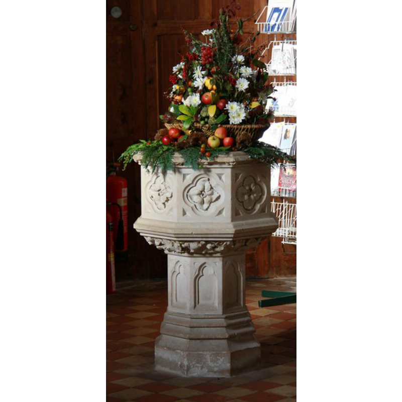
Image copyright © John Salmon, 2011
CC-BY-SA-3.0
Results: 6 records
view of font
Scene Description: the modern font
Copyright Statement: Image copyright © John Salmon, 2011
Image Source: digital photograph taken 24 October 2011 by John Salmon [www.geograph.org.uk/photo/2663854] [accessed 18 September 2013]
Copyright Instructions: CC-BY-SA-3.0
view of church exterior - north view
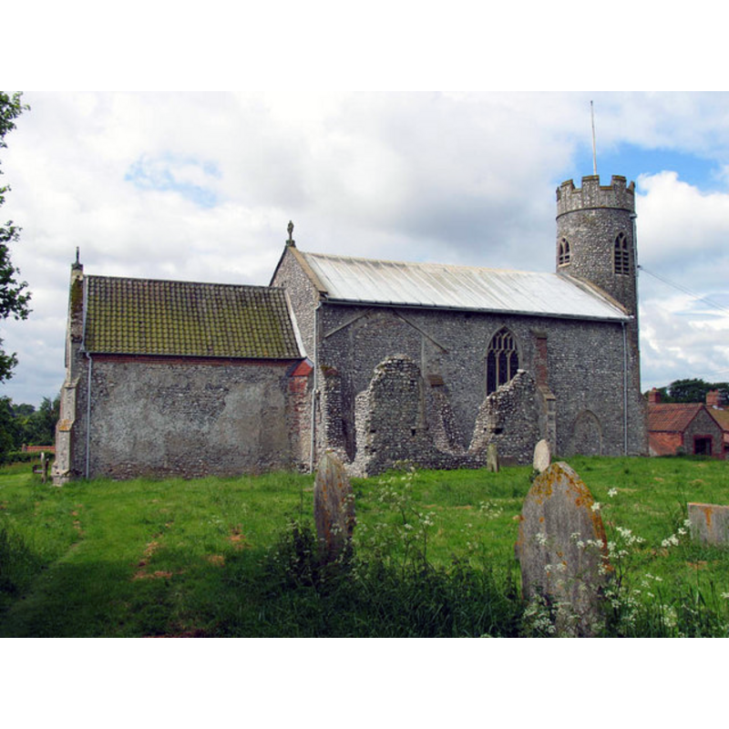
Copyright Statement: Image copyright © John Salmon, 2005
Image Source: digital photograph taken 4 June 2005 by John Salmon [www.geograph.org.uk/photo/315470] [accessed 18 September 2013]
Copyright Instructions: CC-BY-SA-3.0
view of church exterior - south view
Scene Description: Modern font
Copyright Statement: Image copyright © John Salmon, 2003
Image Source: digital photograph taken 20 August 2003 by John Salmon [www.geograph.org.uk/photo/310589] [accessed 18 September 2013]
Copyright Instructions: CC-BY-SA-3.0
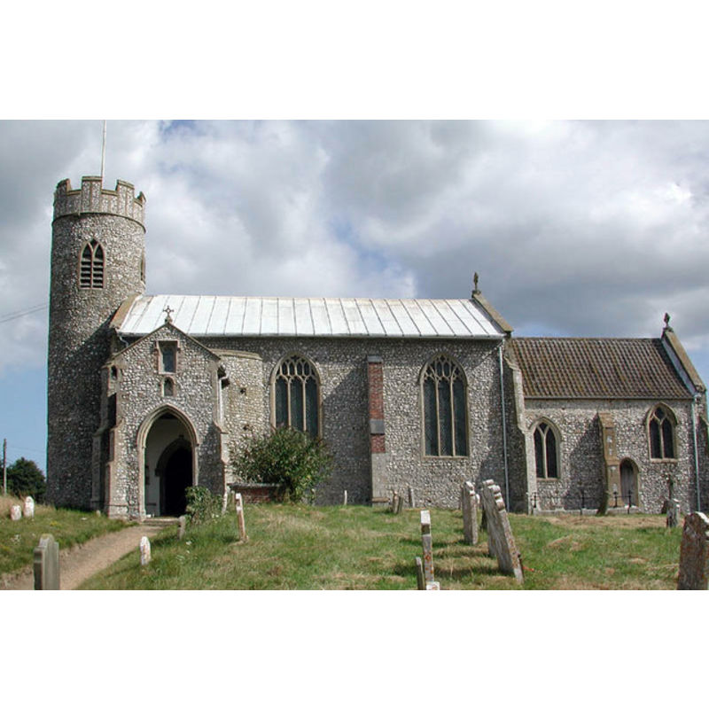
view of church exterior - northeast view
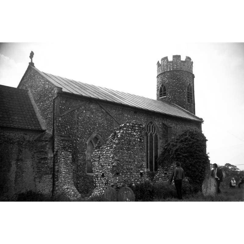
Scene Description: Photo caption: "Showing ruined north transept"
Copyright Statement: Image copyright © George Plunkett, 2013
Image Source: B&W photograph taken 2 June 1973 by George Plunkett [www.georgeplunkett.co.uk/Norfolk/A/Aylmerton St John Baptist church from NE [5350] 1973-06-02.jpg] [accessed 18 September 2013]
Copyright Instructions: Standing permission by Jonathan Plunkett
view of church exterior - southeast view
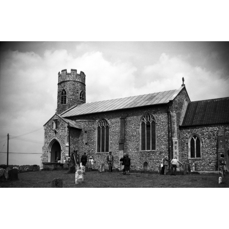
Copyright Statement: Image copyright © George Plunkett, 2013
Image Source: B&W photograph taken 2 June 1973 by George Plunkett [www.georgeplunkett.co.uk/Norfolk/A/Aylmerton St John Baptist church from SE [5349] 1973-06-02.jpg] [accessed 18 September 2013]
Copyright Instructions: Standing permission by Jonathan Plunkett
view of church interior - nave - looking east
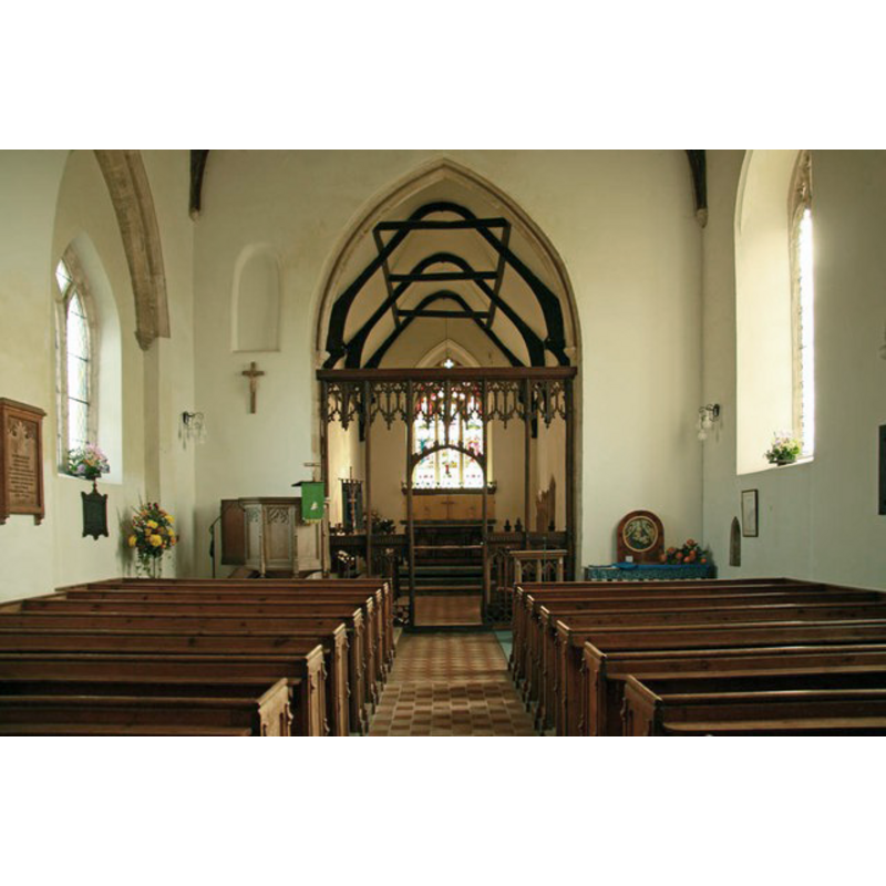
Copyright Statement: Image copyright © John Salmon, 2011
Image Source: digital photograph taken 24 October 2011 by John Salmon [www.geograph.org.uk/photo/2663848] [accessed 18 September 2013]
Copyright Instructions: CC-BY-SA-3.0
INFORMATION
Font ID: 12912AYL
Object Type: Baptismal Font1?
Font Century and Period/Style: 11th century, Pre-Conquest
Church / Chapel Name: Parish Church of St. John the Baptist
Church Patron Saint(s): St. John the Baptist
Church Notes: round-tower church
Church Address: Church Road, Aylmerton, Norfolk NR11 8PZ
Site Location: Norfolk, East Anglia, England, United Kingdom
Directions to Site: Located 5 km SW of Cromer
Ecclesiastic Region: Diocese of Norwich
Historical Region: Hundred of North Erpingham
Additional Comments: disappeared font? (the one from the pre-Conquest church here)
Font Notes:
Click to view
The Domesday entry for "Almertune", transcribed and translated in Blomefield (1805-1810), reports "William Earl Warren held a moiety of this town, by the gift of the Conqueror, of which Viulf, a freeman of Edric was deprived", which includes also "the moiety of the church, endowed then with 10 acres". Blomefield (ibid.) adds: "The Church is dedicated to St. John Baptist, and consisted of 2 medieties, both belonging to the Earl Warren's manor. [...] In the beginning of King Edward the First's reign, each rector had a manse and 15 acres of land; the mediety of Thomas, the rector, was valued at 5 marks, and that of John the rector at 5 marks", but the first recorded rector occurs in 1294: "John de Sutton occurs rector, the 22d of Edward I." The present font is noted in Pevsner & Wilson (1997): "Font. Octagonal, 1876, with carved leaves in quatrefoils on the bowl." Knott (2005) describes it as "an unfortunate replacement" of the 1870s restoration [NB: the fabric of the church goes back to tpre-Conquest times, but we have no information on the earlier font(s) of this church].
Credit and Acknowledgements: We are grateful to Jonathan Plunkett for the photographs of this church taken by his father, George Plunkett, in June 1973
COORDINATES
UTM: 31U 381945 5864144
Latitude & Longitude (Decimal): 52.913972, 1.244291
Latitude & Longitude (DMS): 52° 54′ 50.3″ N, 1° 14′ 39.45″ E
REFERENCES
- Blomefield, Francis, An essay towards a topographical history of Norfolk, 1805-1810, vol. 8: 80-83 / www.british-history.ac.uk/report.aspx?compid=78412] [accessed 18 September 2013]
- Knott, Simon, The Norfolk Churches Site, Simon Knott, 2004. [standing permission to reproduce images received from Simon (February 2005]. URL: www.norfolkchurches.co.uk.