Attlebridge / Atebruge / Atlebruge / Attlebrigg
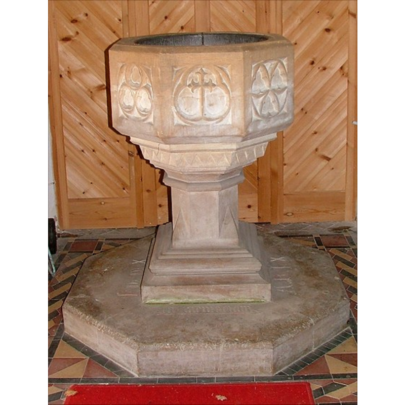
Image copyright © Simon Knott, 2006
Standing permission
Results: 6 records
view of font
Scene Description: the modern font
Copyright Statement: Image copyright © Simon Knott, 2006
Image Source: digital photograph March 2006 taken by Simon Knott March [www.norfolkchurches.co.uk/attlebridge/attlebridge.htm] [accessed 4 April 2007]
Copyright Instructions: Standing permission
view of church exterior - southeast view
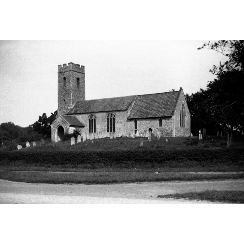
Scene Description: Photo caption: ""Slim unbuttressed west tower without datable details. Nave and chancel apparently of c1300 with Perpendicular additions." (Pevsner)"
Copyright Statement: Image copyright © George Plunkett, 2014
Image Source: B&W photograph taken 8 August 1939 by George Plunkett [www.georgeplunkett.co.uk/Norfolk/A/Attlebridge St Andrew's church south side [3230] 1939-08-08.jpg] [accessed 9 April 2014]
Copyright Instructions: Standing permission by Jonathan Plunkett
view of church exterior - southeast view
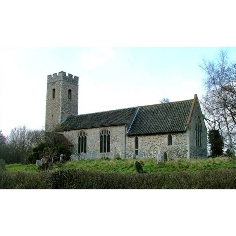
Copyright Statement: Image copyright © Simon Knott, 2006
Image Source: digital photograph March 2006 taken by Simon Knott March [www.norfolkchurches.co.uk/attlebridge/attlebridge.htm] [accessed 4 April 2007]
Copyright Instructions: Standing permission
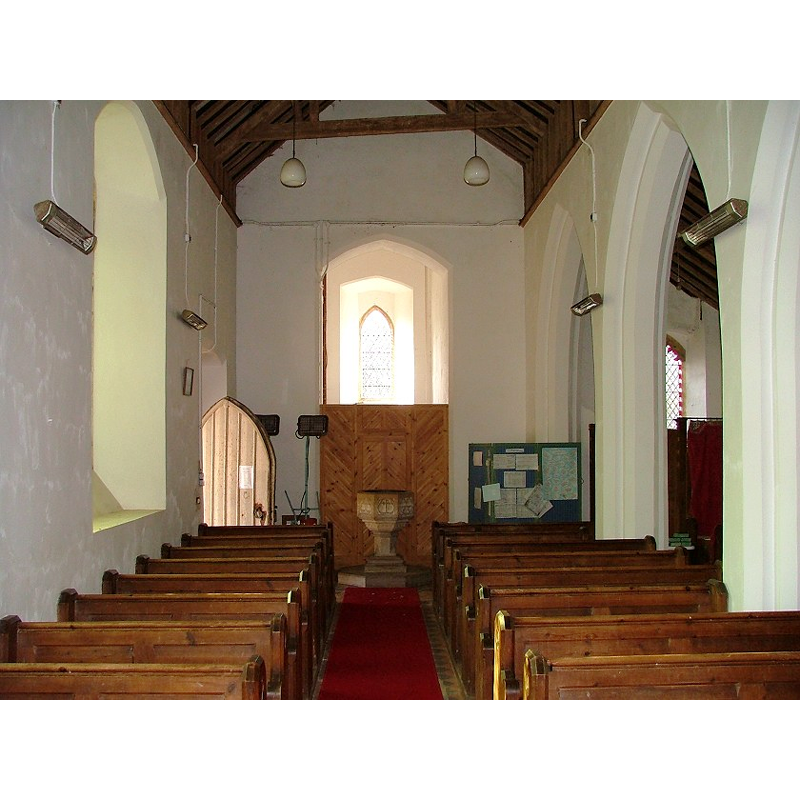
view of church interior - nave - looking west
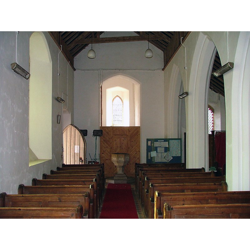
Scene Description: the modern font is visible at the west end
Copyright Statement: Image copyright © Simon Knott, 2006
Image Source: digital photograph March 2006 taken by Simon Knott March [www.norfolkchurches.co.uk/attlebridge/attlebridge.htm] [accessed 9 April 2014]
Copyright Instructions: Standing permission
view of church interior - nave - looking east
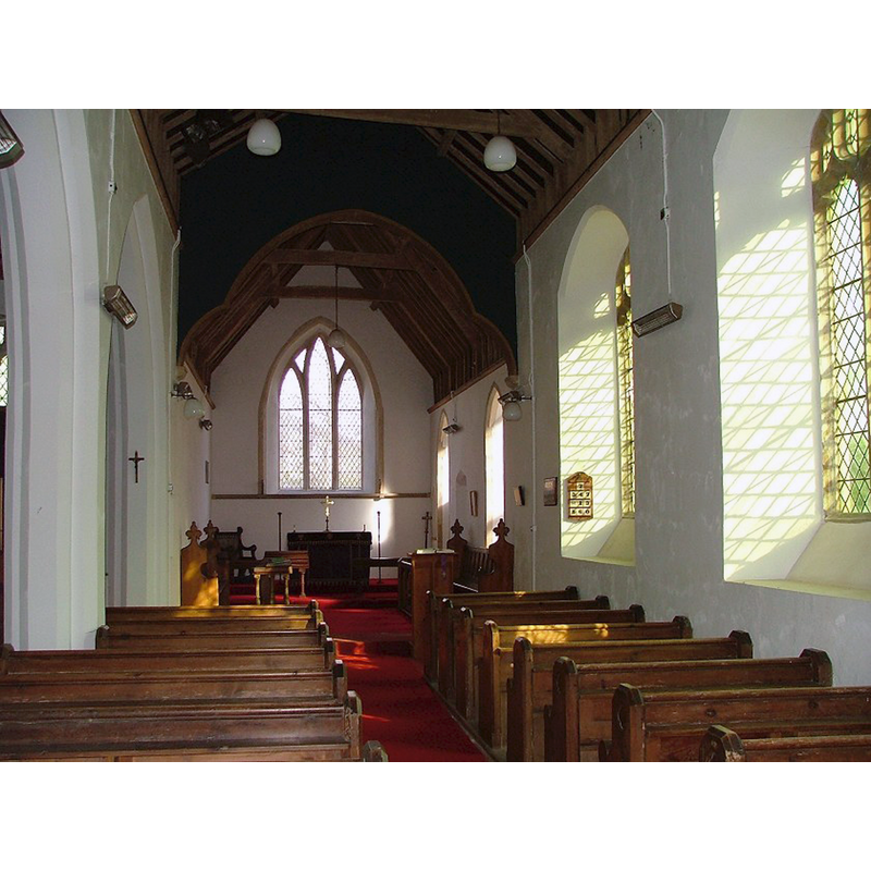
Copyright Statement: Image copyright © Simon Knott, 2006
Image Source: digital photograph March 2006 taken by Simon Knott March [www.norfolkchurches.co.uk/attlebridge/attlebridge.htm] [accessed 9 April 2014]
Copyright Instructions: Standing permission
view of church interior - looking west
Copyright Statement: Image copyright © Simon Knott, 2006
Image Source: digital photograph March 2006 taken by Simon Knott March [www.norfolkchurches.co.uk/attlebridge/attlebridge.htm] [accessed 4 April 2007]
Copyright Instructions: Standing permission
INFORMATION
Font ID: 12911ATT
Object Type: Baptismal Font1?
Font Century and Period/Style: 11th century, Norman
Church / Chapel Name: Parish Church of St. Andrew
Church Patron Saint(s): St. Andrew
Church Address: 5 Station Road, Attlebridge, Norfolk NR9 5AA
Site Location: Norfolk, East Anglia, England, United Kingdom
Directions to Site: Located near Alderford, off the Fakenham-Norwich Rd.
Ecclesiastic Region: Diocese of Norwich
Historical Region: Hundred of Taverham
Additional Comments: disappeared font? (the one from the Conquest-time church here)
Font Notes:
Click to view
There are four entries for Attlebridge [variant spelling] in the Domesday survey [http://domesdaymap.co.uk/place/TG1216/attlebridge/] [accessed 9 April 2014], one of which reports a church and church lands in it. Blomefield (1805-1810) notes that the church was in William Bishop of Thetford's land, "a church with 60 acres [...] The Church is dedicated to St. Andrew, and was a rectory [...], granted by Heymer, rector of Felthorp, to the priory of Norwich [...] It was appropriated to the use of Elemosunary, June 5, 1236, by Thomas Bishop of Norwich. [...] John Fitz Walter de Kaund, occurs rector in the time of Nicholas, prior of Norwich [...] The church has a nave and one isle covered with lead, the chancel tiled; at the west end is a tower foursquare, and embattled." The present modern font is noted in Pevsner and Wilson (1997): "Font. Octagonal, dated 1866." Illustrated in Knott (2006). The sides of the octagonal basin are decorated with panels with inscribed trefoils at least one of which contains a Latin cross; the underbowl has a band of saw-tooth motif between mouldings; plain octagonal stem on moulded square lower base; octagonal plinth [NB: we have no information on the font of the early church here].
Credit and Acknowledgements: We are grateful to Simon Knott, of Norfolk Churches, for his photographs of church and modern font; we are also grateful to Jonathan Plunkett for the photograph of this church taken by his father, George Plunkett, in August 1939
COORDINATES
UTM: 31U 375102 5841434
Latitude & Longitude (Decimal): 52.708378, 1.15127
Latitude & Longitude (DMS): 52° 42′ 30.16″ N, 1° 9′ 4.57″ E
INSCRIPTION
Inscription Text: [1866]
Inscription Notes: [cf. FontNotes]
REFERENCES
- Blomefield, Francis, An essay towards a topographical history of Norfolk, 1805-1810, vol. 10: 399-403 / [www.british-history.ac.uk/report.aspx?compid=78701] [accessed 9 April 2014]
- Knott, Simon, The Norfolk Churches Site, Simon Knott, 2004. [standing permission to reproduce images received from Simon (February 2005]. URL: www.norfolkchurches.co.uk.