Norwich No. 34 / Norwic / Timberhill
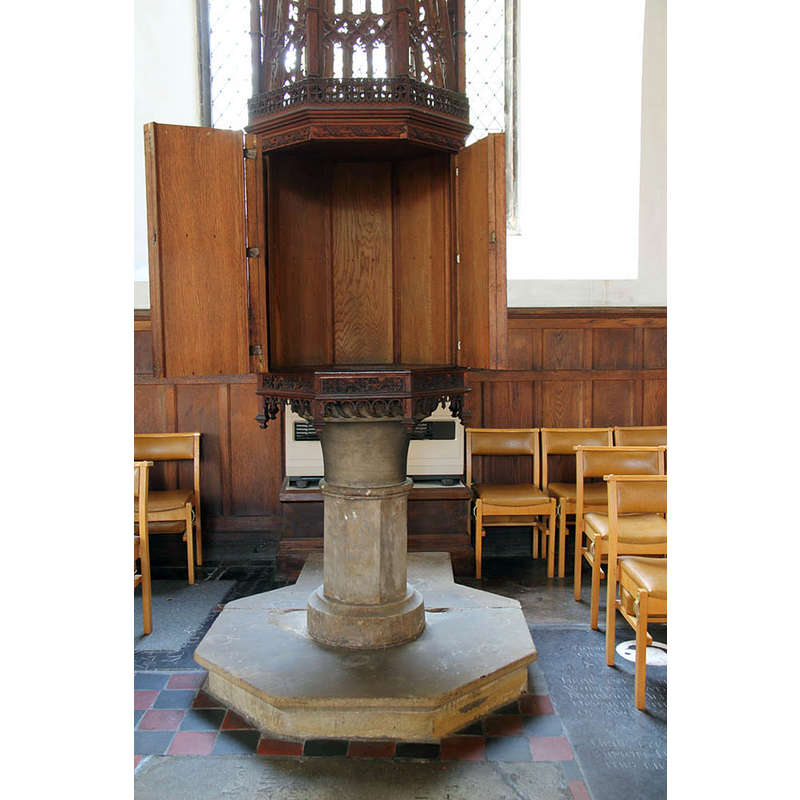
Image copyright © John Salmon, 2012
CC-BY-SA-2.0
Results: 5 records
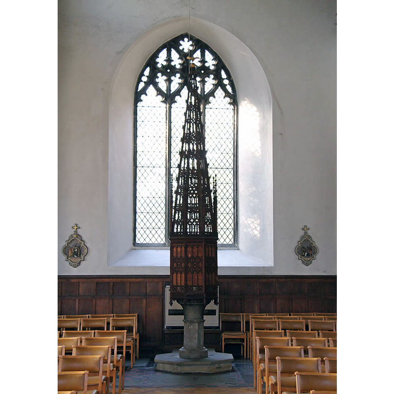
view of font
Copyright Statement: Image copyright © John Salmon, 2012
Image Source: digital photograph taken 30 October 2012 by John Salmon [www.geograph.org.uk/photo/3208764] [accessed 7 September 2015]
Copyright Instructions: CC-BY-SA-2.0
view of font and cover
Copyright Statement: Image copyright © John Salmon, 2012
Image Source: digital photograph taken 30 October 2012 by John Salmon [www.geograph.org.uk/photo/3208736] [accessed 7 September 2015]
Copyright Instructions: CC-BY-SA-2.0
view of church exterior - south view
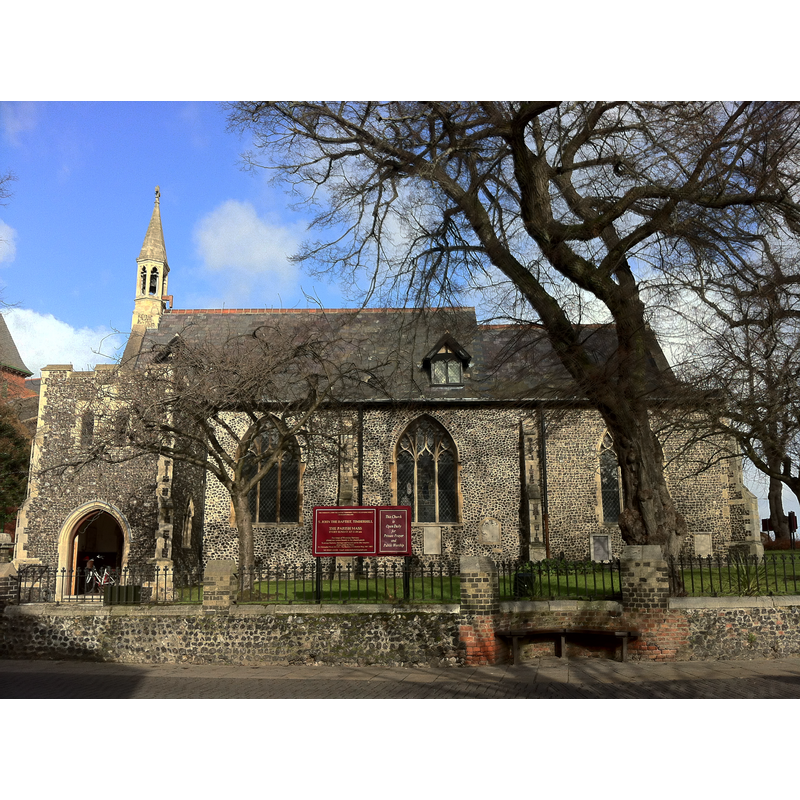
Scene Description: the tower collapsed in 1784; re-built 1877
Copyright Statement: Image copyright © Andrewrabbott, 2015
Image Source: digital photograph taken 8 February 2015 by Andrewrabbott [https://commons.wikimedia.org/wiki/File:St_John_the_Baptist_on_Timberhill.JPG] [accessed 7 September 2015]
Copyright Instructions: CC-BY-SA-2.0
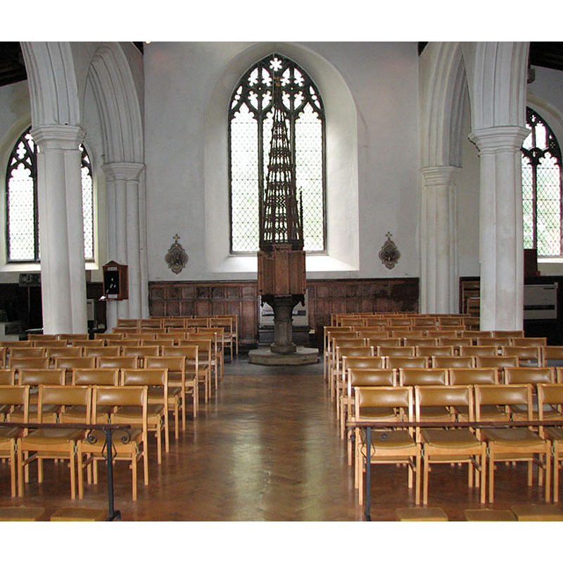
view of church interior - nave - looking east
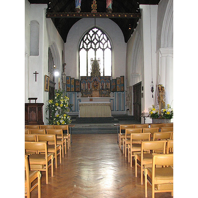
Copyright Statement: Image copyright © Evelyn Simak, 2010
Image Source: digital photograph taken 5 May 2010 by Evelyn Simak [www.geograph.org.uk/photo/1845339] [accessed 7 September 2015]
Copyright Instructions: CC-BY-SA-2.0
view of church interior - nave - looking west
Copyright Statement: Image copyright © Evelyn Simak, 2010
Image Source: digital photograph taken 5 May 2010 by Evelyn Simak [www.geograph.org.uk/photo/1845355] [accessed 7 September 2015]
Copyright Instructions: CC-BY-SA-2.0
INFORMATION
Font ID: 12891NOR
Object Type: Baptismal Font1?
Font Century and Period/Style: 11th century, Pre-Conquest? / Norman
Church / Chapel Name: Parish Church of St. John the Baptist
Church Patron Saint(s): St. John the Baptist
Church Notes: original church here 11thC;
Church Address: Grouts Thoroughfare, Timberhill, Norwich, Norfolk NR1 3LA
Site Location: Norfolk, East Anglia, England, United Kingdom
Directions to Site: Located on Timberhill, Ber St. [also on Ber St. is St. John de Sepulchre's]
Ecclesiastic Region: Diocese of Norwich
Additional Comments: dsetroyed font? (the one from the original 11thC church here [cf. FontNotes])
Font Notes:
Click to view
There are ten entries for Norwich [variant spelling] in the Domesday survey [https://opendomesday.org/place/TG2308/norwich/] [accessed 13 October 2020], one of which records "22.7 churches. 2.57 church lands" in it; a separate entry records a priest and a church in it. The font is probably modern, as the old one may have been destroyed in the collapse of the tower in 1784; re-built 1877. Pevsner & Wilson (1997) do not mention the font but note the font cover: "A glorious tall pinnacle, richly traceried, by E.J. Tench, 1929."
COORDINATES
UTM: 31U 384679 5832031
Latitude & Longitude (Decimal): 52.626008, 1.296239
Latitude & Longitude (DMS): 52° 37′ 33.63″ N, 1° 17′ 46.46″ E
LID INFORMATION
Date: 1929
Material: wood, oak
Apparatus: no; rim-buffet type
Notes: [cf. FontNotes]
REFERENCES
- Pevsner, Nikolaus, Norfolk 1: Norwich and North-East [2nd ed.], Harmondsworth: Penguin Books, 1997, p. 239