Great Stanmore / Stanmere / Stanmore / Stanmore Magna
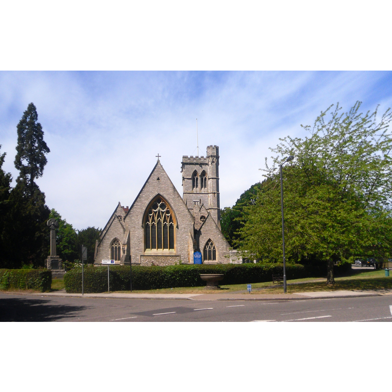
Image copyright © Des Blenkinsopp, 2011
CC-BY-SA-2.0
Results: 5 records
view of church exterior in context - west view
Scene Description: Source caption: "St John the Evangelist, Stanmore [...] this is the replacement, a pleasant enough Victorian church, opened in 1851, but one which hasn't featured on Geograph till now."
Copyright Statement: Image copyright © Des Blenkinsopp, 2011
Image Source: digital photograph taken 25 May 2011 by Des Blenkinsopp [www.geograph.org.uk/photo/2456840] [accessed 23 May 2019]
Copyright Instructions: CC-BY-SA-2.0
view of church exterior in context
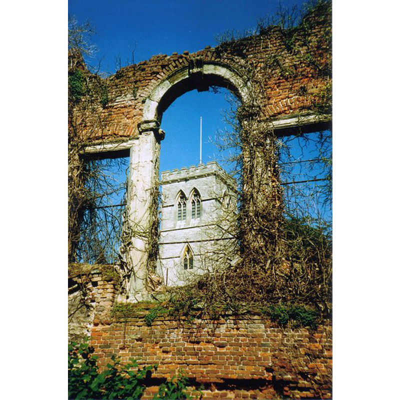
Scene Description: Source caption: "St John's Church, Stanmore. The new St John's church was built as the old structure has become unsafe. The old church is now slightly ruined, but well maintained. This picture was taken from within the ruin of the old church. Access is allowed to the public for limited times during the summer months"
Copyright Statement: Image copyright © Declan Galvin, 2006
Image Source: digital photograph taken 22 July 2006 by Declan Galvin [www.geograph.org.uk/photo/356290] [accessed 23 May 2019]
Copyright Instructions: CC-BY-SA-2.0
view of church exterior in context - northeast view
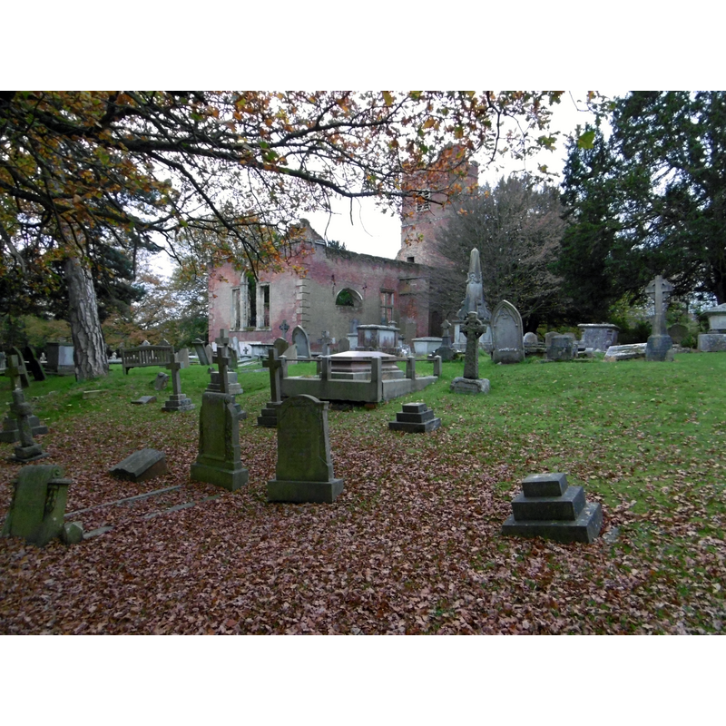
Scene Description: Source caption: "Old Stanmore Church and churchyard. There are two churches in Stanmore Churchyard. The old one was consecrated in 1632 by Archbishop Laud. The new church was begun in 1849 and contains much of the furnishings of the old church."
Copyright Statement: Image copyright © Marathon, 2015
Image Source: digital photograph taken 11 November 2015 by Marathon [www.geograph.org.uk/photo/4736971] [accessed 23 May 2019]
Copyright Instructions: CC-BY-SA-2.0
view of church interior - detail
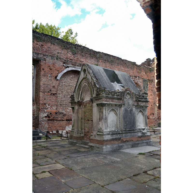
Copyright Statement: Image copyright © MrsEllacott, 2018
Image Source: digital photograph taken 13 September 2018 by MrsEllacott [https://commons.wikimedia.org/wiki/File:Remains_with_Old_Stanmore_Church.jpg] [accessed 23 May 2019]
Copyright Instructions: CC-BY-SA-4.0
symbol - shield - coat of arms - Wolstenholmes family
!["Other pieces from the Laudian church include an octagonal font, bearing the Wolstenholmes' arms, of white marble on a grey marble baluster-stem" [VCH [cf. FontNotes]]](/static-50478a99ec6f36a15d6234548c59f63da52304e5/others/image_not_available.jpg)
Scene Description: "Other pieces from the Laudian church include an octagonal font, bearing the Wolstenholmes' arms, of white marble on a grey marble baluster-stem" [VCH [cf. FontNotes]]
!["Other pieces from the Laudian church include an octagonal font, bearing the Wolstenholmes' arms, of white marble on a grey marble baluster-stem" [VCH [cf. FontNotes]]](/static-50478a99ec6f36a15d6234548c59f63da52304e5/bsi-testing-site/others/image_not_available.jpg)
INFORMATION
Font ID: 12884STA
Object Type: Baptismal Font1
Font Date: ca. 1632?
Font Century and Period/Style: 17th century, Carline? / Restoration? / Laudian?
Workshop/Group/Artisan: heraldic font
Church / Chapel Name: Parish Church of St. John the Evangelist
Font Location in Church: Inside the church
Church Patron Saint(s): St. John the Evangelist
Church Address: Rectory Lane Graveyard at Uxbridge Rd, Stanmore, London HA5 3QA, UK
Site Location: Greater London, South East, England, United Kingdom
Directions to Site: Located off (S) the A410, 18 km N of Charing Cross, in the London Borough of Harrow, on the W border of Edgware
Ecclesiastic Region: Diocese of London
Historical Region: Hundred of Gore -- formerly Middlesex
Additional Comments: disappeared fonts (?) (one at least from the Domesday-time church in it)
Font Notes:
Click to view
There is an entry for this Stanmore [variant spelling] in the Domesday survey [https://opendomesday.org/place/TQ1692/stanmore/] [accessed 23 May 2019]; it mentions a priest and "0.5 lands", but not a church in it, though there must have been one in it. The Visit Stanmore web site [www.stanmoretouristboard.org.uk/churches/saint-marys-church-stanmore.html] [accessed 23 May 2019] notes: "We could all be forgiven for thinking that 'Old Church Lane' which runs through Great Stanmore is named after the red brick ruined church of St. John which stands adjacent to the end of the lane as it intersects with the Uxbridge Road. In fact the 'Old Church' predates the ruined one by hundreds of years and was built in the 14th century. This medieval Church was built on the site of an old wooden Saxon church. This Saxon church consecrated in 1094 was in turn built on the site of a Roman compitum shrine. A compitum shrine was a place which served as a centre of public worship and public meeting. It would most probably have been adapted to Christian worship sometime after the restoration of religious freedom in 313. [...] The Medieval church was built in the fourteenth century and dedicated to St. Mary but was also known as the 'Church of our Lady'. It was erected some way to the south of the present St. John the Evangelist Church, which would in those times have been near the centre of the village, sitting on the left bank of the Stanburn stream outside of the moat surrounding the Stanmore manor house. These days that would be the junction of Church Lane and Wolverton Road. It was a small building which was originally constructed with an aisle-less nave, about thirty-four feet long, and the west gable, was supported by a pair of diagonal buttresses. There was also evidence that considerable alterations seem to have taken place in the fifteenth century. [...] The discovery of the medieval church was a bit of an accident really as although St Mary‘s church was used until 1632, worship was then transferred to the St. Johns (now ruined red brick) church further up the road. The site left overgrown and derelict for hundreds of years was eventually lost in the sands of time. Then by a stroke of luck a team of workmen came across the foundations in 1889, when an accommodation road was being dug to go under the proposed Stanmore to Harrow railway line. From these discoveries, contemporary historian and archaeologist Hugh Braun was able to construct a floor plan of the medieval church." The Victoria County History (Middlesex, 1976) notes, among several pieces from the Laudian church, "an octagonal font, bearing the Wolstenholmes' arms, of white marble on a grey marble baluster stem". The VCH (ibid.) further mentions "a font given by Queen Adelaide" [i.e. Adelaide (1792-1848) consort of William IV], and informs of two previous churches in this place, one, "probably dedicated to St. Mary [...] said to be worth 6 marks in the 13th century", and another, St. John's, consecrated by bishop William Laud in 1632". The entry for the 17th-century church in Historic England [Listing NGR: TQ1664792157] [accessed 23 May 2019] notes: "The church of St John the Evangelist, Great Stanmore. 1632, attributed to Nicholas Stone. [...] Consecrated in 1632 by Archbishop William Laud (then Bishop of London), this church replaced an earlier medieval building and was paid for by the City merchant adventurer Sir John Wolstenholme. Nicholas Stone, Master Mason to Charles I, was paid for a font and supplying a porch here. [...] A highly picturesque ruin, and of architectural importance as an example of Caroline classicism, showing the impact of Inigo Jones. Churches of this period are relatively few." [NB: we have no information of the font from the earlier church].
COORDINATES
UTM: 30U 685845 5721756
Latitude & Longitude (Decimal): 51.616111, -0.315556
Latitude & Longitude (DMS): 51° 36′ 58″ N, 0° 18′ 56″ W
MEDIUM AND MEASUREMENTS
Material: stone, marble
REFERENCES
- Victoria County History [online], University of London, 1993-. URL: https://www.british-history.ac.uk.