Kingsbury nr. Birmingham / Chinesberie / Chinesburie
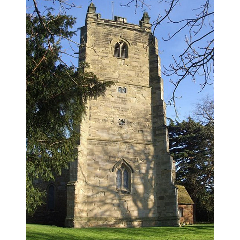
Image copyright © Rob Farrow, 2008
CC-BY-SA-2.0
Results: 5 records
view of church exterior - west view
Scene Description: Source caption: "A plaque above the lowest window states that it was restored in 1928, though originally dating from the late C13th. Between these two dates, some time in the C16th or C17th the western face of the tower (the face seen here) underwent considerable renovation."
Copyright Statement: Image copyright © Rob Farrow, 2008
Image Source: digital photograph taken 7 December 2008 by Rob Farrow [www.geograph.org.uk/photo/1073293] [accessed 8 December 2014]
Copyright Instructions: CC-BY-SA-2.0
view of church exterior - south view
![Source caption: "Kingsbury's fine old church dates back to the C12th with numerous additions over the centuries. It stands in an attractive churchyard next to the ancient [Old Hall]"](/static-50478a99ec6f36a15d6234548c59f63da52304e5/compressed/1141212001_compressed.png)
Scene Description: Source caption: "Kingsbury's fine old church dates back to the C12th with numerous additions over the centuries. It stands in an attractive churchyard next to the ancient [Old Hall]"
Copyright Statement: Image copyright © Rob Farrow, 2008
Image Source: digital photograph taken 7 December 2008 by Rob Farrow [www.geograph.org.uk/photo/1073281] [accessed 8 December 2014]
Copyright Instructions: CC-BY-SA-2.0
design element - motifs - moulding
![[cf. Font notes]](/static-50478a99ec6f36a15d6234548c59f63da52304e5/others/image_not_available.jpg)
Scene Description: [cf. Font notes]
![[cf. Font notes]](/static-50478a99ec6f36a15d6234548c59f63da52304e5/bsi-testing-site/others/image_not_available.jpg)
design element - patterns - tracery
Scene Description: [cf. Font notes]
symbol - shield - blank - 3
Scene Description: [cf. Font notes]
INFORMATION
Font ID: 12877KIN
Object Type: Baptismal Font1
Font Century and Period/Style: 14th century, Decorated
Workshop/Group/Artisan: heraldic font
Church / Chapel Name: Parish Church of St. Peter and St. Paul
Font Location in Church: Inside the church, in the W end of the S aisle
Church Patron Saint(s): St. Peter & St. Paul
Church Address: Church Lane, Kingsbury, Warwickshire B78 2LJ
Site Location: Warwickshire, West Midlands, England, United Kingdom
Directions to Site: Located between Birmingham and Tamworth, 10 km S of the latter
Ecclesiastic Region: Diocese of Birmingham
Historical Region: Hundred of Coleshill [in Domesday] -- Hundred of Hemlingford
Additional Comments: disappeared font? (the one from the Domesday-time church here)
Font Notes:
Click to view
There is an entry for this Kingsbury [variant spelling] in the Domesday survey [http://domesdaymap.co.uk/place/SP2196/kingsbury/] [accessed 8 December 2014]; it mentions two priests but not a church in it, though there probably was one there. The Victoria County History (Warwick, 1947) notes: "There was probably an aisleless nave with a square chancel; the remains of one window survive in the chancel. About the middle of the 12th century north and south aisles were added, the southern being the first. The north aisle, if not both, may have been altered in the 13th century, and near the end of the same century the west tower was added. The greatest changes were made very early in the 14th century, when the chancel was doubled in length [...] The font is of the 14th century. It has a twelvesided bowl with a moulded lower edge. The stem is hexagonal; three of its sides are treated with a trefoiled panel and varying tracery; the other three are carved with blank shields represented as hanging from hooks; the base is stepped." English Heritage [Listing NGR: SP2147696265] (1953) reports a different shape of basin: "octagonal font has plain bowl and stem with blind trefoiled arches and trefoil spandrels."
COORDINATES
UTM: 30U 589155 5824561
Latitude & Longitude (Decimal): 52.5638, -1.6847
Latitude & Longitude (DMS): 52° 33′ 49.68″ N, 1° 41′ 4.92″ W
MEDIUM AND MEASUREMENTS
Material: stone
Font Shape: dodecagonal, mounted
Basin Interior Shape: round
Basin Exterior Shape: dodecagonal
REFERENCES
- Victoria County History [online], University of London, 1993-. URL: https://www.british-history.ac.uk.