Alton Barnes / Alton Berners / Aultone
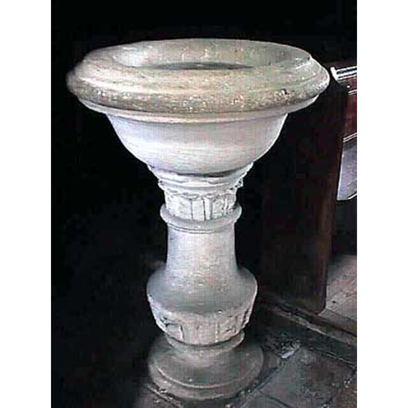
Image copyright © John Wilkes, 2008
Standing permission
Results: 4 records
view of font
Copyright Statement: Image copyright © John Wilkes, 2008
Image Source: digital photograph by John Wilkes [www.allthecotswolds.com]
Copyright Instructions: Standing permission
view of church exterior - southwest view

Copyright Statement: Image copyright © John Wilkes, 2008
Image Source: digital photograph by John Wilkes [www.allthecotswolds.com]
Copyright Instructions: Standing permission
view of church interior - nave - looking east
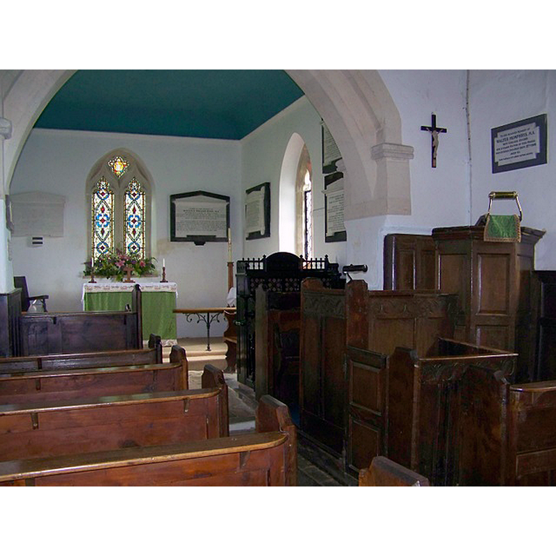
Scene Description: Source caption: "Interior, The Church of St Mary, Alton Barnes. Most of the simple furniture is of oak and dates from the 17th century."
Copyright Statement: Image copyright © Maigheach-gheal, 2009
Image Source: digital photograph taken 3 August 2009 by Maigheach-gheal [www.geograph.org.uk/photo/1428693] [accessed 17 September 2016]
Copyright Instructions: CC-BY-SA-2.0
view of church interior - nave - looking west
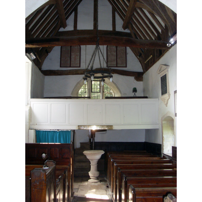
Scene Description: with the modern font in the foreground
Copyright Statement: Image copyright © Kevin Farmer, 2008
Image Source: digital photograph taken 30 August 2008 by Kevin Farmer [www.geograph.org.uk/photo/2021014] [accessed 17 September 2016]
Copyright Instructions: CC-BY-SA-2.0
INFORMATION
Font ID: 12873ALT
Object Type: Baptismal Font1?
Font Century and Period/Style: 10th - 11th century, Pre-Conquest
Church / Chapel Name: Parish Church of St. Mary the Virgin
Church Patron Saint(s): St. Mary the Virgin
Church Address: Alton Barnes, Wiltshire, SN8 4LE
Site Location: Wiltshire, South West, England, United Kingdom
Directions to Site: Located off (E) the A361, 10 km E of Devizes
Ecclesiastic Region: Diocese of Salisbury
Historical Region: Hundred of Swanborough
Additional Comments: disappeared font? (the font from the Saxon church here)
Font Notes:
Click to view
There is an entry for Alton [Barnes] [variant spelling] in the Domesday survey [http://domesdaymap.co.uk/place/] [accessed 17 September 2016], but it mentions neither cleric nor church in it. The Victoria County History (Wiltshire, vol. 10, 1975) notes: "Saxon work in the church at Alton Barnes indicates that it was built there before the Conquest. [...] Its Saxon origin is clear from parts of its masonry, including long and short quoins at the west end, and from the high narrow proportions of the nave." Thre is no font mentioned in the VCH entry. A digital photograph taken 25 August 2007 Oxfordshire Church Illustrations appears in Flicker [http://flickr.com/photos/oxfordshire_church_photos/342275581/] [accessed 27 December 2006]. The present baptismal font in this church is modern, a round basin on a baluster-type pedestal [NB: we have no information on the earlier font(s) of this church].
Credit and Acknowledgements: We are grateful to John Wilkes, of www.allthecotswolds.com, for his photographs of church and font
COORDINATES
UTM: 30U 580233 5690178
Latitude & Longitude (Decimal): 51.3572, -1.8477
Latitude & Longitude (DMS): 51° 21′ 25.92″ N, 1° 50′ 51.72″ W
MEDIUM AND MEASUREMENTS
Material: stone
Font Shape: hemispheric, mounted
Basin Interior Shape: round
Basin Exterior Shape: round
REFERENCES
- Victoria County History [online], University of London, 1993-. URL: https://www.british-history.ac.uk.