Harmondsworth / Hermodesuuorde / Hermodesworde
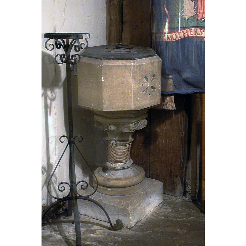
Image copyright © John Salmon, 2010
CC-BY-SA-2.0
Results: 5 records
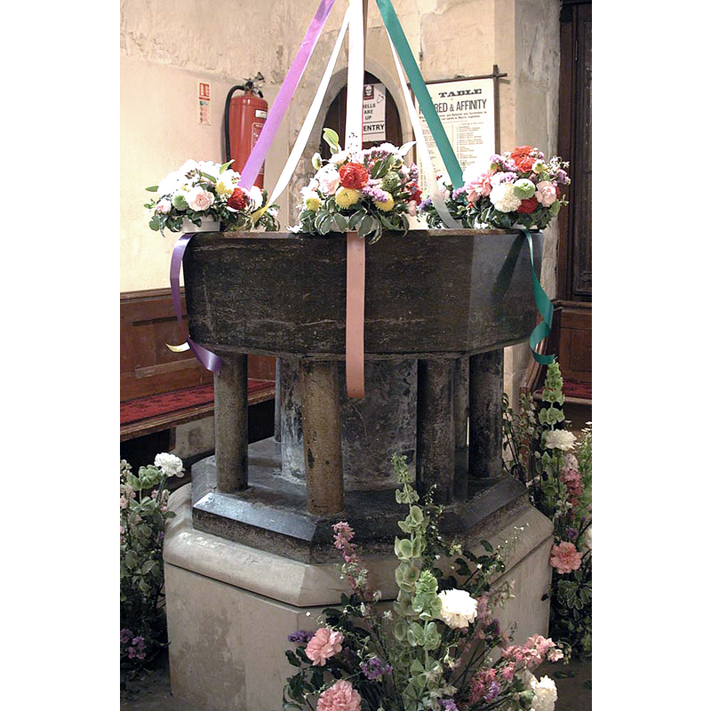
view of font and cover
Scene Description: the mid-19thC(?) font
Copyright Statement: Image copyright © John Salmon, 2010
Image Source: digital photograph taken 27 September 2003 by John Salmon [www.geograph.org.uk/photo/1687835] [accessed 7 June 2019]
Copyright Instructions: CC-BY-SA-2.0
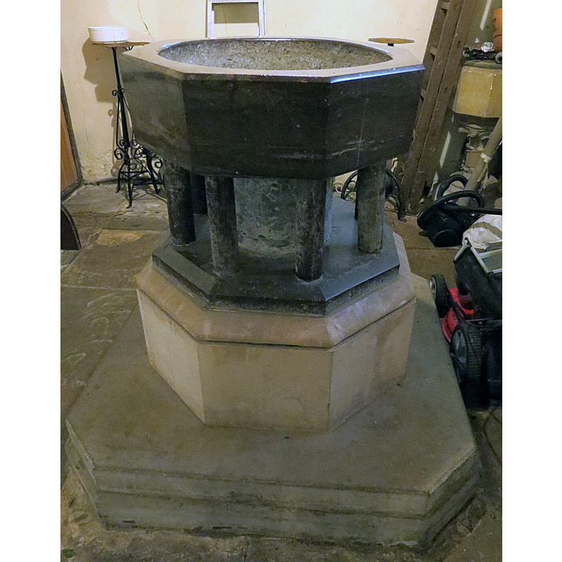
view of font
Scene Description: the altered medieval font
Copyright Statement: Image copyright © John Salmon, 2010
Image Source: digital photograph taken 27 September 2003 by John Salmon [www.geograph.org.uk/photo/1687834] [accessed 7 June 2019]
Copyright Instructions: CC-BY-SA-2.0
view of church exterior - tower - south side
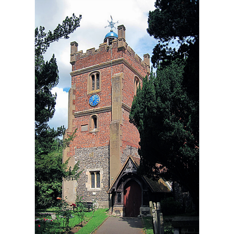
Copyright Statement: image copyright © Oast House Archive, 2017
Image Source: digital photograph 14 July 20117 in the Oast House Archive [www.geograph.org.uk/photo/2507556] [accessed 7 June 2019]
Copyright Instructions: CC-BY-SA-2.0
view of font
Scene Description: showing the altered the medieval font in the foreground, and the modern font in the background, right side, semi-hidden by a step-ladder
Copyright Statement: Image copyright © Bob Speel, 2009
Image Source: digital photograph by Bob Speel [http://www.speel.me.uk/chlondon/chh/harmondsworth/font.jpg] [accessed 7 June 2019]
Copyright Instructions: Permission received from the author (e-mail of 8 June 2019)
view of church interior - looking northeast
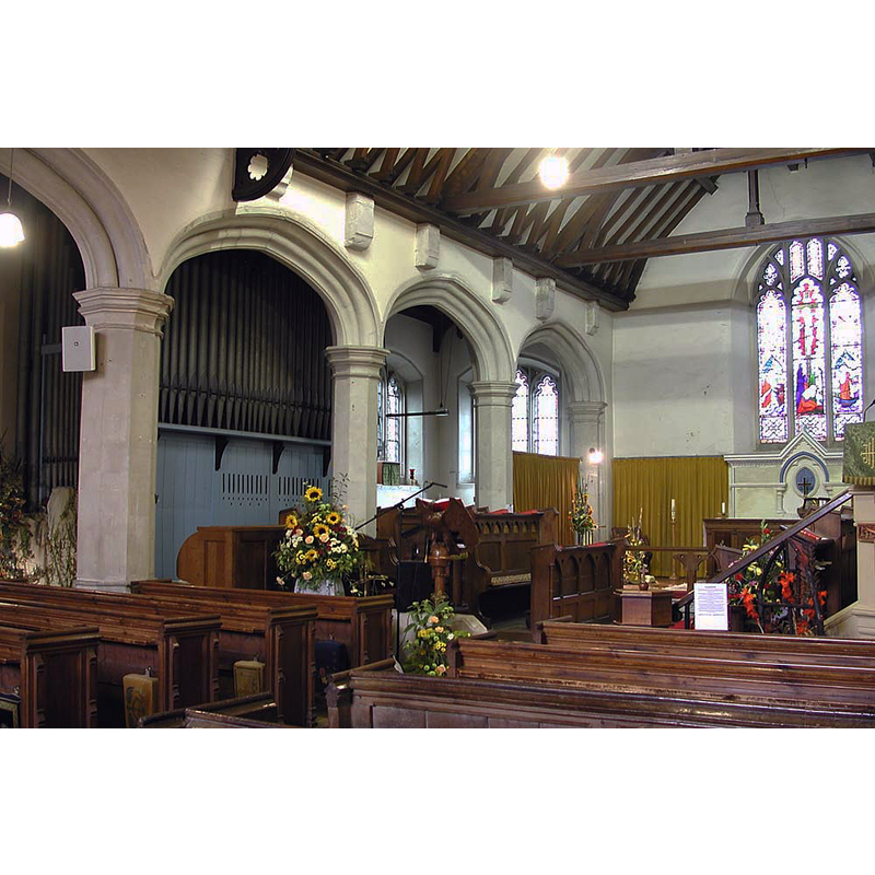
Copyright Statement: Image copyright © John Salmon, 2010
Image Source: digital photograph taken 27 September 2003 by John Salmon [www.geograph.org.uk/photo/1687843] [accessed 7 June 2019]
Copyright Instructions: CC-BY-SA-2.0
INFORMATION
Font ID: 12870HAR
Object Type: Baptismal Font1
Font Date: ca. 1200?
Font Century and Period/Style: 12th - 13th century, Late Norman / Transitional?
Church / Chapel Name: Parish Church of St. Mary
Font Location in Church: Inside the church
Church Patron Saint(s): St. Mary the Virgin
Church Address: High St, Harmondsworth, West Drayton UB7 0AQ, UK -- Tel.: 0208 8972385
Site Location: Greater London, South East, England, United Kingdom
Directions to Site: Located off (SE) the M4-M25 junction, 2-3 km N of Stanwell, NW of Heathrow airport, in the London Borough of Hillingdon
Ecclesiastic Region: Diocese of London
Historical Region: Hundred of Elthorne -- formerly Middlesex
Additional Comments: altered font (the basin appears to be either a full re-carving or a modern replacement; the lower base is modern as well)
Font Notes:
Click to view
There are two entries for Harmondsworth [variant spelling] in the Domesday survey [https://opendomesday.org/place/TQ0577/harmondsworth/] [accessed 7 June 2019] neither of which mentions cleric or church in it. Pevsner (1951) writes: "The font is absolutely unadorned, octagonal of Purbeck marble and on round shafts: c. 1200". The entry for this parish in the Victoria County History (Middlesex, vol. 4, 1971) notes the granting of the church at Harmondsworth to the Abbey of the Holy Trinity, in Rouen, France [footnoted "Regesta Regum Anglo-Normannorum, i, ed. Davis, no. 29"]; the entry adds: "The oldest work in the church is in the south aisle which has a re-set south doorway of the mid 12th century, one of the two finest in Middlesex. [...] The plain octagonal font of Purbeck marble dates from c. 1200 [...] The church was extensively restored in 1862-3." Listed in Leach (1975) as a plain font made of Purbeck marble. The CRSBI (2019) notes "an octagonal Purbeck font; originally 13thc but with a shiny new bowl [...] the bowl is surely a modern replacement, especially as it has no signs of any locks or staples" in this church. The entry for this church in Historic England [Source ID: 1080201] notes: "Parish church. C12 south arcade and doorway, C13 north arcade. Chancel rebuilt 1396-98 [...] Baptistery: in base of tower. Contains font of c.1200 of Purbeck marble: octagonal bowl on plinth ringed by eight small circular shafts." Bob Speel mentions this font as well as "A smaller font, looking 1860ish, in pale stone on a carved central shaft, is tucked away in a corner" in his entry for this church [www.speel.me.uk/chlondon/harmondsworthch.htm] [accessed 7 June 2019]. [NB: of the sources consulted, only the CRSBI [cf. supra] appears to identify the basin as a modern replacement, although Bob Speel [cf. supra] suggests the font may have been re-tooled].
Credit and Acknowledgements: We are grateful to Bob Speel for his photograph of the fonts here
COORDINATES
UTM: 30U 675014 5707264
Latitude & Longitude (Decimal): 51.4894, -0.479048
Latitude & Longitude (DMS): 51° 29′ 21.84″ N, 0° 28′ 44.57″ W
MEDIUM AND MEASUREMENTS
Material: stone, limestone (Purbeck marble)
Font Shape: octagonal, mounted
Basin Interior Shape: round
Basin Exterior Shape: octagonal
Drainage Notes: no lining
REFERENCES
- Victoria County History [online], University of London, 1993-. URL: https://www.british-history.ac.uk.
- Leach, Rosemary, A Investigation into the use of Purbeck Marble in Medieval England, Hartlepool: E.W. Harrisons & Sons, 1975, p. 77
- Pevsner, Nikolaus, Middlesex, Harmondsworth: Penguin Books, 1951, p. 95