Hasfield / Hasfelde
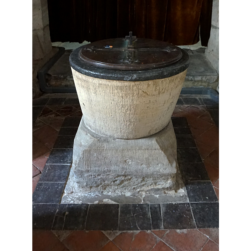
Image copyright © Ian S, 2016
CC-BY-SA-2.0
Results: 6 records
view of font and cover - east side
Copyright Statement: Image copyright © Ian S, 2016
Image Source: edited detail of a digital photograph taken 26 May 2016 by Ian S [www.geograph.org.uk/photo/4977424] [accessed 6 February 2019]
Copyright Instructions: CC-BY-SA-2.0
view of church exterior - north view
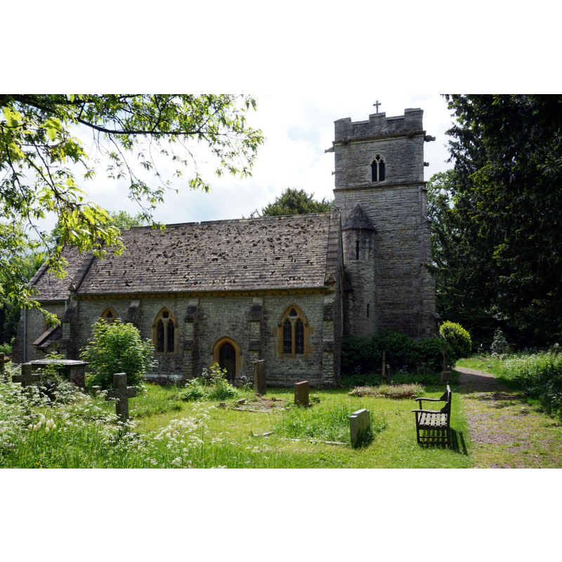
Copyright Statement: Image copyright © Ian S, 2016
Image Source: digital photograph taken 26 May 2016 by Ian S [www.geograph.org.uk/photo/4977412] [accessed 6 February 2019]
Copyright Instructions: CC-BY-SA-2.0
view of church exterior - southwest view
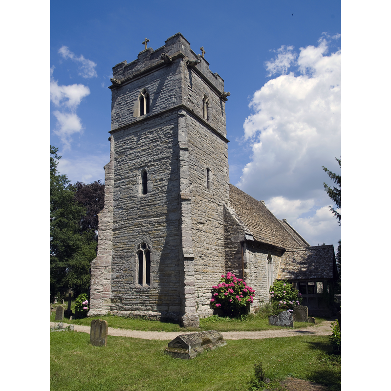
Scene Description: Source caption: "The parish church, called St. Peter's when it was established in the 14th century is now dedicated to St. Mary. It has a square tower which still retains the earlier dedication to St Peter. The tower, which houses the church's four bells, is decorated with crenellations and gargoyle like figures that double as waterspouts. Inside the church are several notable artifacts including three stained glass windows, a Norman font and a monument to lady Pauncefort for sending her "right hand" to Palestine to ransom her lord from the infidels."
Copyright Statement: Image copyright © Saffron Blaze, 2011
Image Source: digital photograph taken 14 July 2011 by Saffron Blaze [https://commons.wikimedia.org/wiki/File:Hasfield_Parish_Church.jpg] [accessed 6 February 2019]
Copyright Instructions: CC-BY-SA-2.0
view of font and cover in context - west side
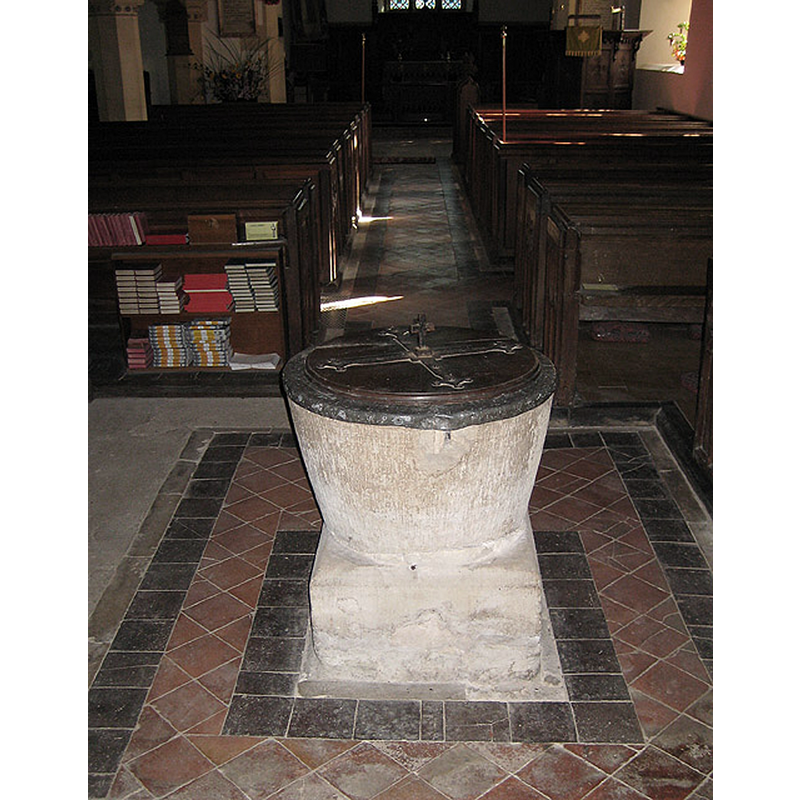
Scene Description: Source caption: "Tub-shaped font, St Mary's, Hasfield. Believed to be 12th century."
Copyright Statement: Image copyright © Pauline E, 2008
Image Source: digital photograph taken 29 September 2008 by Pauline E [www.geograph.org.uk/photo/987184] [accessed 6 February 2019]
Copyright Instructions: CC-BY-SA-2.0
view of church interior - looking west
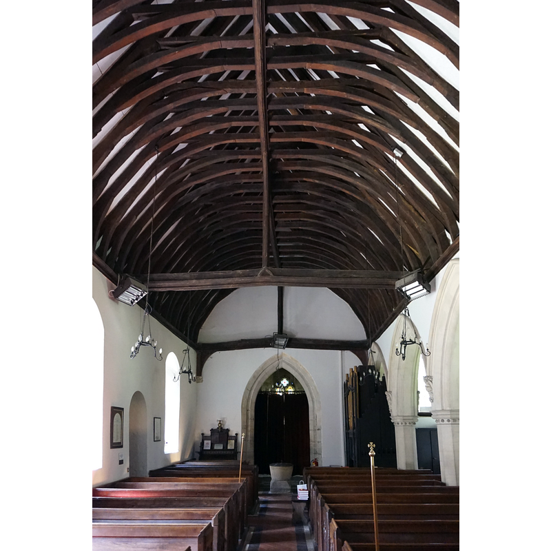
Scene Description: with the font visible at the far end
Copyright Statement: Image copyright © Ian S, 2016
Image Source: digital photograph taken 26 May 2016 by Ian S [www.geograph.org.uk/photo/4977490] [accessed 6 February 2019]
Copyright Instructions: CC-BY-SA-2.0
view of church interior - looking east
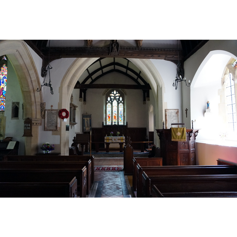
Copyright Statement: Image copyright © Ian S, 2016
Image Source: digital photograph taken 26 May 2016 by Ian S [www.geograph.org.uk/photo/4977426] [accessed 6 February 2019]
Copyright Instructions: CC-BY-SA-2.0
INFORMATION
Font ID: 12865HAS
Object Type: Baptismal Font1
Font Century and Period/Style: 12th century, Late Norman
Church / Chapel Name: Parish Church of St. Mary the Virgin [formerly St. Peter's]
Font Location in Church: Inside the church
Church Patron Saint(s): St. Mary the Virgin [formerly dedicated to St. Peter]
Church Address: Hasfield, Gloucestershire GL19 4LG, UK
Site Location: Gloucestershire, South West, England, United Kingdom
Directions to Site: Located off (S) the B4213, 10 km NWN of Gloucester, 10 km SW f Tewkesbury
Ecclesiastic Region: Diocese of Gloucester
Historical Region: Humdred of Westminster, lower division
Font Notes:
Click to view
There is an entry for Hasfield [variant spelling] in the Domesday survey [https://opendomesday.org/place/SO8227/hasfield/] [accessed 6 February 2019] but it mentions neither cleric nor church in it. Tymms (1834) reports a baptismal font "of lead" in Hasfield, but we have no information of any other font in this church except for the Norman one found inside the church. The entry for this parish in the Victoria County History (Gloucester, vol. 8, 1968) notes: "The earliest documentary evidence of a church at Hasfield is the mention of a parson c. 1220. [...] The original fabric was probably 12th-century, and a tub-shaped font of that period survives". Noted in Verey & Brooks (1999-2002): "Font. Low Norman tub-shaped bowl, on a chamfered rectangular plinth." The basin upper rim shows evidence of damage consistent with the forceful removal of the old metal staples of the cover; the inner basin is lead lined. The font cover is round and flat, with metal decorations and handle; appears modern; Victorian?
COORDINATES
UTM: 30U 551257 5755284
Latitude & Longitude (Decimal): 51.945902, -2.254263
Latitude & Longitude (DMS): 51° 56′ 45.25″ N, 2° 15′ 15.35″ W
MEDIUM AND MEASUREMENTS
Material: stone
Font Shape: bucket-shaped, mounted
Basin Interior Shape: round
Basin Exterior Shape: round
Drainage Notes: lead lining
LID INFORMATION
Date: modern [Victorian?]
Material: wood
Apparatus: no
Notes: [cf. FontNotes]
REFERENCES
- Victoria County History [online], University of London, 1993-. URL: https://www.british-history.ac.uk.
- Tymms, Samuel, Family Topographer, being a compendious account of the antient and present state of the counties of England: vol. IV, Oxford circuit, London: Nichols & Son, 1834, p. 51