Oldbury-on-the-Hill / Aldebeire
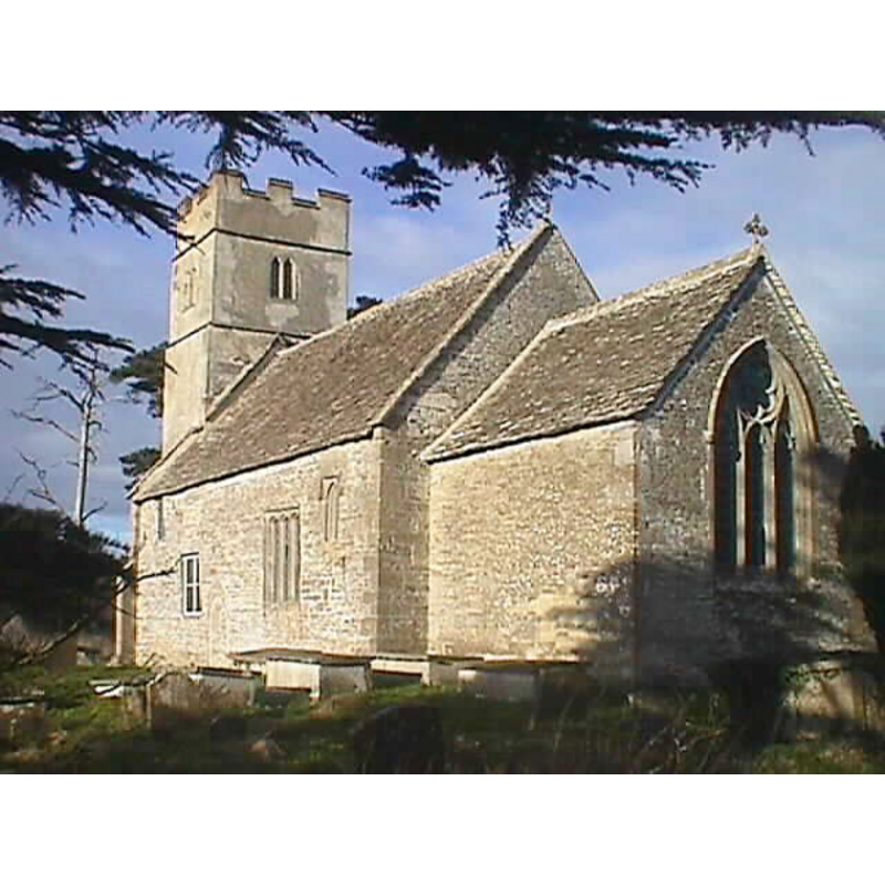
Image copyright © John Wilkes, 2007
Standing permission
Results: 4 records
view of church exterior - southeast view
Copyright Statement: Image copyright © John Wilkes, 2007
Image Source: digital photograph by John Wilkes
Copyright Instructions: Standing permission
view of church interior - looking west
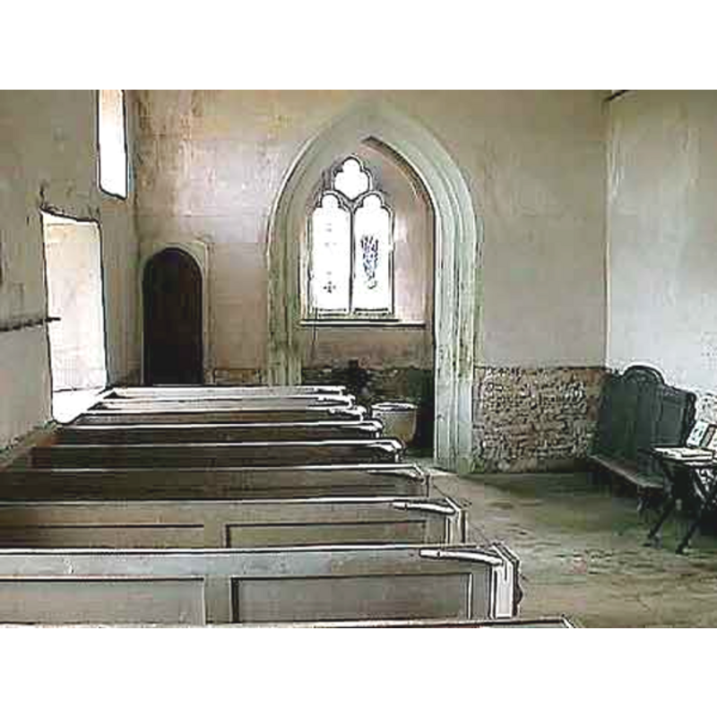
Scene Description: the font in the tower space
Copyright Statement: Image copyright © John Wilkes, 2007
Image Source: digital photograph by John Wilkes
Copyright Instructions: Standing permission
view of church exterior - detail
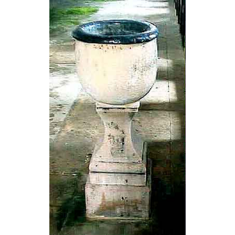
Scene Description: planter?
Copyright Statement: Image copyright © John Wilkes, 2007
Image Source: digital photograph by John Wilkes
Copyright Instructions: Standing permission
view of church interior

Copyright Statement: Image copyright © Alf Beard, 2003
Image Source: digital photograph by Alf Beard
Copyright Instructions: PERMISSION NOT AVAILABLE -- IMAGE NOT FOR PUBLIC USE
INFORMATION
Font ID: 12852OLD
Object Type: Baptismal Font1
Font Century and Period/Style: 13th century, Medieval
Church / Chapel Name: Parish Church of St. Arilda [aka St. Arild's] [redundant]
Church Patron Saint(s): St. Arilda [aka Arild, Ariva]]
Church Address: Oldbury-on-the-Hill, Didmarton, Badminton, Gloucestershire, GL9 1EA
Site Location: Gloucestershire, South West, England, United Kingdom
Directions to Site: Located 8 km SW of Tetbury, 24 km from Oldbury-upon-Severn
Ecclesiastic Region: Diocese of Gloucester
Historical Region: Hundred of Grimboldestou [in Domesday
Additional Comments: disappeared font?
Font Notes:
Click to view
There is an entry for Oldbury[-on-the-Hill] [variant spelling] in the Domesday survey [http://domesdaymap.co.uk/place/ST8188/oldbury-on-the-hill/] [accessed 10 November 2014], but it mentions neither cleric nor church in it. A font here is noted in Mee (1938): "the primitive little chalice font is perhaps the oldest possession". Noted in Verey & Brooks (1999-2002): "Unusual egg-shaped font, probably of 1768." [NB: the fabric of the church dates from the 13th century, but we have no information on the medieval font].
Credit and Acknowledgements: We are grateful to John Wilkes, of www.allthecotswolds.com, for the photographs of this church and font.
COORDINATES
UTM: 30U 551053 5715985
Latitude & Longitude (Decimal): 51.5926, -2.263
Latitude & Longitude (DMS): 51° 35′ 33.36″ N, 2° 15′ 46.8″ W
REFERENCES
- Mee, Arthur, Gloucestershire, the Glory of the Cotswolds, London: Hodder & Stoughton, 1938
- Verey, David, Gloucestershire, London: Penguin Books, 1999-2002, vol. 1: 534