Barton Mills / Barton Parva / Bertona / Bertunna
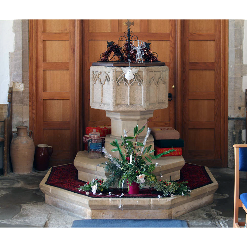
Image copyright © John Salmon, 2012
CC-BY-SA-2.0
Results: 4 records
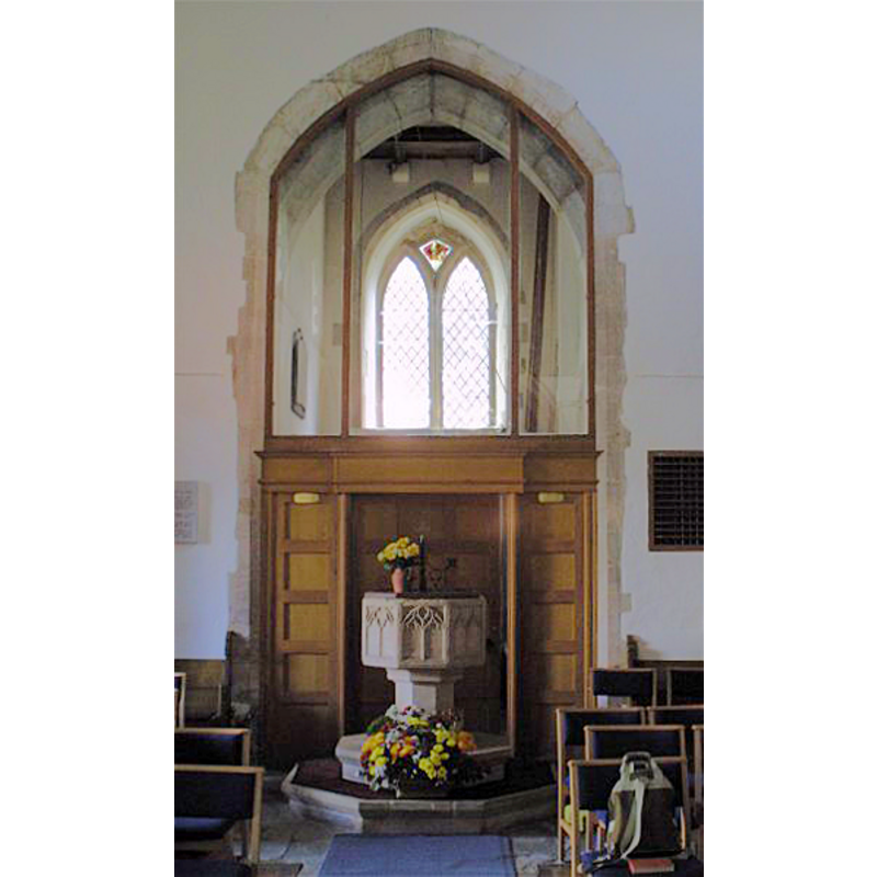
view of font
Scene Description: only the basin is original (14thC?)
Copyright Statement: Image copyright © John Salmon, 2012
Image Source: digital photograph taken 8 December 2012 by John Salmon [www.geograph.org.uk/photo/3255578] [accessed 13 November 2019]
Copyright Instructions: CC-BY-SA-2.0
design element - patterns - tracery - window tracery
Scene Description: [cf. Font notes]
Copyright Statement: Image copyright © John Salmon, 2012
Image Source: digital photograph taken 8 December 2012 by John Salmon [www.geograph.org.uk/photo/3255578] [accessed 13 November 2019]
Copyright Instructions: CC-BY-SA-2.0
view of church exterior - south view
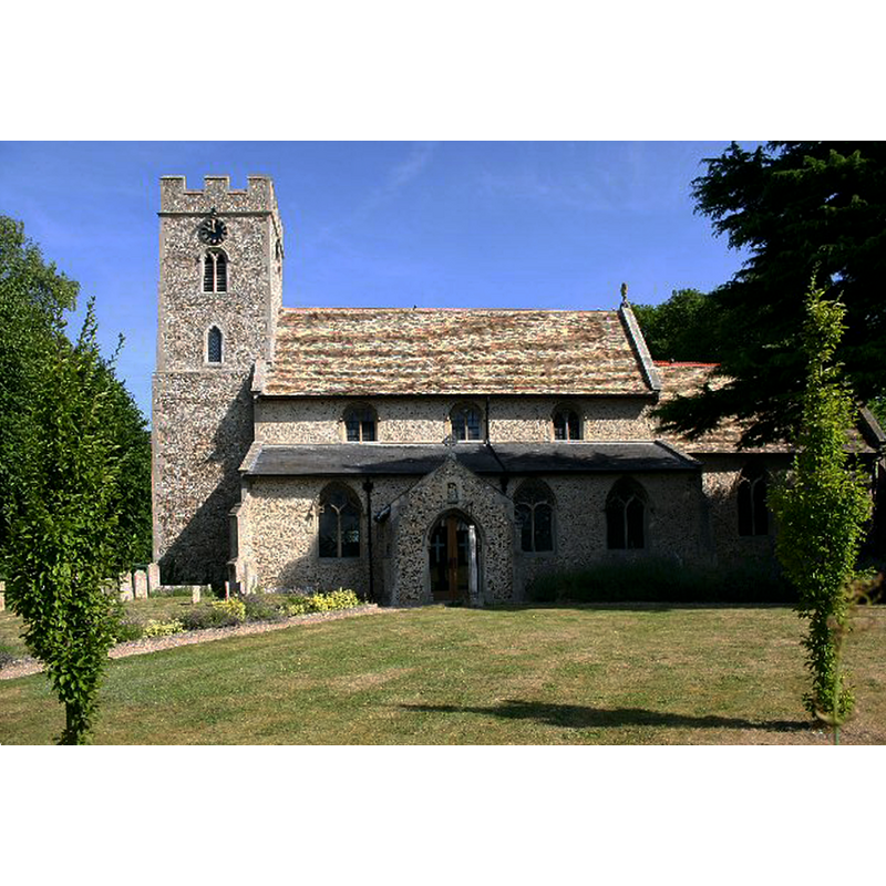
Copyright Statement: Image copyright © Bob Jones, 2006
Image Source: digital photograph taken 24 July 2006 by Bob Jones [www.geograph.org.uk/photo/207926] [accessed 13 November 2019]
Copyright Instructions: CC-BY-SA-2.0
view of font and cover in context
Copyright Statement: Image copyright © Simon Knott, 2003
Image Source: digital photograph by Simon Knott [www.suffolkchurches.co.uk/bartonmills.htm] [accessed 20 March 2007]
Copyright Instructions: Standing permission
INFORMATION
Font ID: 12844BAR
Object Type: Baptismal Font1
Font Century and Period/Style: 14th century [basin only?] [composite font], Medieval [composite]
Church / Chapel Name: Parish Church of St. Mary the Virgin
Font Location in Church: Inside the church
Church Patron Saint(s): St. Mary the Virgin
Church Address: The St, Barton Mills, Bury Saint Edmunds IP28 6AP, UK -- Tel.: +44 1638 720770
Site Location: Suffolk, East Anglia, England, United Kingdom
Directions to Site: Located off (SW) the A11-A1101-A1065 crossroads, 1-2 km SSE of Mildenhall
Ecclesiastic Region: Diocese of St.Edmundsbury & Ipswich
Historical Region: Hundred of Lackford
Additional Comments: altered font? [cf. FontNotes] -- disappeared font? (the one from the 13thC church here)
Font Notes:
Click to view
There are three entries for Barton Mills in the Domesday survey [https://opendomesday.org/place/TL7173/barton-mills/] [accessed 13 November 2019] none of which mentions cleric or church in it. Parker (1855) writes: "The font is D[ecorated]; an octagon, with panelled basin". Noted in Tyrrell-Green (1928) as a baptismal font of the Decorated period decorated with tracery patterns. Noted in Cautley (1982). Knott (2003) describes it as a good font of the 14th century. Parker (1855) mentions a holy-water stoup on the righ side of the Perpendicular porch. The entry for this church in Historic England [Listing NGR: TL7168973819] notes: "The church was largely rebuilt mid C14; the tower is a little earlier, and the chancel has a core of mid C13 [...] Octagonal font with C14 octagonal traceried bowl, the stem probably renewed ".
COORDINATES
UTM: 31U 330969 5801286
Latitude & Longitude (Decimal): 52.3358, 0.519
Latitude & Longitude (DMS): 52° 20′ 8.88″ N, 0° 31′ 8.4″ E
MEDIUM AND MEASUREMENTS
Material: stone
Font Shape: octagonal, mounted
Basin Interior Shape: round
Basin Exterior Shape: octagonal
LID INFORMATION
Material: wood
Apparatus: no
Notes: octagonal and flat
REFERENCES
- Cautley, Henry Munro, Suffolk churches and their treasures, Woodbridge: The Boydell Press, 1982, p. 66
- Knott, Simon, The Suffolk Churches Site, Simon Knott, 1999-. [standing permission to reproduce images received from Simon [February 2005]. URL: www.suffolkchurches.co.uk.
- Parker, John Henry, The Ecclesiastical and architectural topography of England [...] Suffolk, 1855, [unpaged]
- Tyrrell-Green, E., Baptismal Fonts Classified and Illustrated, London: Society for Promoting Christian Knowledge: The Macmillan Co., 1928, p. 97