Tredington nr. Tewkesbury / Teodechesberie / Teodekesberie
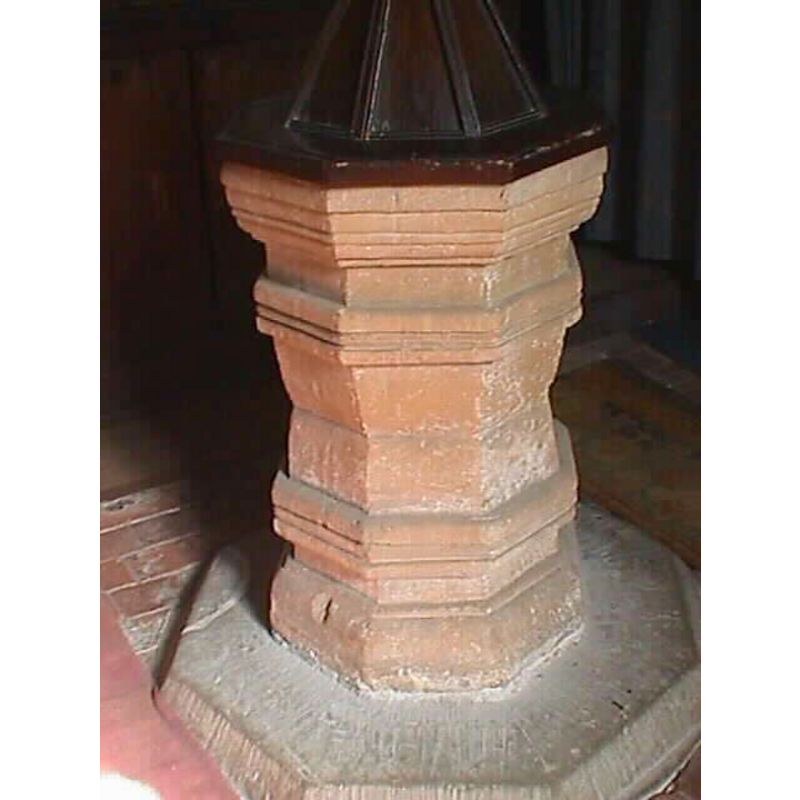
Image copyright © John Wilkes, 2007
Standing permission
Results: 6 records
view of font and cover
Copyright Statement: Image copyright © John Wilkes, 2007
Image Source: digital photograph taken on 19 March 2007 by John Wilkes
Copyright Instructions: Standing permission
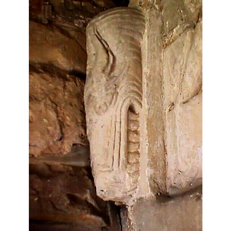
design element - motifs - moulding
Scene Description: [cf. Font notes]
Copyright Statement: Image copyright © John Wilkes, 2007
Image Source: digital photograph taken on 19 March 2007 by John Wilkes
Copyright Instructions: Standing permission
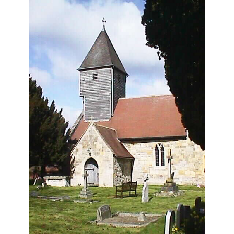
view of church exterior - south view
Copyright Statement: Image copyright © John Wilkes, 2007
Image Source: digital photograph taken on 19 March 2007 by John Wilkes
Copyright Instructions: Standing permission
view of church interior - detail
Copyright Statement: Image copyright © John Wilkes, 2007
Image Source: digital photograph taken on 19 March 2007 by John Wilkes
Copyright Instructions: Standing permission
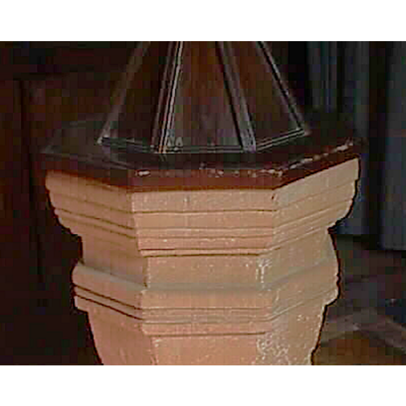
view of font and cover - detail
Copyright Statement: Image copyright © John Wilkes, 2007
Image Source: detail of a digital photograph taken on 19 March 2007 by John Wilkes
Copyright Instructions: Standing permission
design element - motifs - moulding
Scene Description: [cf. Font notes]
Copyright Statement: Image copyright © John Wilkes, 2007
Image Source: digital photograph taken on 19 March 2007 by John Wilkes
Copyright Instructions: Standing permission
INFORMATION
Font ID: 12834TRE
Object Type: Baptismal Font1
Font Date: ca. 1700?
Font Century and Period/Style: 17th - 18th century, Jacobean
Church / Chapel Name: Parish Church of St. John the Baptist
Font Location in Church: Inside the church
Church Patron Saint(s): St. John the Baptist
Church Address: Tredington, Gloucestershire GL20 7AB, UK
Site Location: Gloucestershire, South West, England, United Kingdom
Directions to Site: Located near Stoke Orchard, 4 km SE of Tewkesbury
Ecclesiastic Region: Diocese of Gloucester
Historical Region: Hundred of Tewkesbury, lower division
Additional Comments: disappeared font? (the one from the 12thC church here)
Font Notes:
Click to view
There is an entry for this Tredington [variant spellings] in the Domesday survey [https://opendomesday.org/place/SO9029/tredington/] [accessed 4 February 2019] but it mentions neither cleric nor church in it. The entry for this parish in the Victoria County History (Gloucestr, vol. 8, 1968 ) notes: "it is clear from architectural evidence that Tredington church had been built by the 12th century" but it states that "The font is of c. 1700", and has no information on the whereabouts of the earlier font(s). Verey & Brooks (1999-2002) have: "Font. Octagonal, of c. 1700." The present baptismal font is a moulded geometric piece in reddish stone that looks like a mirror of itself from the middle down; the pyramidal wooden cover has an octagonal base; Victorian? The whole is raised on an octagonal plinth. [NB: we have no information on the font of the medieval church here].
Credit and Acknowledgements: We are grateful to John Wilkes, of The Gloucestershire Photo Library [www.allthecotswolds.com], for the photographs of this church and font.
COORDINATES
UTM: 30U 559099 5757382
Latitude & Longitude (Decimal): 51.963986, 51.963986
Latitude & Longitude (DMS): 51° 57′ 50.35″ N, 2° 8′ 23.36″ W
MEDIUM AND MEASUREMENTS
Material: stone
Font Shape: octagonal, mounted
Basin Interior Shape: round
Basin Exterior Shape: octagonal
LID INFORMATION
Date: Victorian?
Material: wood, oak?
Apparatus: no
Notes: [cf. FontNotes]
REFERENCES
- Victoria County History [online], University of London, 1993-. URL: https://www.british-history.ac.uk.
- Verey, David, Gloucestershire, London: Penguin Books, 1999-2002, vol. 2: 777