Purton nr. Gloucester / Perttone
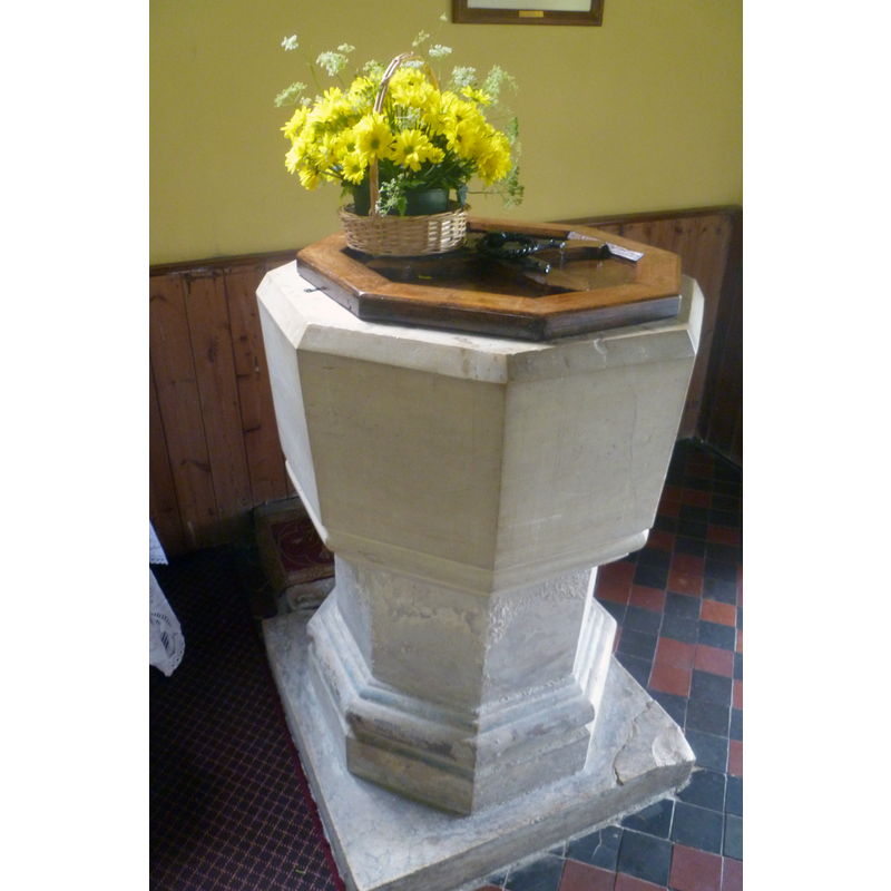
Image copyright © John Wilkes, 2017
Standing permission
Results: 3 records
view of font and cover
Scene Description: the modern font
Copyright Statement: Image copyright © John Wilkes, 2017
Image Source: digital photograph taken in 23 May 2017 by John Wilkes [www.allthecotswolds.com] [replacement photograph]
Copyright Instructions: Standing permission
view of church exterior - east view
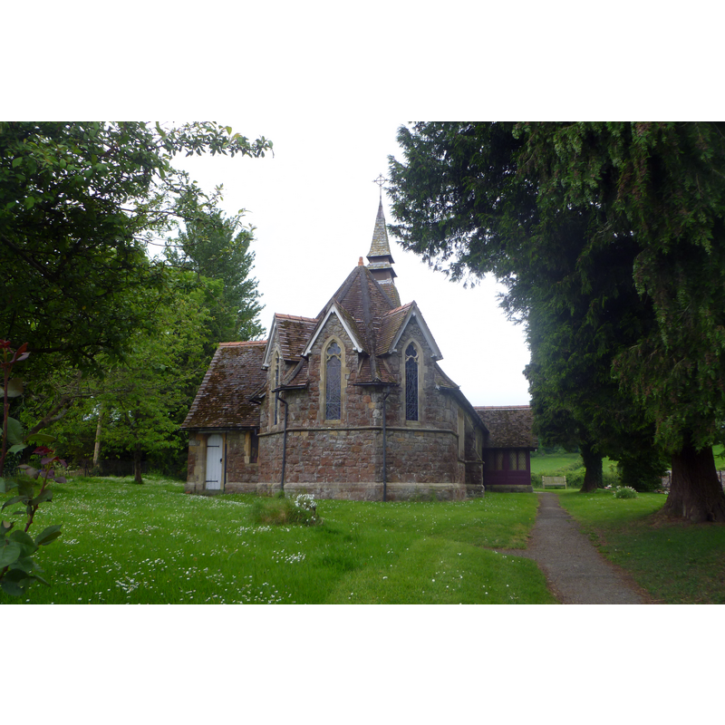
Scene Description: the modern church
Copyright Statement: Image copyright © John Wilkes, 2017
Image Source: digital photograph taken in 23 May 2017 by John Wilkes [www.allthecotswolds.com] [replacement photograph]
Copyright Instructions: Standing permission
view of church interior - nave - looking east
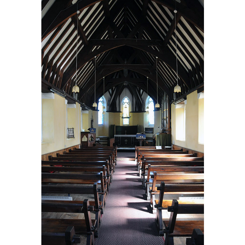
Scene Description: the modern church
Copyright Statement: Image copyright © Philip Halling, 2014
Image Source: digital photograph taken 23 March 2014 by Philip Halling [www.geograph.org.uk/photo/3907887] [accessed 23 May 2017]
Copyright Instructions: CC-BY-SA-2.0
INFORMATION
Font ID: 12830PUR
Object Type: Baptismal Font1?
Font Century and Period/Style: 11th century, Pre-Conquest? / Norman
Church / Chapel Name: Parish Church of St. John the Evangelist
Church Patron Saint(s): St. John the Evangelist
Church Notes: present church built 1874
Church Address: Riddle Street, Purton, Gloucestershire, GL13 9HS
Site Location: Gloucestershire, South West, England, United Kingdom
Directions to Site: Located off (W) the A38, on the banks of the Severn, 5 km N of Berkeley, 17 km SSW of Gloucester
Ecclesiastic Region: Diocese of Gloucester
Historical Region: Hundred of Bledisloe [in Domesday]
Additional Comments: disappeared font? (the one from the Domesday-time church here)
Font Notes:
Click to view
There are two entries for this Purton [variant spelling] in the Domesday Survey [http://opendomesday.org/place/SO6704/purton/] [accessed 23 May 2017], one of which reports a church and church lands in it. The baptismal in this church font consists of an octagonal basin with plain sides, the upper rim chamfered, the underbowl moulded, raised on a plain stam and a moulded lower base, all octagonal as well. Flat octagonal wooden cover with metal ring handle. Both font and cover appear to be 19th-century, probably contemporary with the building itself, of 1874 [NB: we have no information on the font of the medieval church here reported in the Domesday Survey]
Credit and Acknowledgements: We are grateful to John Wilkes, of www.allthecotswolds.com, for the photographs of this church and modern font.
COORDINATES
UTM: 30U 538128 5731762
Latitude & Longitude (Decimal): 51.735474, -2.447848
Latitude & Longitude (DMS): 51° 44′ 7.7″ N, 2° 26′ 52.25″ W