Wendover / Wandoure / Wandovre / Wendoure / Wendovre / Wendower
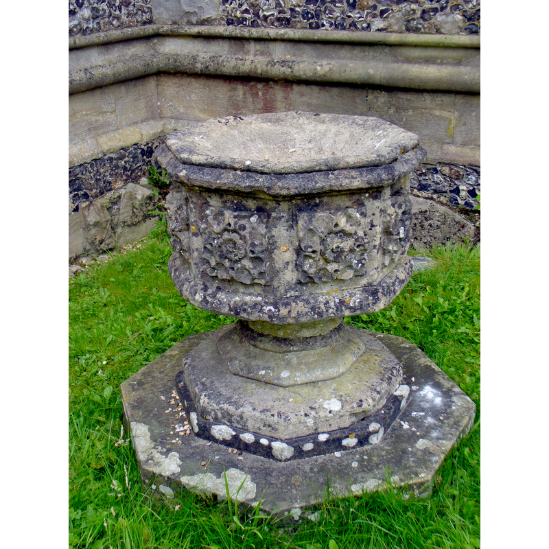
Image copyright © Colin Smith, 2016
Image and permission received from Colin Smith (e-mail of 3 December 2016)
Results: 6 records
view of font
Scene Description: the disused modern font in the churchyard
Copyright Statement: Image copyright © Colin Smith, 2016
Image Source: digital photograph taken 16 August 2016 by Colin Smith
Copyright Instructions: Image and permission received from Colin Smith (e-mail of 3 December 2016)
view of font and cover
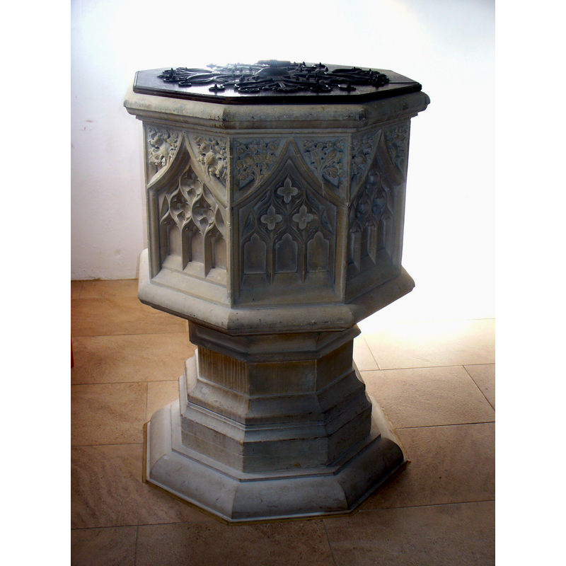
Scene Description: the modern font in use inside the church
Copyright Statement: Image copyright © Colin Smith, 2016
Image Source: digital photograph taken 16 August 2016 by Colin Smith
Copyright Instructions: Image and permission received from Colin Smith (e-mail of 3 December 2016)
view of font basin
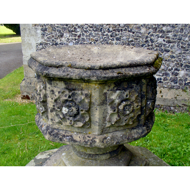
Scene Description: the disused modern font in the churchyard
Copyright Statement: Image copyright © Colin Smith, 2016
Image Source: digital photograph taken 16 August 2016 by Colin Smith
Copyright Instructions: Image and permission received from Colin Smith (e-mail of 3 December 2016)
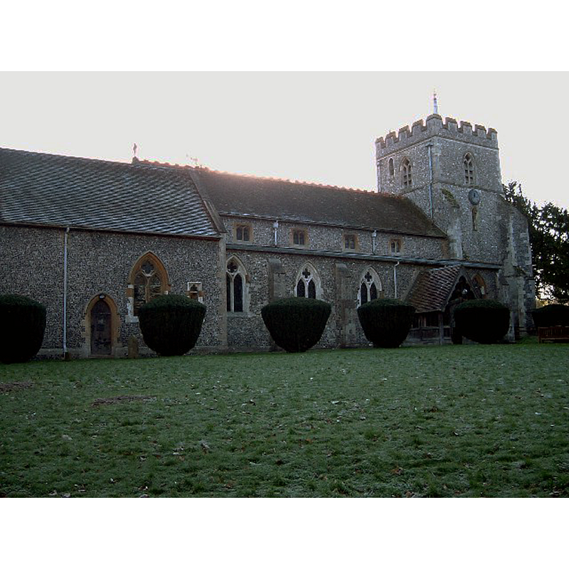
view of church exterior - northwest view
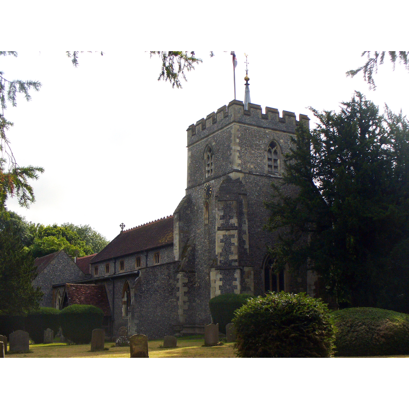
Copyright Statement: Image copyright © Colin Smith, 2016
Image Source: digital photograph taken 16 August 2016 by Colin Smith
Copyright Instructions: Image and permission received from Colin Smith (e-mail of 3 December 2016)
view of church exterior - northeast view
Copyright Statement: Image copyright © Rob Farrow, 2005
Image Source: digital photograph taken 18 December 2005 by Rob Farrow [www.geograph.org.uk/photo/92791] [accessed 30 September 2015]
Copyright Instructions: CC-BY-SA-2.0
view of church interior - nave - looking east
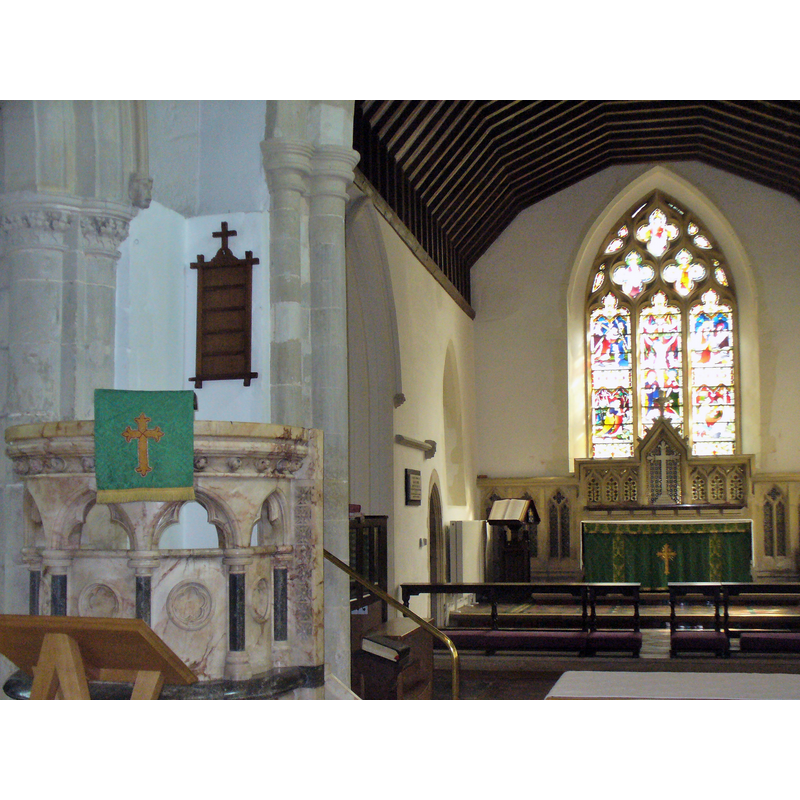
Copyright Statement: Image copyright © Colin Smith, 2016
Image Source: digital photograph taken 16 August 2016 by Colin Smith
Copyright Instructions: Image and permission received from Colin Smith (e-mail of 3 December 2016)
INFORMATION
Font ID: 12822WEN
Object Type: Baptismal Font1?
Font Century and Period/Style: 11th - 12th century, Norman
Church / Chapel Name: Parish Church of St. Mary
Font Location in Church: [cf. FontNotes]
Church Patron Saint(s): St. Mary the Virgin
Church Address: Church Lane, Wendover, Buckinghamshire, HP22 6NL
Site Location: Buckinghamshire, South East, England, United Kingdom
Directions to Site: Located 8 km SW of Aylesbury, 37 km SSE of Buckingham
Ecclesiastic Region: Diocese of Oxford
Historical Region: Hundred of Aylesbury
Additional Comments: disappeared font? {the orig font of the 12thC church here)
Font Notes:
Click to view
There are two entries for Wendouver [variant spelling] in the Domesday survey [http://opendomesday.org/place/SP8607/wendover/] [accessed 30 September 2015], neither of which mentions cleric or church in it. Lewis' Dictionary of 1848 reports: "a beautiful font was presented by Robert Fox, Esq., of The Lodge, in 1840." Sheahan (1862) reports: "The font is modern, with a pyramidal carved oak canopy", and notes that the church was newly restored in 1839. The Victoria County History (Buckingham, vol. 3, 1925) notes: "The church of Wendover appears to have been attached to the manor [...] until the time of Faramus of Boulogne [ca.1105-ca.1184], who gave it to the priory of St. Mary Overy in Southwark during the reign of Henry II [i.e., 1154-1189], [...] It is probable that previous to the middle of the 13th century the church had a nave with north and south aisles and that at this date these were lengthened by two bays [...] The fittings throughout the church are modern, including the font, which is octagonal and designed in 14th-century style". The modern font reported in Sheahan, then, is probably from the 1838-1839 restoration. A visit to this church by Colin Smith on 16 August 2016 turned out two fonts, both of modern appearance; one is inside the church, octagonal basin decorated with traceried window panels on an octagonal moulded stem; the other is in the churchyard, octagonal basin with large rose on each panel, on an octagonal pedestal base and a plinth of the same shape; covered in lichens. [NB: we have no information on the earlier font of this church, but Parker (1850) notes "the remains of a stoup" without a date in the south doorway]
Credit and Acknowledgements: We are grateful to Colin Smith for his photographs of these two fonts and church
COORDINATES
UTM: 30U 656014 5736499
Latitude & Longitude (Decimal): 51.757625, -0.739474
Latitude & Longitude (DMS): 51° 45′ 27.45″ N, 51° 45′ 27.45″ N
LID INFORMATION
Date: 19th-century?
Material: wood, oak
Notes: [cf. FontNotes]
REFERENCES
- Victoria County History [online], University of London, 1993-. URL: https://www.british-history.ac.uk.
- Parker, John Henry, The Ecclesiastical and architectural topography of England: Oxfordshire, Oxford, London: Published under the sanction of the Central Commitee of the Archaeological Institute of Great Britain and Ireland [by] John Henry Parker, 1850, [entry no.] 201
- Sheahan, James Joseph, History and topography of Buckinghamshire, comprising a general survey of the county, preceded by an epitome of the early history of Great Britain, London; Pontefract: Longman, Green, Longman, and Roberts; William Edward Bonas [...], 1862, p. 210, 211