Walton d'Eivile nr. Wellesbourne / Walton Deivile / Walton Mauduit
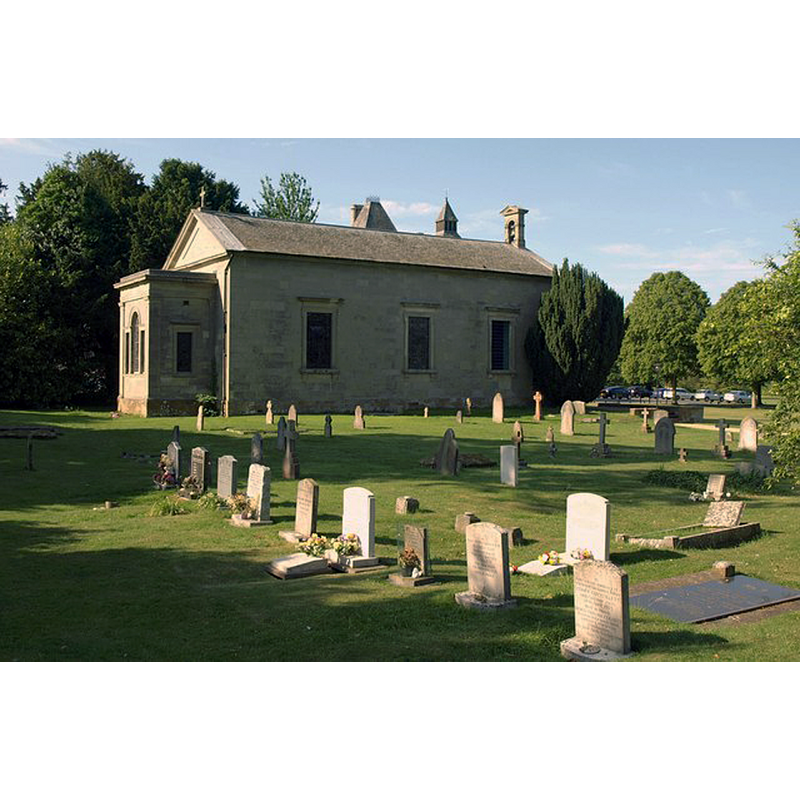
Image copyright © Derek Harper, 2011
CC-BY-SA-2.0
Results: 2 records
view of church exterior - northeast view
Scene Description: Source caption: "The church was rebuilt in 1750 and enlarged in 1842 [...] A pair of turrets on Walton Hall appear above its roofline."
Copyright Statement: Image copyright © Derek Harper, 2011
Image Source: digital photograph taken 11 June 2011 by Derek Harper [www.geograph.org.uk/photo/2498235] [accessed 6 January 2015]
Copyright Instructions: CC-BY-SA-2.0
view of church exterior - southwest view
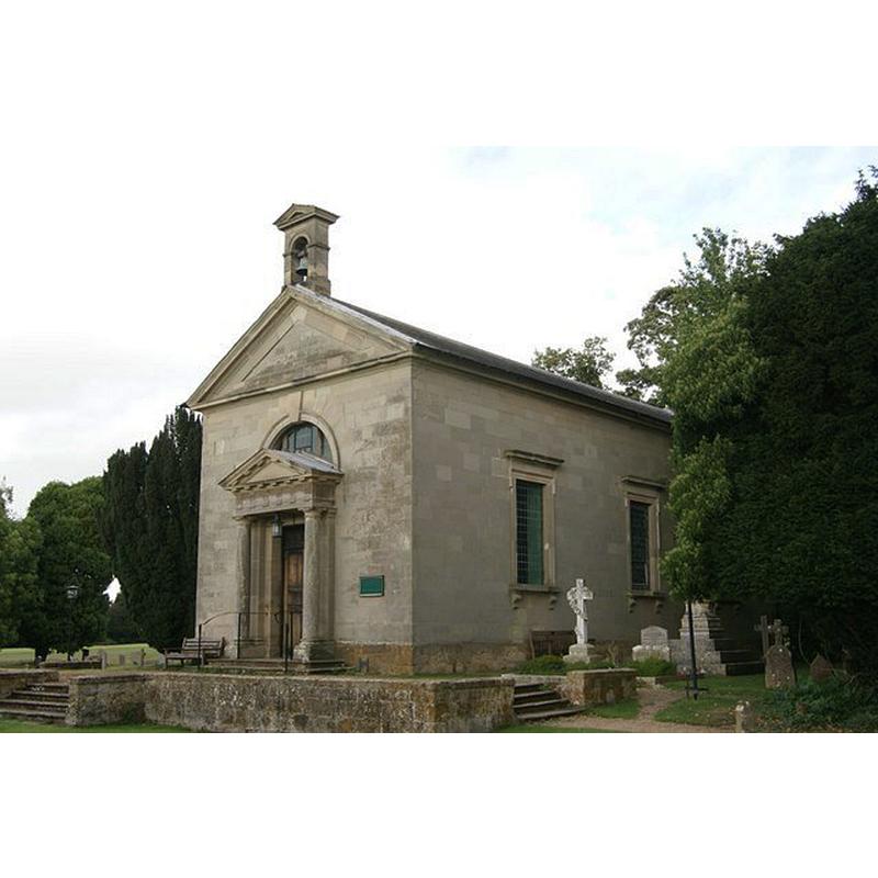
Scene Description: Source caption: "St James's Church, Walton Hall. This church lies alongside the Victorian mansion of Walton Hall, which is now a luxury hotel."
Copyright Statement: Image copyright © Colin Cregg, 2009
Image Source: digital photograph taken 22 September 2009 by Colin Cregg [www.geograph.org.uk/photo/1501306] [accessed 6 January 2015]
Copyright Instructions: CC-BY-SA-2.0
INFORMATION
Font ID: 12812WAL
Object Type: Baptismal Font1
Font Century and Period/Style: 12th century, Late Norman
Church / Chapel Name: Parish Church of St. James
Font Location in Church: Inside the new church
Church Patron Saint(s): St. James
Church Address: Wellesbourne, Warwickshire CV35 9HU / Walton, Warwick CV35 9HU
Site Location: Warwickshire, West Midlands, England, United Kingdom
Directions to Site: Located 6 km WNW of Kineton, 10 km ESE of Stratford-upon-Avon [the original medieval village has disappeard -- the church is approximately 50 m. N of Walton Hall, S of Wellesbourne]
Ecclesiastic Region: Diocese of Coventry
Historical Region: Hundred of Tremeslau [aka Tremlowe]
Additional Comments: altered font (old Norman font restored; new replacement base)
Font Notes:
Click to view
No individual entry found for Walton d'Elvile in the Domesday survey. Reader (1835: 29) reports that the Domesday survey has separate entries for Walton Mauduit and Walton d'Eivile, in Tremeslau Hundred [NB: these may be the two Domesday survey entries under 'Walton' in the Hundred of Tremlowe [http://opendomesday.org/place/SP2853/walton/], but the qualifiers are not found in the text or references; neither entry mentions cleric or church in it]. Lewis' Dictionary of 1848 notes: "the font belonged to an ancient Norman church which stood on the same site." The Ecclesiologist (vol. xvii, 1886: 131) reports after the alterations to the Walton church: "The font stands in its proper place". The Ward and Lock's guide to Warwickshire, ([1883?]) notes: "St James's Church is a small edifice, which occupies the site (in Walton Park) of an old Norman structure, destroyed in the early part of the seventeenth century. The present church was built in 1750, by Sir Charles Mordaunt, as a private chapel; it was originally only about seventeet feet long, but in 1843, Sir John Mordaunt enlarged it so as to afford accommodation for the inhabitants of the hamlet, and it was consecrated in that year, as was also a portion of the old churchyard in which it stands. The Early Norman font of the old church, which had been lying under some elm trees in the park for more than two hundred years, was then restored and placed on a new base at the cost of Miss Emma Mordaunt, and it now serves the purpose for which it was originally designed." The Victoria County History (Warwick, vol. 5, 1949) notes on this church: "The church of ST. JAMES at Walton, originally a chapel of Wellesbourne, was rebuilt by Sir Charles Mordaunt in 1750 and was 'much admired for the modesty and simplicity of its architectural style'. (fn. 95) In 1842 it was very much enlarged and was constituted a parish church. It is built of grey stone and consists of chancel, nave, west porch, and a small turret containing one bell; the only medieval feature is the font, which was found in the churchyard and may be Norman." [the VCH entry is footnoted: "a Kelly, Direct. of Warws. (1936)"]. English Heritage [Listing NGR: SP2850152432] (1967) notes: "Church. Rebuilt 1750 for Sir Charles Mordaunt; enlarged 1842 for Sir John Mordaunt. [...] pudding-basin font of uncertain date, with C19 base".
COORDINATES
UTM: 30U 596776 5781894
Latitude & Longitude (Decimal): 52.17902, -1.58462
Latitude & Longitude (DMS): 52° 10′ 44.47″ N, 1° 35′ 4.63″ W
MEDIUM AND MEASUREMENTS
Material: stone
Font Shape: hemispheric, mounted
Basin Interior Shape: round
Basin Exterior Shape: round
REFERENCES
- Victoria County History [online], University of London, 1993-. URL: https://www.british-history.ac.uk.
- Lewis, Samuel, A Topographical Dictionary of England, Comprising the Several Counties, Cities, Boroughs, Corporate and Market Towns, Parishes, Chapelries, and Townships, and the Islands of Guernsy, Jersey, and Man, with Historical and Statistical Descriptions [...], London: S. Lewis, 1831, [www.british-history.ac.uk/report.asp?compid=51374] [accessed 14 March 2007]