Ringstead nr. Northampton / Ryngestede / Wringsted
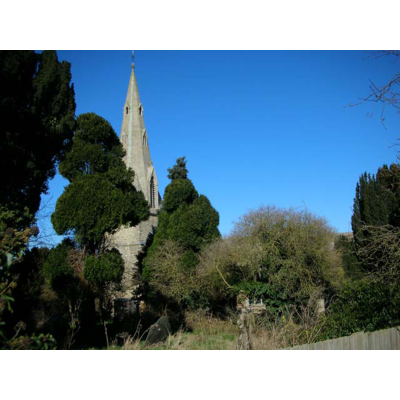
Image copyright © Will Lovell, 2006
CC-BY-SA-3.0
Results: 2 records
BU01: design element - motifs - moulding
![[cf. Font notes]](/static-50478a99ec6f36a15d6234548c59f63da52304e5/others/image_not_available.jpg)
Scene Description: [cf. Font notes]
![[cf. Font notes]](/static-50478a99ec6f36a15d6234548c59f63da52304e5/bsi-testing-site/others/image_not_available.jpg)
view of church exterior - tower
Copyright Statement: Image copyright © Will Lovell, 2006
Image Source: digital photograph taken 1 March 2006 by Will Lovell [www.geograph.org.uk/photo/130419] [accessed 28 May 2012]
Copyright Instructions: CC-BY-SA-3.0
INFORMATION
Font ID: 12747RIN
Object Type: Baptismal Font1
Font Date: ca. 1300?
Font Century and Period/Style: 13th - 14th century, Medieval
Church / Chapel Name: Parish Church of St. Mary [aka The Nativity of the Blessed Virgin Mary]
Font Location in Church: Inside the church, in the W end of the N aisle, W of the N entranceway
Church Patron Saint(s): St. Mary the Virgin / The Nativity of St. Mary
Church Address: 9 Church Street, Ringstead, Northamptonshire NN14 4DH
Site Location: Northamptonshire, East Midlands, England, United Kingdom
Directions to Site: Located 5 km SW of Thrapston, 24 NE of Northampton
Ecclesiastic Region: Diocese of Peterborough
Historical Region: Hundred of Higham Ferrers
Additional Comments: composite font? [cf. Parker in FontNotes]
Font Notes:
Click to view
Lewis' Dictionary of 1848 reports "a plain ancient font on moulded shafts" in this church. Described, with a section illustration of its shaft, in Parker (1849): "The Font stands against the first pillar within the north door. The shaft is of a very singular section: the plain octagonal bason either does not belong to it, or has been set upon it with very little care." Noted in Pevsner & Cherry (1973): "Octagonal, plain, with a stem with attached keeled shafts; c.1300 perhaps." The Victoria County History (Northampton, vol. 4, 1937) notes: "The building dates in the main from the first half of the 13th century, but it probably developed from an aisleless church, the nave of which covered the same area as at present. [...] The font is of the early part of the 14th century and has a plain octagonal bowl with moulded under-edge and shafted stem: there is a rectangular recess cut at the north-west angle, probably for the fastening of the cover." The church interior plan in the VCH (ibid.) shows the font located at the west end of the north aisle, just west of the north entranceway
COORDINATES
UTM: 30U 666581 5804463
Latitude & Longitude (Decimal): 52.365092, -0.553359
Latitude & Longitude (DMS): 52° 21′ 54.33″ N, 0° 33′ 12.09″ W
MEDIUM AND MEASUREMENTS
Material: stone
Font Shape: octagonal, mounted
Basin Interior Shape: round
Basin Exterior Shape: octagonal
REFERENCES
- Victoria County History [online], University of London, 1993-. URL: https://www.british-history.ac.uk.
- Lewis, Samuel, A Topographical Dictionary of England, Comprising the Several Counties, Cities, Boroughs, Corporate and Market Towns, Parishes, Chapelries, and Townships, and the Islands of Guernsy, Jersey, and Man, with Historical and Statistical Descriptions [...], London: S. Lewis, 1831, [www.british-history.ac.uk/report.asp?compid=51238] [accessed 26 February 2007]
- Parker, John Henry, Architectural notices of the churches of the Archdeaconry of Northampton: Deaneries of Higham Ferrers and Haddon, London; Oxford: John Henry Parker, 1849, p. 72
- Pevsner, Nikolaus, Northamptonshire, Harmondsworth: Penguin Books, 1973, p. 385