George Nympton / Nymet St. George / Nymeton Sci. Georgii / Nympton St. George
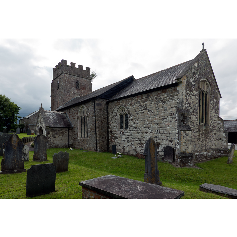
Image copyright © Roger A Smith, 2021
CC-BY-SA-2.5
Results: 2 records
view of church exterior - southeast view
Scene Description: Source caption: "The Church of St. George, George Nympton"
Copyright Statement: Image copyright © Roger A Smith, 2021
Image Source: digital photograph 10 July 2021 by Roger A Smith [https://www.geograph.org.uk/photo/6897411] [accessed 16 February 2024]
Copyright Instructions: CC-BY-SA-2.5
view of church exterior - northwest view
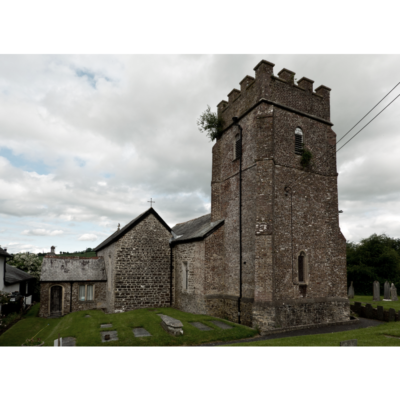
Scene Description: Source caption: "The Church of St. George, George Nympton"
Copyright Statement: Image copyright © Roger A Smith, 2021
Image Source: digital photograph 10 July 2021 by Roger A Smith [https://www.geograph.org.uk/photo/6897413] [accessed 16 February 2024]
Copyright Instructions: CC-BY-SA-2.5
INFORMATION
Font ID: 12734NYM
Object Type: Baptismal Font1
Font Century and Period/Style: 15th century, Late Gothic / Perpendicular
Church / Chapel Name: Parish Church of St. George
Font Location in Church: Inside the church
Church Patron Saint(s): St. George
Church Notes: church documented 1288
Church Address: George Nympton, South Molton EX36 4JE, United Kingdom
Site Location: Devon, South West, England, United Kingdom
Directions to Site: Located off (S) the B3226, in the municipality and 4 SW of South Molton, about 20 km SE of Barnstaple
Ecclesiastic Region: Diocese of Exeter
Historical Region: Hundred of South Molton
Font Notes:
Click to view
No entry found for George Nympton in the Domesday survey. Lewis' Dictionary (1831) mentions "a curious font" [NB: in Lewis' code 'curious' usually means with busy or complex ornamentation]. A "font of great antiquity" in the interior of this church is mentioned in The National Gazetteer of Great Britain and Ireland (1868) [https://www.genuki.org.uk/big/eng/DEV/GeorgeNympton/Gaz1868] [accessed 16 February 2024]. The entry for this church in Historic England [Listing NGR: SS7003322967] notes: "Parish church. C15, tower built 1673, restoration and partial rebuilding of 1882 [...] The font is a probably C15 octangonal bowl, the stem decorated with blind tracery with an C18 ogival timber font cover."
COORDINATES
UTM: 30U 440121 5649212
Latitude & Longitude (Decimal): 50.99137, -3.8532
Latitude & Longitude (DMS): 50° 59′ 28.93″ N, 3° 51′ 11.52″ W
MEDIUM AND MEASUREMENTS
Material: stone
LID INFORMATION
Date: 18th century?
Material: wood
Notes: [cf. FontNotes]
REFERENCES
- Lewis, Samuel, A Topographical Dictionary of England, Comprising the Several Counties, Cities, Boroughs, Corporate and Market Towns, Parishes, Chapelries, and Townships, and the Islands of Guernsy, Jersey, and Man, with Historical and Statistical Descriptions [...], London: S. Lewis, 1831, [www.british-history.ac.uk/report.asp?compid=51188] [accessed 22 February 2007]