Normanton nr. Grantham / Normanton-on-Cliffe
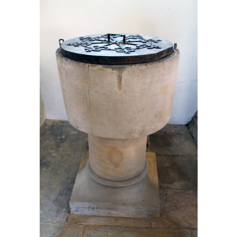
Image copyright © J Hannan-Briggs, 2012
CC-BY-SA-2.0
Results: 4 records
view of font and cover
Scene Description: the cover, stem and lower base appear modern
Copyright Statement: Image copyright © J Hannan-Briggs, 2012
Image Source: digital photograph taken 14 October 2012 by J. Hannan-Briggs [www.geograph.org.uk/photo/3185980] [accessed 14 July 2015]
Copyright Instructions: CC-BY-SA-2.0
view of church exterior - southeast view
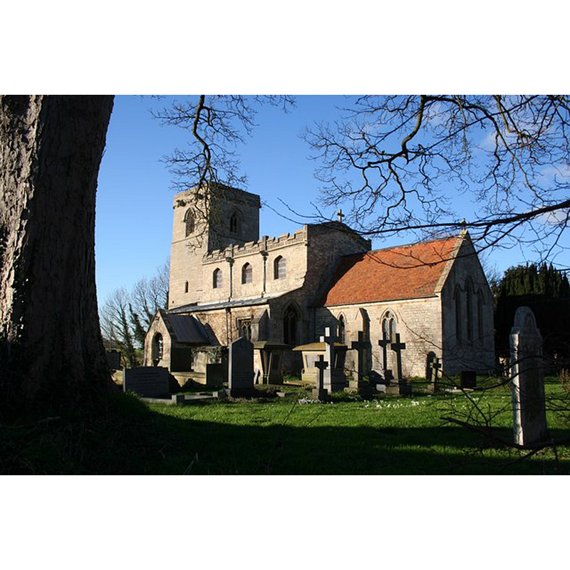
Copyright Statement: Image copyright © Richard Croft, 2007
Image Source: digital photograph taken 2 February 2007 by Richard Croft [www.geograph.org.uk/photo/335355] [accessed 14 July 2015]
Copyright Instructions: CC-BY-SA-2.0
view of church interior - nave - looking west
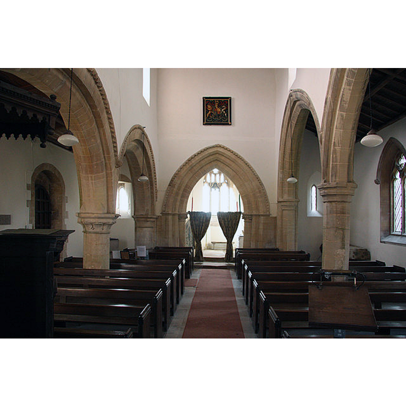
Scene Description: Source caption: "St.Nicholas' nave. Looking west with a late 12th century S arcade, early 14th century N arcade and 13th century tower arch."
Copyright Statement: Image copyright © Richard Croft, 2010
Image Source: digital photograph taken 5 March 2010 by Richard Croft [www.geograph.org.uk/photo/1743022] [accessed 14 July 2015]
Copyright Instructions: CC-BY-SA-2.0
view of church interior - nave - looking east
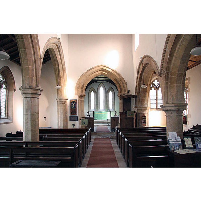
Scene Description: Source caption: "St.Nicholas' nave. Looking east with a late 12th century S arcade and early 14th century N arcade."
Copyright Statement: Image copyright © Richard Croft, 2010
Image Source: digital photograph taken 5 March 2010 by Richard Croft [www.geograph.org.uk/photo/1743027] [accessed 14 July 2015]
Copyright Instructions: CC-BY-SA-2.0
INFORMATION
Font ID: 12726NOR
Object Type: Baptismal Font1
Font Century and Period/Style: 12th century [basin only?], Medieval [composite]
Church / Chapel Name: Parish Church of St. Nicholas [redundant since 1974 --- in the care of the Churches Trust]
Font Location in Church: Inside the church
Church Patron Saint(s): St. Nicholas of Myra
Church Address: Normanton-on-Cliffe, Grantham, Lincolnshire, NG32 3BH
Site Location: Lincolnshire, East Midlands, England, United Kingdom
Directions to Site: Located 11-12 km NNE of Grantham
Ecclesiastic Region: Diocese of Lincoln
Historical Region: Hundred of Loveden
Additional Comments: altered font? (only the basin appears original)
Font Notes:
Click to view
No entry for this Normanton found in the Domesday survey. Lewis' Dictionary of 1848 reports "a large stone font" in this church. The entry for this church in English Heritage [Listing NGR: SK9489346249] (1966) notes: "The font is a plain C12 circular tubs on a round columnar base." Not mentioned in Pevsner & al, (1989). The bucket-shaped basin appears totally plain; it retains a couple of metal staples from an old font cover; raised on a plain cylindrical stem and a round-to-square lower base, both of which appears modern, or totally re-cut.
COORDINATES
UTM: 30U 661879 5875550
Latitude & Longitude (Decimal): 53.005, -0.5874
Latitude & Longitude (DMS): 53° 0′ 18″ N, 0° 35′ 14.64″ W
MEDIUM AND MEASUREMENTS
Material: stone
Font Shape: bucket-shaped, mounted
Basin Interior Shape: round
Basin Exterior Shape: round
LID INFORMATION
Date: modern
Material: wood, oak
Apparatus: no
Notes: round and flat, with metal decoration and ring handle; appears modern
REFERENCES
- Lewis, Samuel, A Topographical Dictionary of England, Comprising the Several Counties, Cities, Boroughs, Corporate and Market Towns, Parishes, Chapelries, and Townships, and the Islands of Guernsy, Jersey, and Man, with Historical and Statistical Descriptions [...], London: S. Lewis, 1831, [www.british-history.ac.uk/report.asp?compid=51182] [accessed 21 February 2007]