Hartlip / Heordlyp / Hertlepe
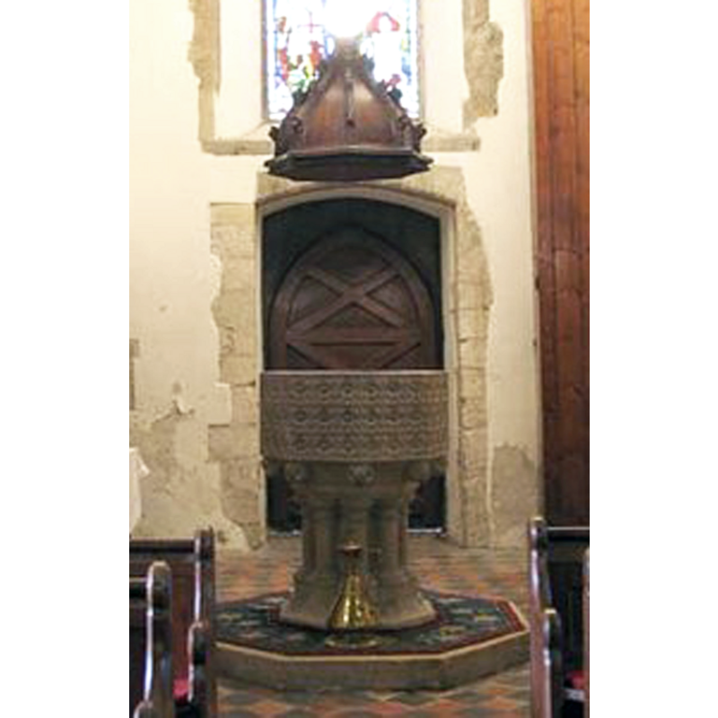
Image copyright © John Salmon, 2007
CC-BY-SA-3.0
Results: 5 records
view of font and cover
Scene Description: the modern replica font and its cover [cf. FontNotes]
Copyright Statement: Image copyright © John Salmon, 2007
Image Source: detail of digital photograph taken 21 March 2007 by John Salmon [www.geograph.org.uk/photo/375142] [accessed 7 September 2013]
Copyright Instructions: CC-BY-SA-3.0
view of church exterior - northwest view
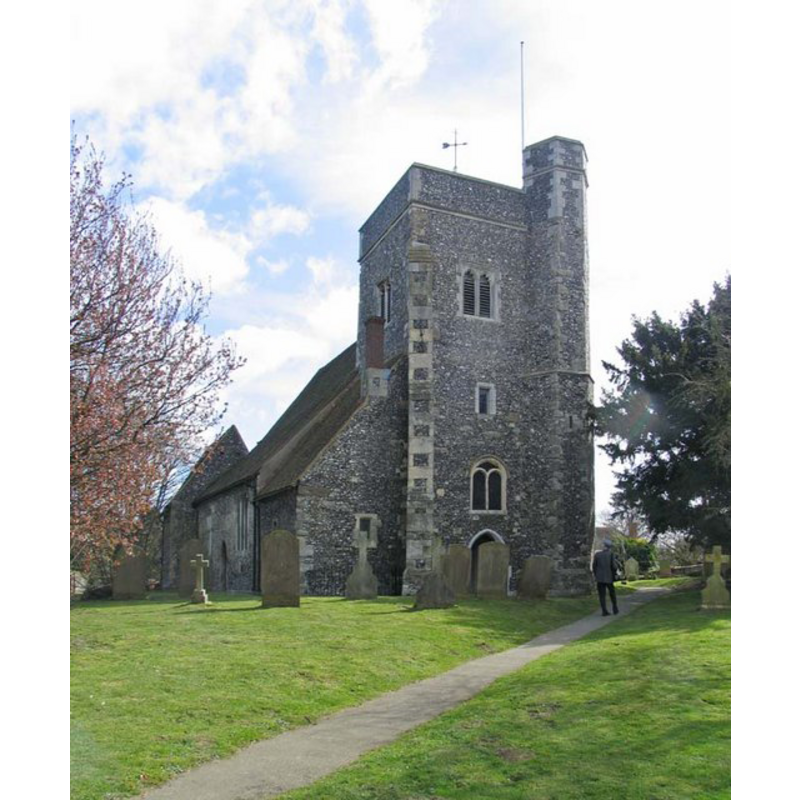
Copyright Statement: Image copyright © John Salmon, 2007
Image Source: digital photograph taken 21 March 2007 by John Salmon [www.geograph.org.uk/photo/375139] [accessed 7 September 2013]
Copyright Instructions: CC-BY-SA-3.0
view of church exterior - southeast view
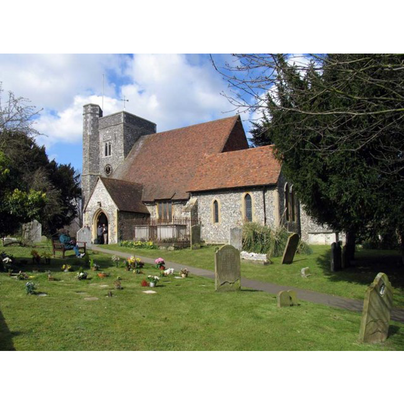
Copyright Statement: Image copyright © John Salmon, 2007
Image Source: digital photograph taken 21 March 2007 by John Salmon [www.geograph.org.uk/photo/375149] [accessed 7 September 2013]
Copyright Instructions: CC-BY-SA-3.0
view of font and cover in context
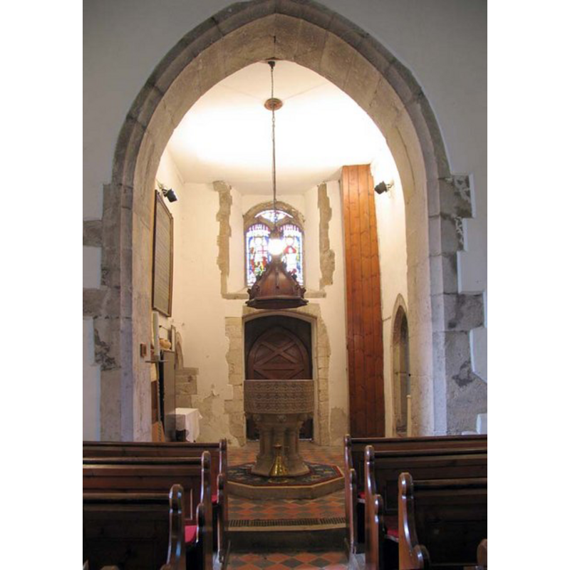
Scene Description: the base of the west tower serving as baptistery now
Copyright Statement: Image copyright © John Salmon, 2007
Image Source: digital photograph taken 21 March 2007 by John Salmon [www.geograph.org.uk/photo/375142] [accessed 7 September 2013]
Copyright Instructions: CC-BY-SA-3.0
view of church interior - nave - looking east
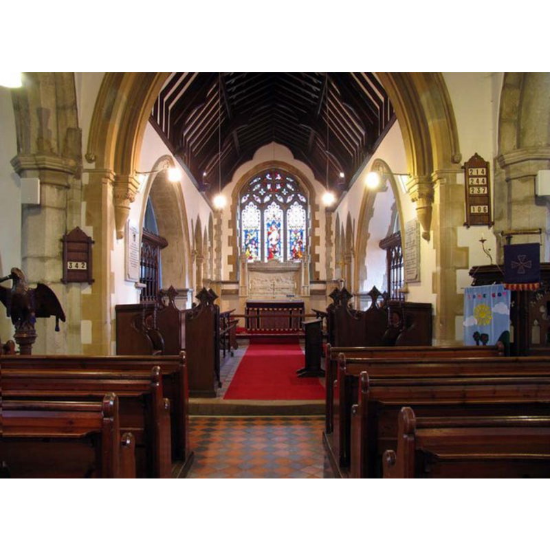
Copyright Statement: Image copyright © John Salmon, 2007
Image Source: digital photograph taken 21 March 2007 by John Salmon [www.geograph.org.uk/photo/375146] [accessed 7 September 2013]
Copyright Instructions: CC-BY-SA-3.0
INFORMATION
Font ID: 12647HAR
Object Type: Baptismal Font1
Font Century and Period/Style: 13th century, Medieval
Cognate Fonts: replica copy of the font at Swaton, Lincs. [cf. FontNotes]
Church / Chapel Name: Parish Church of St. Michael and All Angels
Church Patron Saint(s): St. Michael & All Angels
Church Address: The Street, Hartlip, Kent, ME9 7TL
Site Location: Kent, South East, England, United Kingdom
Directions to Site: Located 3 km SE of Rainham, 8 km W of Sittingbourne, 9 km ESE of Chatham
Ecclesiastic Region: Diocese of Canterbury
Historical Region: Hundred of Milton [aka Middleton] -- Lath of Sherwinhope [aka Scray, Wiwarlet]
Additional Comments: copy font -- disappeared font (the one noted in Lewis and Wilson [cf. FontNotes]; was it the one from the original church here?)
Font Notes:
Click to view
No entry found for Hartlip in the Domesday survey. Halsted (1798) writes: "The church is dedicated to St. Michael, and consists of three isles and three chancels, with a square tower at the west end of it, in which hang five bells. King Henry III. in his 9th year [i.e., 1225], gave the church of Hertlepe, with its appurtenances, to the prior of St. Andrew's, in Rochester. Stephen, archbishop of Canterbury, in 1225, admitted the monks into the possession of this church, to be possessed by them to their own proper uses for ever: saving, nevertheles, a vicarage to be conferred on a proper person at their presentation, who should sustain the burthens of this church, reserving to him, the archbishop, the taxation of the vicarage. Which instrument was confirmed by John, prior, and the convent of the church of Canterbury. [...]The church of Hartlip, together with the advowson of the vicarage, remained part of the possessions of the priory of Rochester till the dissolution of it in the 32d year of king Henry VIII [i.e., 1541] [...] Thomas, the last rector, resigned in 1225." [NB: not clear when the church was founded; after 1225 it became a vicarage, as noted above]. Lewis' Dictionary of 1848 reports "a handsome font" placed in the re-built north-east chancel, and the 'handsome font' term is used also in Wilson's Imperial Gazetteer of 1870-1872. Glynne (1877), however, writes: "The font is new; a very good imitation of the fine Decorated font at Swaton in Lincolnshire." An entry entitled 'Local historian looks at Hartlip, No. 8' in the Hartlip Parish Magazine (October 1966: 8) [http://hartlip.org.uk/hartlip/parishmag/1966_Oct_6.aspx] [accessed 7 September 2013] notes "the font is comparatively modern". The present font in this church is, as indicated in Glynne above, a good replica copy of the font at Swaton [aka Swayton] St. Michael's, in Lincolnshire, an octagonal basin with its panels completly covered in a pattern of square flowers, the underbowl chamfer having one ball flower at each angle, the supporting base a cluster of eight colonnettes with moulded capitals and bases. The wooden font cover is a Jacobean-style dome, with crocketed arrises, either original or a good rendering of the popular design; it is raised and lowered with the help of a counterweight system. [NB: the church was originally of the Decorated period, but we have no information on the earlier font]
COORDINATES
UTM: 31U 335599 5691073
Latitude & Longitude (Decimal): 51.347124, 0.639285
Latitude & Longitude (DMS): 51° 20′ 49.64″ N, 0° 38′ 21.43″ E
LID INFORMATION
Date: 17th century? / Modern?
Material: wood, oak?
Apparatus: yes; counterweight
Notes: [cf. FontNotes]
REFERENCES
- Victoria County History [online], University of London, 1993-. URL: https://www.british-history.ac.uk.
- Hasted, Edward, The History and topographical survey of the County of Kent [...], Canterbury: Printed for the author, by Simmons and Kirkby, 1778-, vol. 6: 15-24 / [www.british-history.ac.uk/report.aspx?compid=62943] [accessed 7 September 2013]
- Lewis, Samuel, A Topographical Dictionary of England, Comprising the Several Counties, Cities, Boroughs, Corporate and Market Towns, Parishes, Chapelries, and Townships, and the Islands of Guernsy, Jersey, and Man, with Historical and Statistical Descriptions [...], London: S. Lewis, 1831, [www.british-history.ac.uk/report.asp?compid=51011] [accessed 8 February 2007]
- Wilson, John Marius, Imperial Gazetteer of England and Wales: embracing recent changes in counties, dioceses, parishes, and boroughs [...], Edinburgh: A. Fullarton & Co., 1870-1872, [cited in www.visionofbritain.org.uk/place/4975 [accessed 7 September 2013]]