Hackney / Central Hackney
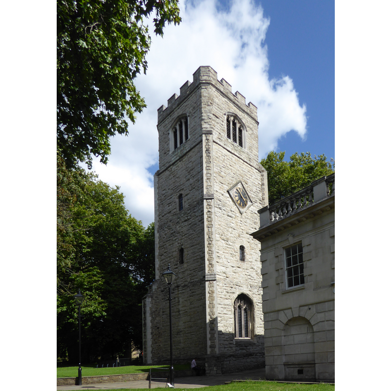
Image copyright © Ethan Doyle White, 2017
CC-BY-SA-4.0
Results: 3 records
view of church exterior in context - tower
Scene Description: Late-13thC tower of Saint Augustine's, the medieval church in Hackney; it was dedicated to St. John after 1660; the body of the old church was demolished in 1797 but the tower retained [cf. FonNotes]
Copyright Statement: Image copyright © Ethan Doyle White, 2017
Image Source: digital photograph taken 6 August 2017 by Ethan Doyle White [https://commons.wikimedia.org/wiki/File:Augustine's_Tower_in_Hackney.JPG] [accessed 26 June 2019]
Copyright Instructions: CC-BY-SA-4.0
view of church exterior - west view
![Source caption: "The Church of St John at Hackney [...] was built in 1792, in an open field, north east of Hackney's medieval parish church, of which only St Augustine's Tower remains. Separated by the southern extension of Lower Clapton Road, it looks north to the late Georgian Clapton Square."](/static-50478a99ec6f36a15d6234548c59f63da52304e5/compressed/1190626009_compressed.png)
Scene Description: Source caption: "The Church of St John at Hackney [...] was built in 1792, in an open field, north east of Hackney's medieval parish church, of which only St Augustine's Tower remains. Separated by the southern extension of Lower Clapton Road, it looks north to the late Georgian Clapton Square."
Copyright Statement: Image copyright © Jim, 2010
Image Source: digital photograph taken 27 September 2010 by Jim [www.flickr.com/photos/54238124@N00/5030294130] [accessed 26 June 2019]
Copyright Instructions: CC-BY-2.0
view of font and cover in context
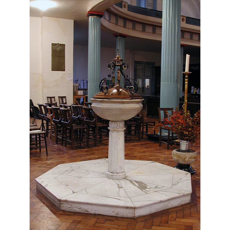
Scene Description: the modern font in the modern church
Copyright Statement: Image copyright © John Salmon, 2010
Image Source: digital photograph taken 7 December 2002 by John Salmon [www.geograph.org.uk/photo/1678961] [accessed 26 June 2019]
Copyright Instructions: CC-BY-SA-2.0
INFORMATION
Font ID: 12642HAC
Object Type: Baptismal Font1?
Font Century and Period/Style: 13th century, Early English
Church / Chapel Name: Parish Church of St. John the Baptist / Church of St John-at-Hackney
Church Patron Saint(s): St. John the Baptist
Church Address: Lower Clapton Rd, Hackney, London E5 0PD, UK
Site Location: Greater London, South East, England, United Kingdom
Directions to Site: Located off (SW) the A107, in NE London, in the Borough of Hackney
Ecclesiastic Region: Diocese of London
Historical Region: Hundred of Ossulstone -- formerly Middlesex
Additional Comments: disappeared font? (the one from the 13thC church here)
Font Notes:
Click to view
No individual entry for Hackney found in the Domesday survey. Lysons (1795) quotes a text on a monument erected in 1750 in this church to the memory of John Sotheby, Esq. This inscription reads: "In this church, under a stone near the font, lyes interred James Sotheby, of Sewardstone" and a reference to the time of king James I, which would indicate that a font was in place inside this church in the early 17th century, thus dating the font to that or an earlier date. A font in St. John's church in central Hackney [or Hackney proper] is noted in Lewis' Dictionary of 1848 in the newly-built church, but it is not clear whether or not this font came with the new building or was brought over from the earlier church it replaced. The entry for this parish in the Victoria County History (Middlesex, vol. 10, 1995) notes: "The parish church of Hackney was a sinecure rectory, [...] presumably by 1275 when it had a vicar [...] and until 1821 when the incumbent vicar became rector and the rectory and vicarage were merged [...] From the former dedication of the church to St. Augustine, [...] a connexion has been assumed with the Knights Hospitallers or Knights Templars [...] The church of ST. JOHN, which stood east of Church Street, [...] was called St. Augustine's from the 14th to the 17th century. [...] From c. 1660 it was known as St. John of Jerusalem, [...] St. John the Baptist, [...] or simply as St. John at Hackney. [...] Only the 16th-century tower survives from what may have been a complete rebuilding [...] The body of the church was pulled down in 1798 [...] The tower was spared lest its eight bells should be too heavy for the new church, although in 1854 they were moved there after it had been underpinned. [...] The new church of St. John was begun in 1791, in a field north-east of the old church, and consecrated [...] in 1797"; no font mentioned in the VCH entry. The present font in use in this church is modern [cf. ImagesArea].
COORDINATES
UTM: 30U 704294 5715019
Latitude & Longitude (Decimal): 51.549224, -0.05336
Latitude & Longitude (DMS): 51° 32′ 57.2″ N, 0° 3′ 12.1″ W
REFERENCES
- Victoria County History [online], University of London, 1993-. URL: https://www.british-history.ac.uk.
- Lewis, Samuel, A Topographical Dictionary of England, Comprising the Several Counties, Cities, Boroughs, Corporate and Market Towns, Parishes, Chapelries, and Townships, and the Islands of Guernsy, Jersey, and Man, with Historical and Statistical Descriptions [...], London: S. Lewis, 1831, [www.british-history.ac.uk/report.asp?compid=50995] [accessed 7 February 2007]
- Lysons, Daniel, The Environs of London, being an historical account of the towns, villages, and hamlets, within twelve miles of that capital, London: printed by A. Strahan for T. Cadell, Jun. and W. Davies, 1795-1796, [www.british-history.ac.uk/report.asp?compid=45419] [accessed 23 March 2007]