Donington-on-Bain / Donington-upon-Bain / Duninctune
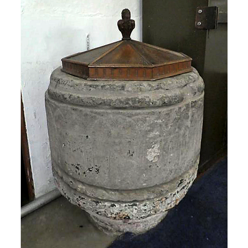
Image copyright © Society for Lincolnshire History and Archaeology, 2018
Standing permission
Results: 6 records
view of font and cover
Copyright Statement: Image copyright © Society for Lincolnshire History and Archaeology, 2018
Image Source: digital photograph taken 9 September 2018 by Dean Bird, in the Society for Lincolnshire History and Archaeology [http://www.slha.org.uk/photogallery/?thistopic=Churches_InteriorFonts] [accessed 31 October 2018]
Copyright Instructions: Standing permission
design element - architectural - arcade - blind - round arches - intersecting arches
Scene Description: [cf. Font notes]
Copyright Statement: Image copyright © Society for Lincolnshire History and Archaeology, 2018
Image Source: digital photograph taken 9 September 2018 by Dean Bird, in the Society for Lincolnshire History and Archaeology [http://www.slha.org.uk/photogallery/?thistopic=Churches_InteriorFonts] [accessed 31 October 2018]
Copyright Instructions: Standing permission
design element - motifs - rope moulding
Scene Description: [cf. Font notes]
Copyright Statement: Image copyright © Society for Lincolnshire History and Archaeology, 2018
Image Source: digital photograph taken 9 September 2018 by Dean Bird, in the Society for Lincolnshire History and Archaeology [http://www.slha.org.uk/photogallery/?thistopic=Churches_InteriorFonts] [accessed 31 October 2018]
Copyright Instructions: Standing permission
view of church exterior - northeast view
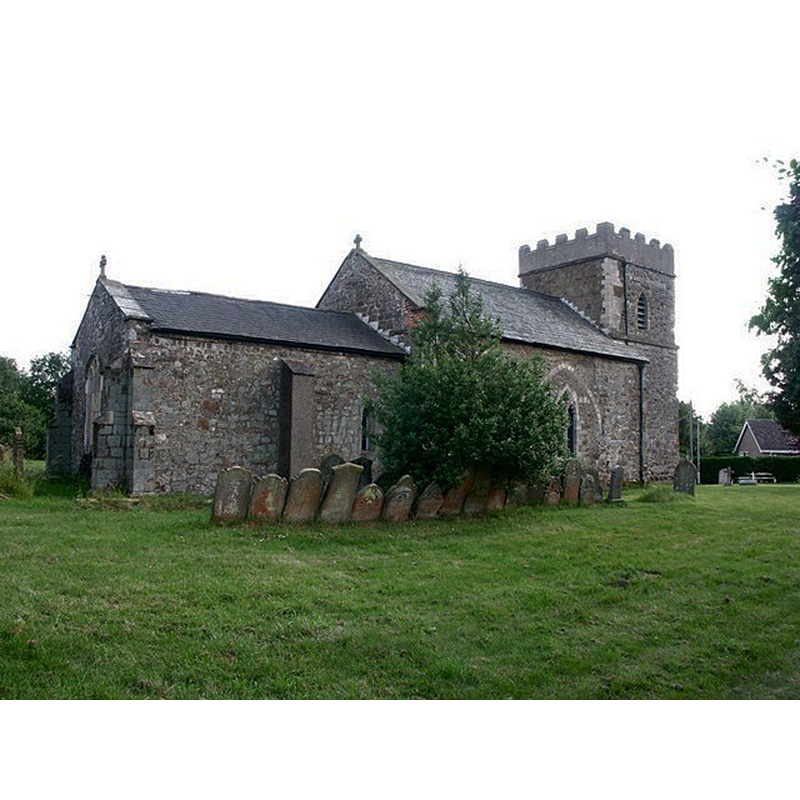
Scene Description: Source caption: "St Andrew, Donington on Bain. The church has an 11th-century tower and a blocked 13th-century arcade. There is a Norman font and an early 17th-century brass to commemorate a former rector."
Copyright Statement: Image copyright © Dave Hitchborne, 2007
Image Source: digital photograph taken 6 July 2004 by Dave Hitchborne [www.geograph.org.uk/photo/430510] [accessed 31 October 2018]
Copyright Instructions: CC-BY-SA-2.0
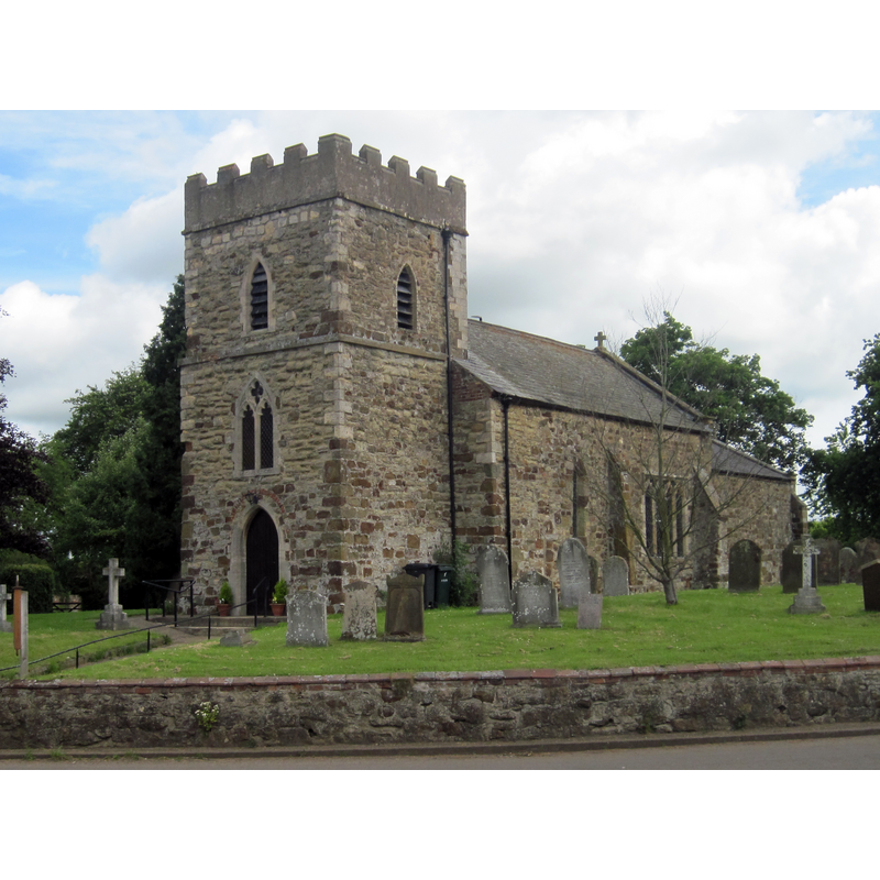
view of church exterior - southwest view
Copyright Statement: Image copyright © Peter Wood, 2012
Image Source: digital photograph taken 27 June 2012 by Peter Wood [www.geograph.org.uk/photo/3015392] [accessed 31 October 2012]
Copyright Instructions: CC-BY-SA-2.0
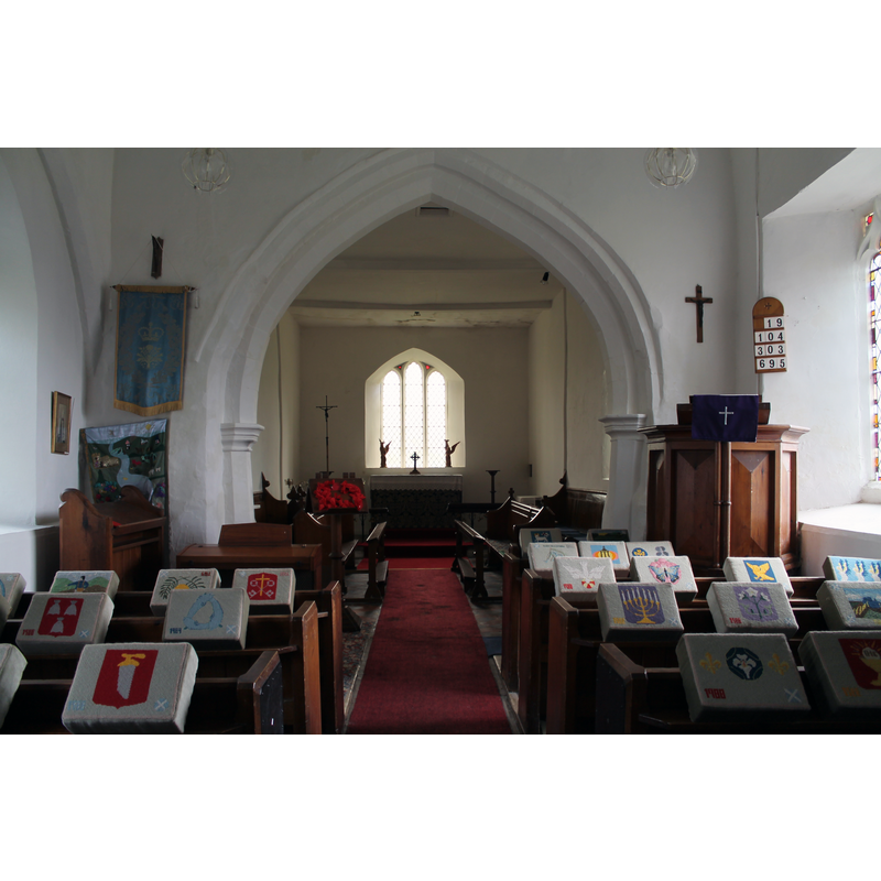
view of church interior - nave - looking east
Copyright Statement: Image copyright © J. Hannan-Briggs, 2014
Image Source: digital photograph taken 13 April 2014 by J.Hannan-Briggs [www.geograph.org.uk/photo/3934718] [accessed 31 October 2018]
Copyright Instructions: CC-BY-SA-2.0
INFORMATION
Font ID: 12598DON
Object Type: Baptismal Font1
Object Details: capital
Font Century and Period/Style: 12th century (late?) [basin only] [composite font], Medieval [composite]
Church / Chapel Name: Parish Church of St. Andrew
Font Location in Church: Inside the church
Church Patron Saint(s): St. Andrew
Church Address: Donington-on-Bain, Louth LN11 9TL, UK
Site Location: Lincolnshire, East Midlands, England, United Kingdom
Directions to Site: Located off the B1225, 11 km SW of Louth, 14 km N of Horncastle
Ecclesiastic Region: Diocese of Lincoln
Historical Region: Hundred of Gartree
Additional Comments: composite font / altered font / recycled font (the base is an inverted capital [cf. FontNotes])
Font Notes:
Click to view
There is an entry for Donington [-on-Bain] [variant spelling] in the Domesday survey [https://opendomesday.org/place/TF2382/donington-on-bain/] [accessed 31 October 2018] but it mentions neither cleric nor church in it. Pevsner, Harris and Antram (1989) note: "Font. Circular, Norman, with incised intersecting arches and a rope moulding. The font stands on a circular E[arly] E[nglish] capital reversed." The enry for this church in Historic England [Listing NGR: TF2356482974] notes: "Parish church. Late C12, C14, c.1779, restored 1868. [...] Late C12 drum font with intersecting pointed arcade inscribed, with broad cable decorated band below, and roll moulded above."
Credit and Acknowledgements: We are grateful to Ken Redmore, Website Editor, and Dean Bird, of the Society for Lincolnshire History and Archaeology, for the photograph of this font
COORDINATES
UTM: 30U 690051 5912679
Latitude & Longitude (Decimal): 53.3291, -0.146
Latitude & Longitude (DMS): 53° 19′ 44.76″ N, 0° 8′ 45.6″ W
MEDIUM AND MEASUREMENTS
Material: stone
Font Shape: tub-shaped, mounted
Basin Interior Shape: round
Basin Exterior Shape: round
LID INFORMATION
Date: modern
Material: wood, oak?
Apparatus: no
Notes: octagonal low pyramid with fleuron finial; modern
REFERENCES
- Pevsner, Nikolaus, Lincolnshire, London: Penguin, 1989, p. 257