West Camel / Camelle [Domesday]
![Main image for West Camel / Camelle [Domesday]](/static-50478a99ec6f36a15d6234548c59f63da52304e5/compressed/1090710003_compressed.png)
Image copyright © Tony Ethridge, 2009
Standing permission
Results: 5 records
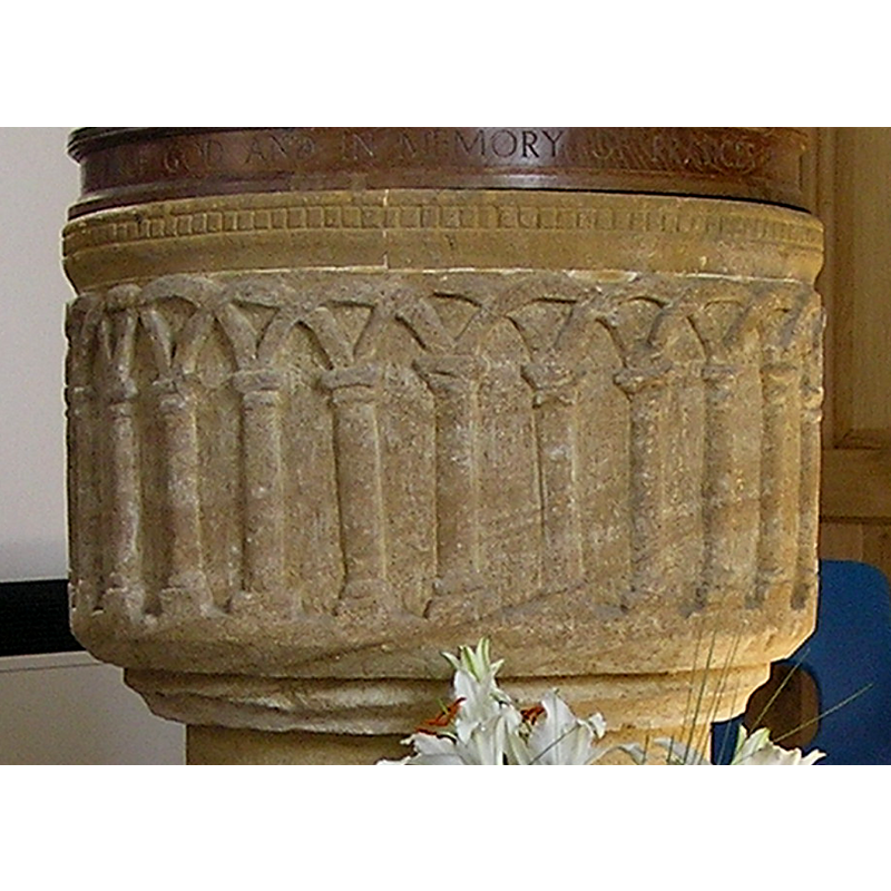
view of font and cover
Copyright Statement: Image copyright © Tony Ethridge, 2009
Image Source: digital photograph taken 17 April 2007 by Tony Ethridge
Copyright Instructions: Standing permission
design element - architectural - arcade - blind - round arches - intersecting arches
view of church exterior - southwest view
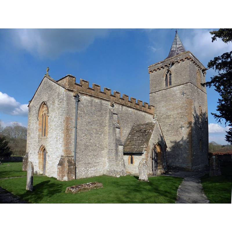
Scene Description: Source caption: "All Saints Church, West Camel
Copyright Statement: Image copyright © Roger Cornfoot, 2018
Image Source: digital photograph taken 28 February 2018 by Roger Cornfoot [www.geograph.org.uk/photo/5695758] [accessed 5 March 2021]
Copyright Instructions: CC-BY-SA-3.0
view of church exterior in context - southeast view
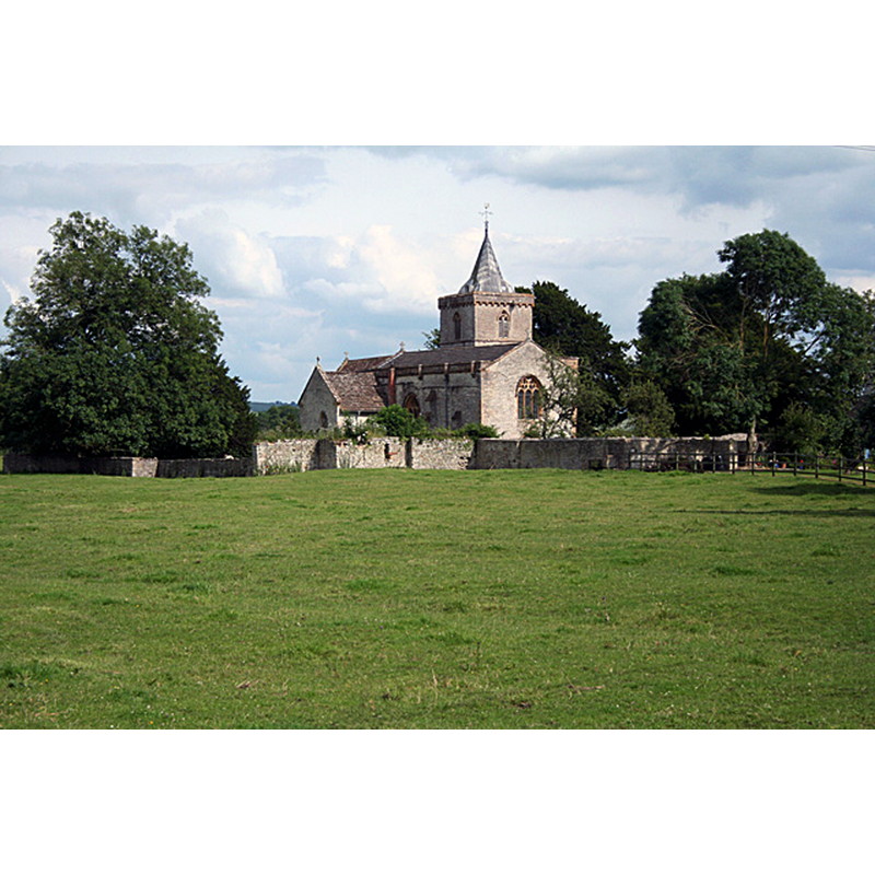
Scene Description: Source caption: "West Camel: All Saints church. Seen from the bridge over the river Cam on Parsonage Road"
Copyright Statement: Image copyright © Martin Borman, 2012
Image Source: digital photograph taken 21 July 2012 by Martin Bodman [www.geograph.org.uk/photo/3047995] [accessed 5 March 2021]
Copyright Instructions: CC-BY-SA-3.0
view of church interior - looking east
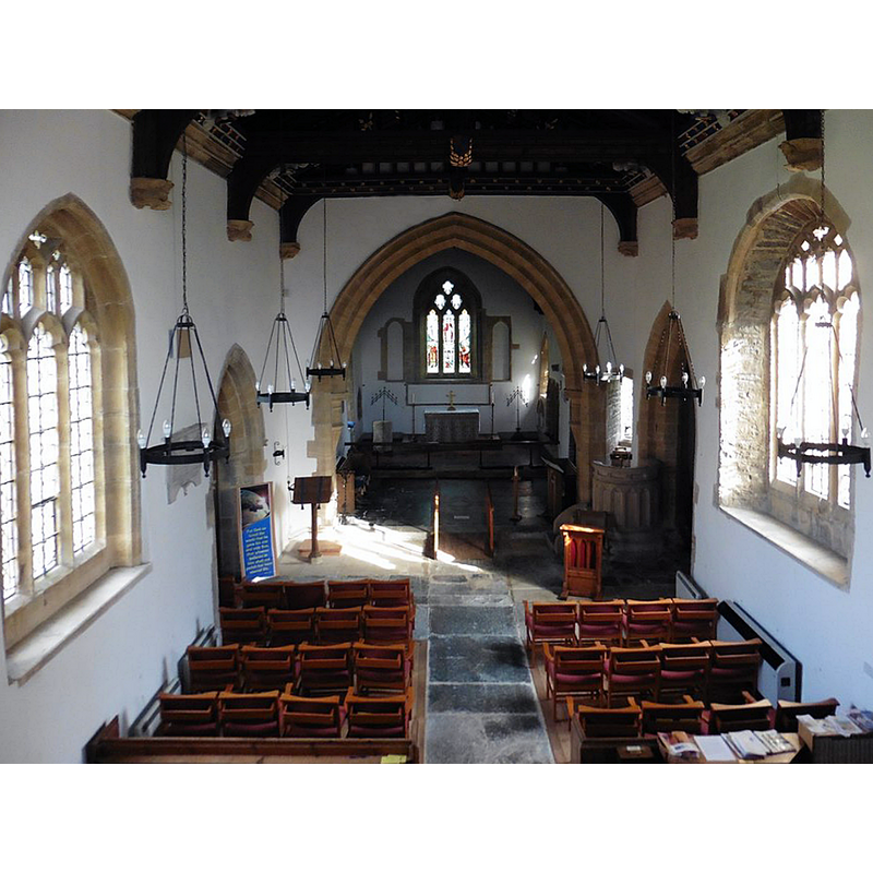
Scene Description: Source caption: "Interior, All Saints Church, West Camel"
Copyright Statement: Image copyright © Roger Cornfoot, 2018
Image Source: digital photograph taken 28 February 2018 by Roger Cornfoot [www.geograph.org.uk/photo/5695761] [accessed 5 March 2021]
Copyright Instructions: CC-BY-SA-3.0
INFORMATION
Font ID: 12563CAM
Object Type: Baptismal Font1
Font Century and Period/Style: 12th century [partly?] [restored], Medieval [composite]
Church / Chapel Name: Parish Church of All Saints
Font Location in Church: Inside the church
Church Patron Saint(s): All Saints
Church Notes: Wade & Wade (1929) report "a fragment of the shaft of a cross, ascribed to the 9th cent., with the interlaced carving generally associated with Celtic and Irish crosses" located at the time near the font. The VCH notes: "If the fragment of decorated crossshaft, influenced by the Jellinge style and now mounted in the north transept, originated in the parish, then the church must date from the late 9th or early 10th century. (fn. 169) The earliest written evidence yet traced is from 1219, (fn. 170) but the Norman font, if not the cross-shaft, is evidence of a church building at an earlier date. The church may well have been founded by Muchelney abbey, owners of the manor from the 10th century, and, physically, it is close to the remaining buildings of the former demesne farm" [http://www.british-history.ac.uk/report.aspx?compid=66489] [accessed 9 March 2008]
Church Address: W Camel Farm, West Camel, Yeovil BA22 7HH, UK -- Tel.: +44 1963 441595
Site Location: Somerset, South West, England, United Kingdom
Directions to Site: Located off (S) the A303, 6 km ENE of Ilchester
Ecclesiastic Region: Diocese of Bath & Wells
Historical Region: Hundred of Somerton
Additional Comments: altered font / restored font (the original late-Norman font) -- disappeared font? (the one from the claimed-9thC church here?)
Font Notes:
Click to view
There is an entry for [West] Camel [variant spelling] in the Domesday survey [http://opendomesday.org/place/ST5724/west-camel/] [accessed 6 February 2018], but it mentions neither cleric nor church in it. Lewis' Dictionary of 1848 reports "a handsome sculptured font" in this church. Described in Wade & Wade (1929): "The font is Norm[an], with shallow arcading round the basin". Described in Pevsner (1958). The Victoria County History (Somerset, vol. 3, 1974) notes: "If the fragment of decorated crossshaft, influenced by the Jellinge style and now mounted in the north transept, originated in the parish, then the church must date from the late 9th or early 10th century. [...] The earliest written evidence yet traced is from 1219, [...] but the Norman font, if not the cross-shaft, is evidence of a church building at an earlier date [...] The present cruciform building dates from the late 13th and earlier 14th centuries with some 15th-century alterations." The font has been restored, or, rather, re-built, with the original carved drum showing the intersecting arches; the rest is all modern. The oak cover, bearing a dedicatory inscription, is also modern.
Credit and Acknowledgements: We are grateful to Tony Ethridge, of Somerset Villages, for the photograph of this font
COORDINATES
UTM: 30U 528193 5651941
Latitude & Longitude (Decimal): 51.018333, -2.598056
Latitude & Longitude (DMS): 51° 1′ 6″ N, 2° 35′ 53″ W
MEDIUM AND MEASUREMENTS
Material: stone
Font Shape: hemispheric, mounted
Basin Interior Shape: round
Basin Exterior Shape: round
LID INFORMATION
Date: modern
Material: wood, oak
Apparatus: no
Notes: [cf. FontNotes]
REFERENCES
- Victoria County History [online], University of London, 1993-. URL: https://www.british-history.ac.uk.
- Lewis, Samuel, A Topographical Dictionary of England, Comprising the Several Counties, Cities, Boroughs, Corporate and Market Towns, Parishes, Chapelries, and Townships, and the Islands of Guernsy, Jersey, and Man, with Historical and Statistical Descriptions [...], London: S. Lewis, 1831, [www.british-history.ac.uk/report.asp?compid=50855] [accessed 23 January 2007]
- Pevsner, Nikolaus, South and West Somerset, Harmondsworth: Penguin Books, 1958, p. 337
- Wade, G.H., Somerset, London: Methurn & Co., 1929, [http://www.gutenberg.org/files/12287/12287-h/12287-h.htm] [accessed 9 March 2008]