Wardley / Wardeley / Warle / Warlee / Warleg / Warley / Werlea
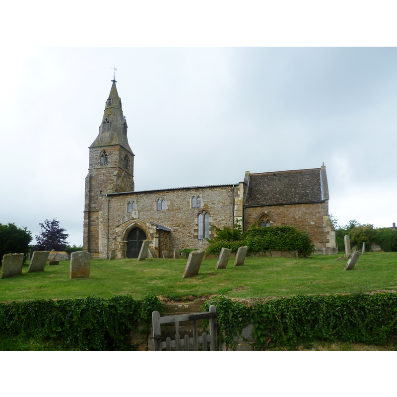
Image copyright © Marathon, 2011
CC-BY-SA-2.0
Results: 3 records
view of church exterior
Scene Description: Source caption: "St Botolph's Church, Wardley. Very much off the beaten track now, Wardley was so remote that during the Commonwealth the Book of Common Prayer was still used against the injunction of the government. St Botolph has a 13th century nave raised in the 15th century, a 14th century spire and the chancel was rebuilt in the 19th century. In other words it is a typical country church with architecture from different periods."
Copyright Statement: Image copyright © Marathon, 2011
Image Source: digital photograph taken 26 May 2011 by Marathon [www.geograph.org.uk/photo/2452278] [accessed 13 July 2015]
Copyright Instructions: CC-BY-SA-2.0
view of church interior - nave - looking east
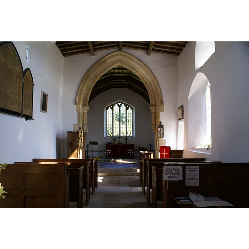
Copyright Statement: Image copyright © Chris Stafford, 2006
Image Source: digital photograph taken 11 October 2006 by Chris Stafford [www.geograph.org.uk/photo/344146] [accessed 13 July 2015]
Copyright Instructions: CC-BY-SA-2.0
view of font
![the late-18thC font [cf. FontNotes]](/static-50478a99ec6f36a15d6234548c59f63da52304e5/others/permission_not_available.jpg)
Scene Description: the late-18thC font [cf. FontNotes]
Copyright Statement: Image copyright © Lord Muttley McFester, 2009
Image Source: digital photograph taken 28 November 2009 by Lord Muttley McFester [www.flickr.com/photos/16545729@N03/4143692662/] [accessed 13 July 2015]
Copyright Instructions: PERMISSION NOT AVAILABLE -- IMAGE NOT FOR PUBLIC USE
INFORMATION
Font ID: 12509WAR
Object Type: Baptismal Font1
Font Century and Period/Style: 12th century, Late Norman? / Transitional?
Church / Chapel Name: Parish Church of St. Botolph
Church Patron Saint(s): St. Botulph [aka St. Botolph, Botolph of Thorney, Botulf]
Church Address: Main Street, Wardley, Rutland, LE15 9AZ, UK
Site Location: Rutland, East Midlands, England, United Kingdom
Directions to Site: Located 4 km WNW of Uppingham
Ecclesiastic Region: Diocese of Peterborough
Additional Comments: disappeared font? (the font of the original 12thC church here)
Font Notes:
Click to view
No entry found for Wardley in the Domesday survey. Pevsner (1984) notes the current font: "Octagonal basin without any decoration. Dated 1797." [NB: although parts of the church are dated to the 12th century, we have no information on the earlier font(s) of this church]
COORDINATES
UTM: 30U 651128 5829657
Latitude & Longitude (Decimal): 52.5959, -0.7687
Latitude & Longitude (DMS): 52° 35′ 45.24″ N, 0° 46′ 7.32″ W
MEDIUM AND MEASUREMENTS
Material: stone
Font Shape: octagonal, mounted
Basin Exterior Shape: octagonal
REFERENCES
- Victoria County History [online], University of London, 1993-. URL: https://www.british-history.ac.uk.
- Pevsner, Nikolaus, Leicestershire and Rutland, Harmondsworth: Penguin Books, 1984, p. 519