Newbold-on-Avon / Newbold-upon-Avon / Newebold
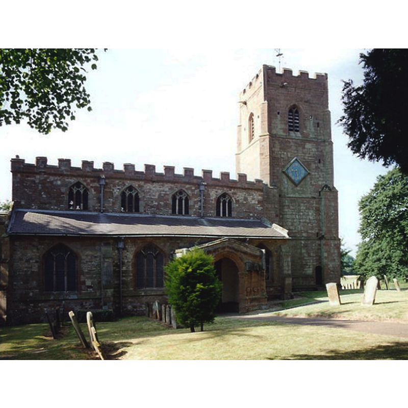
Image copyright © Raymond Hopkins, 1982
CC-BY-SA-2.0
Results: 4 records
view of church exterior - north view
Copyright Statement: Image copyright © Raymond Hopkins, 1982
Image Source: photograph taken in 1982 by Raymond Hopkins [www.geograph.org.uk/photo/913812] [accessed 5 February 2015]
Copyright Instructions: CC-BY-SA-2.0
view of church exterior - southwest view
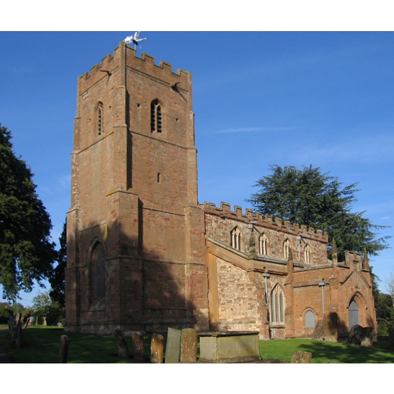
Scene Description: Source caption: "St Botolph's Church, Newbold-on-Avon. The church on the hill in the village, with the old canal tunnel leading under part of the churchyard."
Copyright Statement: Image copyright © David Stowell, 2005
Image Source: digital photograph taken 24 September 2005 by David Stowell [www.geograph.org.uk/photo/59377] [accessed 5 February 2015]
Copyright Instructions: CC-BY-SA-2.0
design element - motifs - quatrefoil - 8


design element - architectural - arch-head - trefoiled - 8
INFORMATION
Font ID: 12507NEW
Object Type: Baptismal Font1
Font Century and Period/Style: 14th century (early?) [re-tooled?], Decorated [altered]
Church / Chapel Name: Parish Church of St. Botolph
Font Location in Church: Inside the church
Church Patron Saint(s): St. Botulph [aka St. Botolph, Botolph of Thorney, Botulf]
Church Address: Main Street, Newbold-on-Avon, Rugby, Warwickshire, CV21 1HR, UK
Site Location: Warwickshire, West Midlands, England, United Kingdom
Directions to Site: Located now in Rugby. 3 km NNW from its city centre [Newbold was incorporated into Rugby in 1932]
Ecclesiastic Region: Diocese of Coventry
Historical Region: Hundred of Bumbelowe [in Domesday] -- Hundred of Knightlow
Additional Comments: altered font? [re-tooled?] (14thC re-tooled in the 19thC?) -- disappeared font? (the one from the mid-11thC here? [cf. FontNotes])
Font Notes:
Click to view
There is an entry for Newbold[-on-Avon] [variant spelling] in the Domesday survey [http://domesdaymap.co.uk/place/SP4877/newbold-on-avon/] [accessed 12 January 2015], but it mentions neither cleric nor church in it [cf. infra]. The Victoria County History (Warwick, vol. 6, 1951) notes: "The church and tithes of Newbold-on-Avon were given to the abbey of St. Nicholas, Angers, by Geoffrey de Wirce [i.e., Geoffrey de la Guerche (Wirce), ca.1040] and were therefore part of the endowment of that abbey's cell, the priory of Monks Kirby. [...] The church [...] dates from the 15th century and is built on the site of an earlier one [...] The font, standing in the centre of the nave at the western end, is of stone, octagonal, each side decorated with sunk quatrefoils, and supported on a panelled octagonal shaft, the panels having trefoiled heads. It has a deep lead-lined basin, the lead being dressed over the rim and finished with a cable-moulded edge. The stonework has been redressed, but it probably dates from the early 14th century." Noted in the Parish web site [www.stbotolphstjohn.org.uk/stbotolphshistory.htm]: "The font at the west end of the nave is lead lined and is of the fourteenth century. It was part of the church that was on this site before the present building. However, the stone was redresses in the nineteenth century."
COORDINATES
UTM: 30U 616550 5805772
Latitude & Longitude (Decimal): 52.389776, -1.287289
Latitude & Longitude (DMS): 52° 23′ 23.2″ N, 1° 17′ 14.24″ W
MEDIUM AND MEASUREMENTS
Material: stone
Font Shape: octagonal, mounted
Basin Interior Shape: round
Basin Exterior Shape: octagonal
Drainage Notes: lead lining
REFERENCES
- Victoria County History [online], University of London, 1993-. URL: https://www.british-history.ac.uk.