Morcott / Morcot / Morcote / Moricote / Morkote
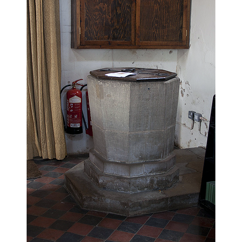
Image copyright © Christopher Jones, 2015
Standing permission
Results: 8 records
view of font and cover
Copyright Statement: Image copyright © Christopher Jones, 2015
Image Source: digital photograph taken by Christopher Jones [www.leicestershirechurches.co.uk/morcott-church-st-mary-the-virgin/] [accessed 21 July 2015]
Copyright Instructions: Standing permission
view of font and cover
![[cf. Font notes]](/static-50478a99ec6f36a15d6234548c59f63da52304e5/compressed/1100703001_compressed.png)
Scene Description: [cf. Font notes]
Copyright Statement: Image copyright © Janice Tostevin, 2010
Image Source: digital photograph taken 11 June 2010 by Janice Tostevin for BSI
Copyright Instructions: Standing permission
view of church exterior - south view
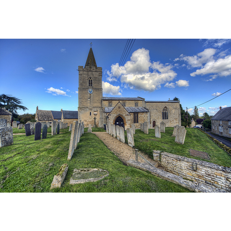
Copyright Statement: Image copyright © Christopher Jones, 2015
Image Source: digital photograph taken by Christopher Jones [www.leicestershirechurches.co.uk/morcott-church-st-mary-the-virgin/] [accessed 21 July 2015]
Copyright Instructions: Standing permission
view of church interior - nave - arcade - capital
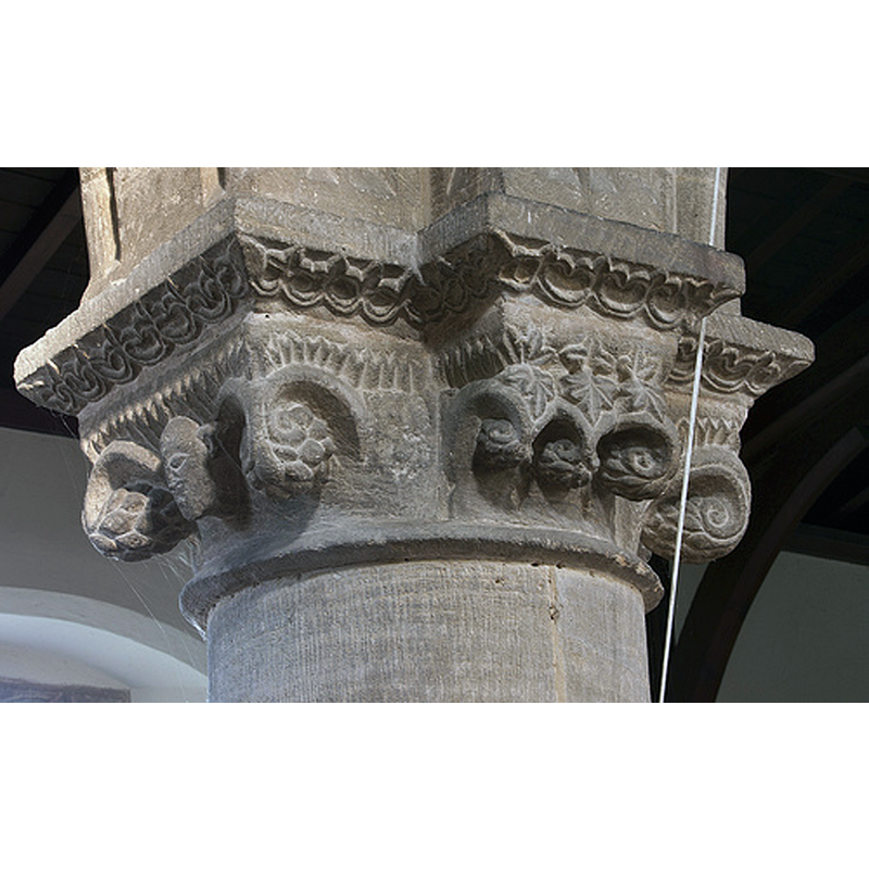
Copyright Statement: Image copyright © Christopher Jones, 2015
Image Source: digital photograph taken by Christopher Jones [www.leicestershirechurches.co.uk/morcott-church-st-mary-the-virgin/] [accessed 21 July 2015]
Copyright Instructions: Standing permission
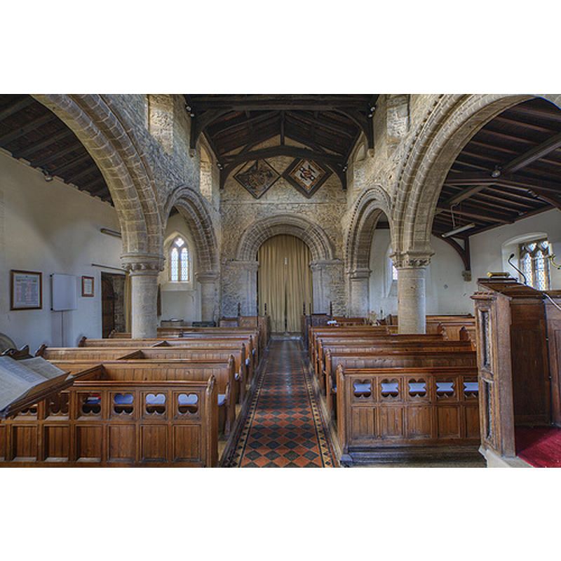
view of church interior - west end - looking north
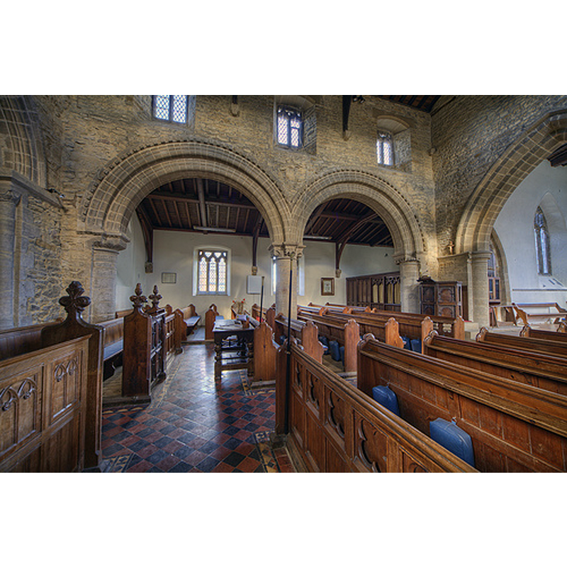
Copyright Statement: Image copyright © Christopher Jones, 2015
Image Source: digital photograph taken by Christopher Jones [www.leicestershirechurches.co.uk/morcott-church-st-mary-the-virgin/] [accessed 21 July 2015]
Copyright Instructions: Standing permission
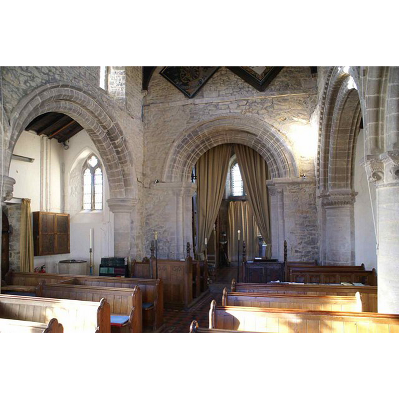
view of church interior - nave - looking west
Copyright Statement: Image copyright © Christopher Jones, 2015
Image Source: digital photograph taken by Christopher Jones [www.leicestershirechurches.co.uk/morcott-church-st-mary-the-virgin/] [accessed 21 July 2015]
Copyright Instructions: Standing permission
view of church interior - chancel and east end
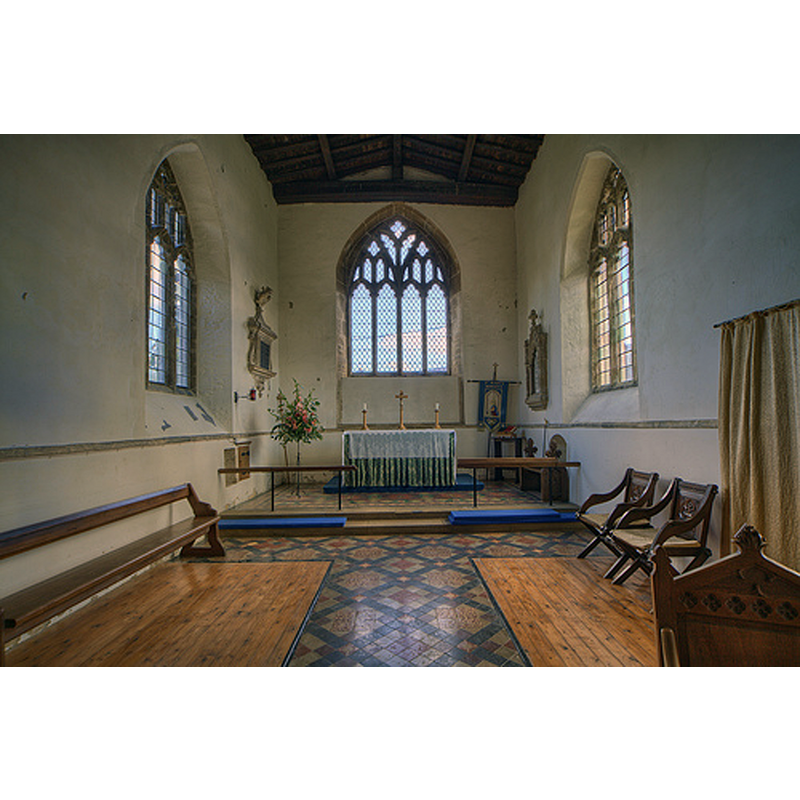
Copyright Statement: Image copyright © Christopher Jones, 2015
Image Source: digital photograph taken by Christopher Jones [www.leicestershirechurches.co.uk/morcott-church-st-mary-the-virgin/] [accessed 21 July 2015]
Copyright Instructions: Standing permission
view of church interior - west end
Scene Description: the top of the font is visible in the left-hand corner, the west end of the south aisle
Copyright Statement: Image copyright © Chris Stafford, 2006
Image Source: digital photograph taken 2 November 2006 by Chris Stafford [www.geograph.org.uk/photo/344453] [accessed 21 July 2015]
Copyright Instructions: CC-BY-SA-2.0
INFORMATION
Font ID: 12503MOR
Object Type: Baptismal Font1
Font Century and Period/Style: 12th - 15th century, Medieval
Church / Chapel Name: Parish Church of St. Mary
Font Location in Church: Inside the church, at the W end of the S aisle
Church Patron Saint(s): St. Mary the Virgin
Church Address: High Street, Morcott, Rutland LE15 9DH, UK
Site Location: Rutland, East Midlands, England, United Kingdom
Directions to Site: Located off the A47, 7 km E of Uppingham
Ecclesiastic Region: Diocese of Peterborough
Historical Region: Hundred of Witchley [in Domesday] -- Hundred of Wrandike
Additional Comments: altered font?
Font Notes:
Click to view
There is entry for Morcott [variant spelling] in the Domesday survey [http://opendomesday.org/place/SK9200/morcott/] [accessed 21 July 2015], but it mentions neither cleric nor church in it. The Victoria County History (Rutland, vol. 2, 1935) notes: "The tower is of the first half of the 12th century and belongs to a church the nave of which covered the same area as at present and whose south doorway remains, though not in its original position. To this building a north aisle was added c. 1150–60, and a south aisle some forty or fifty years later (c. 1200), the arcades of which remain unaltered. [...] The font has a plain octagonal bowl of uncertain date, on a double square base". Noted in Pevsner (1984): "Font. Norman, drum-shaped, with blank arches on shafts." [NB: is this an error? to be re-checked]. The font, as it stands now [June 2010] consists of an octagonal basin with plain tapering sides, raised on a two-step lower base and plinth with a kneeling stone; it is possible that the basin may be formed of two blocks. The wooden cover is octagonal and flat, with metal decoration and ring handle; modern.
Credit and Acknowledgements: We are grateful to Christopher Jones, of Leicestershire Churches [www.leicestershirechurches.co.uk], and to Janice Tostevin for their photographs of this church and font
COORDINATES
UTM: 30U 660084 5830054
Latitude & Longitude (Decimal): 52.5969, -0.6364
Latitude & Longitude (DMS): 52° 35′ 48.84″ N, 0° 38′ 11.04″ W
MEDIUM AND MEASUREMENTS
Material: stone
Font Shape: octagonal, mounted
Basin Interior Shape: round
Basin Exterior Shape: octagonal
LID INFORMATION
Date: modern
Material: wood
Apparatus: no
Notes: [cf. FontNotes]
REFERENCES
- Victoria County History [online], University of London, 1993-. URL: https://www.british-history.ac.uk.
- Pevsner, Nikolaus, Leicestershire and Rutland, Harmondsworth: Penguin Books, 1984, p. 487