Little Casterton / Castretone / Parva Castreton
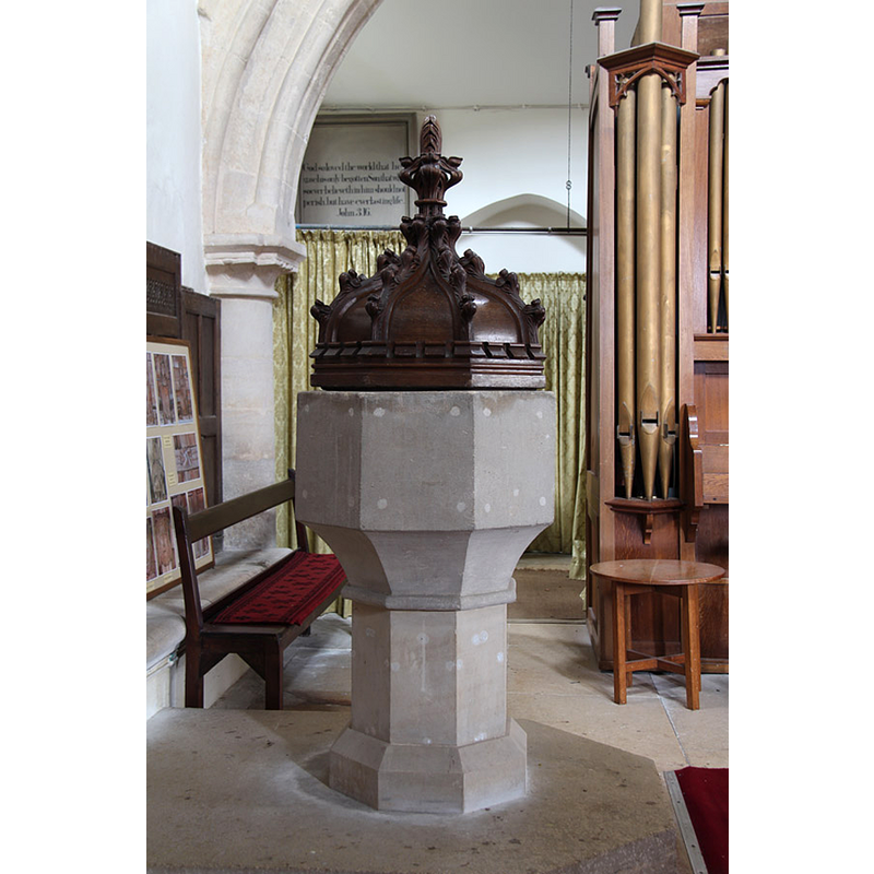
Image copyright © John Salmon, 2015
CC-BY-SA-2.0
Results: 4 records
view of font and cover
Scene Description: both modern
Copyright Statement: Image copyright © John Salmon, 2015
Image Source: digital photograph taken 13 April 2015 by John Salmon [www.geograph.org.uk/photo/4470339] [accessed 22 July 2015]
Copyright Instructions: CC-BY-SA-2.0
view of church exterior - southeast view
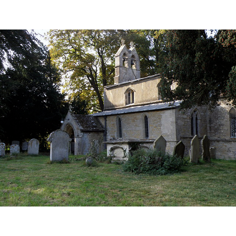
Copyright Statement: Image copyright © Michael Trolove, 2009
Image Source: digital photograph taken 19 September 2009 by Michael Trolove [www.geograph.org.uk/photo/1496381] [accessed 22 July 2015]
Copyright Instructions: CC-BY-SA-2.0
view of church interior - nave - looking west
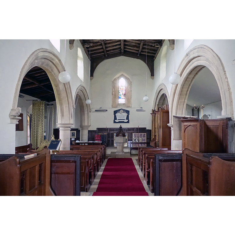
Scene Description: the modern font and cover are visible at the far end
Copyright Statement: Image copyright © John Salmon, 2015
Image Source: digital photograph taken 13 April 2015 by John Salmon [www.geograph.org.uk/photo/4470334] [accessed 22 July 2015]
Copyright Instructions: CC-BY-SA-2.0
view of church interior - nave - looking east
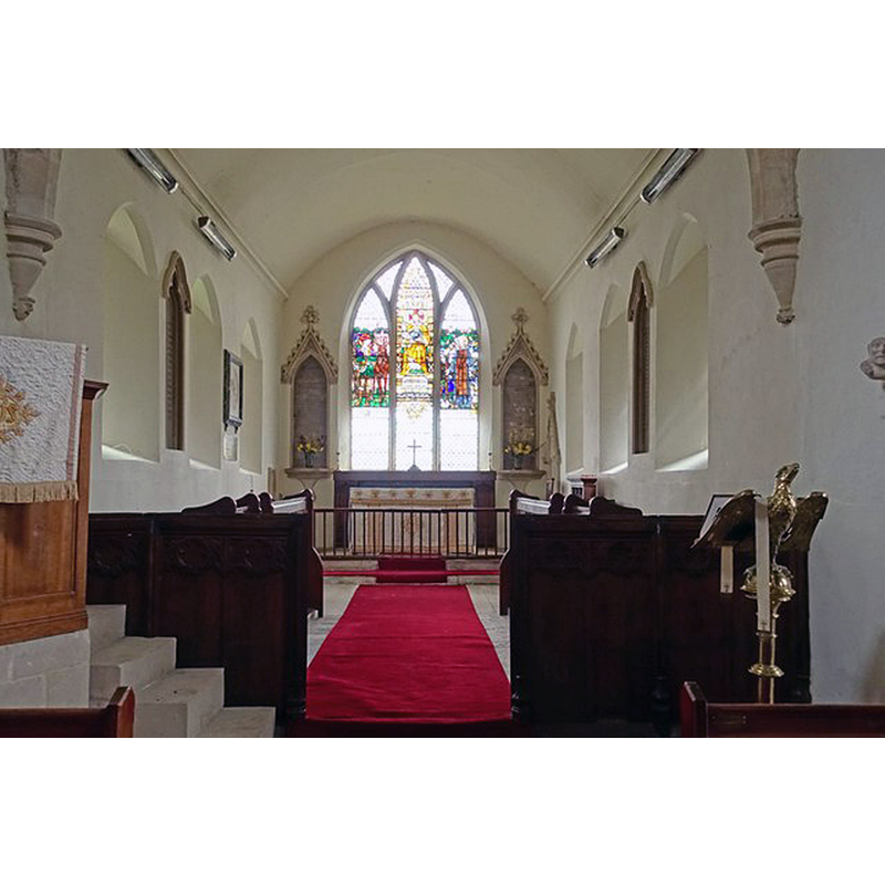
Copyright Statement: Image copyright © John Salmon, 2015
Image Source: digital photograph taken 13 April 2015 by John Salmon [www.geograph.org.uk/photo/4470332] [accessed 22 July 2015]
Copyright Instructions: CC-BY-SA-2.0
INFORMATION
Font ID: 12502CAS
Object Type: Baptismal Font1?
Font Century and Period/Style: 11th century, Pre-Conquest? / Norman
Church / Chapel Name: Parish Church of All Saints
Church Patron Saint(s): All Saints
Church Address: Little Casterton, Rutland, PE9 4BE, UK
Site Location: Rutland, East Midlands, England, United Kingdom
Directions to Site: Located just E of Great Casterton, NNW of Stamford
Ecclesiastic Region: Diocese of Peterborough
Historical Region: Hundred of Witchley [in Domesday] -- East Hundred
Additional Comments: disappeared font? (the one from the Domesday-time church here)
Font Notes:
Click to view
There is an entry for [Little] Casterton [variant spelling] in the Domesday survey [http://opendomesday.org/place/TF0109/little-casterton/] [accessed 22 July 2015]; it mentions a priest, but not a church, in it, though there probably was one there. The Victoria County History (Rutland, vol. 2, 1935) notes: "The original church was probably a rectangular 12th-century building covering the area of the present nave, with small square-ended chancel. To this, c. 1190, a north aisle was added, the wall being pierced by the existing arcade of two bays. [...] The font has a plain octagonal bowl, rounded on the underside, and is probably not older than 1811; it stands on an octagonal stem and has a modern crocketed oak cover."
COORDINATES
UTM: 30U 669321 5839306
Latitude & Longitude (Decimal): 52.6772, -0.4954
Latitude & Longitude (DMS): 52° 40′ 37.92″ N, 0° 29′ 43.44″ W
REFERENCES
- Victoria County History [online], University of London, 1993-. URL: https://www.british-history.ac.uk.