Beeford / Biuuorde / Bivvorde
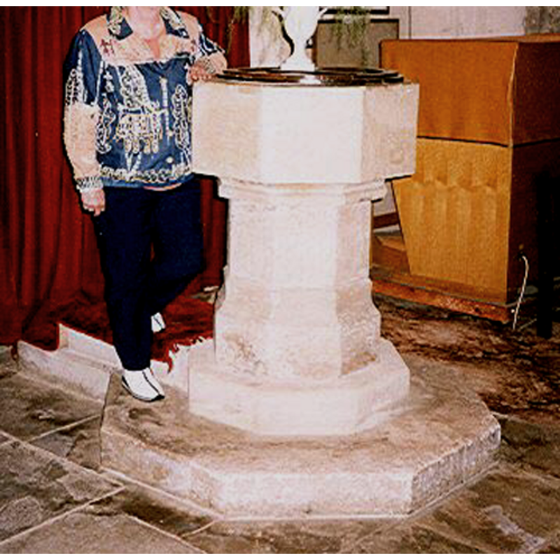
Image copyright © Mary Harris, 2003
Standing permission
Results: 3 records
view of font and cover
Copyright Statement: Image copyright © Mary Harris, 2003
Image Source: digital photograph by Mary Harris taken in September 2003
Copyright Instructions: Standing permission
view of church exterior in context - southeast view
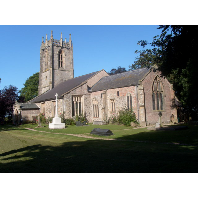
Scene Description: Source caption: "St Leonard's church Beeford "
Copyright Statement: Image copyright © Ron Speed, 2009
Image Source: digital photograph taken 9 September 2009 by Ron Speed [www.geograph.org.uk/photo/1483203] [accessed 1 November 2019]
Copyright Instructions: CC-BY-SA-3.0
design element - motifs - moulding
![[cf. Font notes]](/static-50478a99ec6f36a15d6234548c59f63da52304e5/compressed/1070107002_compressed.png)
Scene Description: [cf. Font notes]
Copyright Statement: Image copyright © Mary Harris, 2003
Image Source: greyscale detail of a digital photograph by Mary Harris taken in September 2003
Copyright Instructions: Standing permission
INFORMATION
Font ID: 12496BEE
Object Type: Baptismal Font1
Font Century and Period/Style: 15th century, Perpendicular
Church / Chapel Name: Parish Church of St. Leonard
Font Location in Church: Inside the church, in the W end of the nave
Church Patron Saint(s): St. Leonard
Church Address: Rectory Ln, Beeford, Driffield YO25 8BA, UK
Site Location: East Riding of Yorkshire, Yorkshire and the Humber, England, United Kingdom
Directions to Site: Located off (NW) the A165-B1249 crossroads, 13 km SSW of Bridlington, 16 km NE of Beverley
Ecclesiastic Region: Diocese of York
Historical Region: Hundred of Holderness [Middle Hundred]
Additional Comments: disappeared font? (the one from the Domesday-time church here)
Font Notes:
Click to view
There is a multiple-place entry for Beeford [variant spelling] in the Domesday survey [https://opendomesday.org/place/TA1254/beeford/] [accessed 1 November 2019]; it reports a priest, a church and 1.0 church lands in it. The entry for this parish in the Victoria County History (York East Riding, vol. 7, 2002) notes: "There was a church with a priest at Beeford in 1086. [...] The church of ST. LEONARD, so called by 1407 [...] There is little evidence of the 11th century building. The chancel was enlarged in the 13th century [...] octagonal font, probably 15th-century". The entry for this church in Historic England [Listing NGR: TA1290454379] notes: "Church. C13 with possible earlier origins, C15 aisles and south porch, C15 west tower, C19 vestry [...] C15 octagonal font on octagonal pier with moulded cap and hollow-chamfered base." The font consists of an octagonal basin with plain vertical sides raised on an octagonal stem and lower base, all of it on an octagonal plinth with priest's stone; the only visible decoration is a moulding around the upper end of the stem, the lower base being slightly splayed. Wooden font cover, flat and round, probably 19th-century.
Credit and Acknowledgements: We are grateful to Mary Harris for the photograph of this font.
COORDINATES
UTM: 30U 678368 5983986
Latitude & Longitude (Decimal): 53.97339, -0.2803
Latitude & Longitude (DMS): 53° 58′ 24.2″ N, 0° 16′ 49.08″ W
MEDIUM AND MEASUREMENTS
Material: stone
Font Shape: octagonal, mounted
Basin Interior Shape: round
Basin Exterior Shape: octagonal
LID INFORMATION
Date: 19th-century
Material: wood, oak?
Apparatus: no
Notes: [cf. FontNotes]
REFERENCES
- Victoria County History [online], University of London, 1993-. URL: https://www.british-history.ac.uk.