Holt nr. Cromer
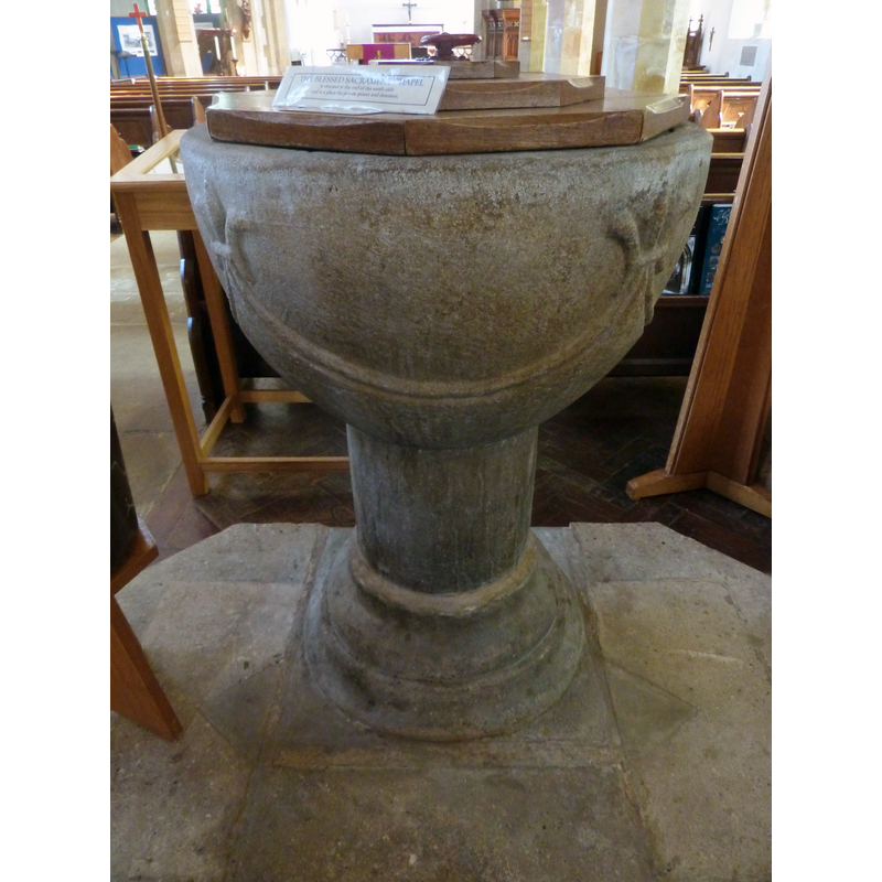
Image copyright © Janice Tostevin, 2011
Standing permission
Results: 9 records
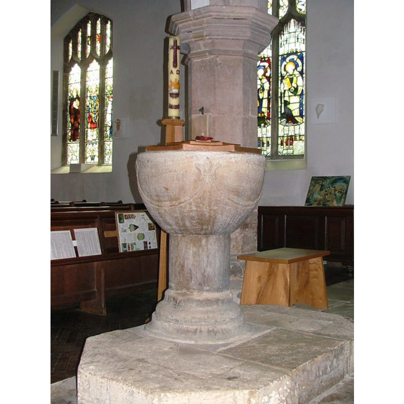
view of font and cover - west side
Copyright Statement: Image copyright © Janice Tostevin, 2011
Image Source: digital photograph taken 8 April 2011 by Janice Tostevin for BSI
Copyright Instructions: Standing permission
design element - motifs - floral - fleur-de-lis
![[cf. Font notes]](/static-50478a99ec6f36a15d6234548c59f63da52304e5/compressed/1110504012_compressed.png)
Scene Description: [cf. Font notes]
Copyright Statement: Image copyright © Janice Tostevin, 2011
Image Source: digital photograph taken 8 April 2011 by Janice Tostevin for BSI
Copyright Instructions: Standing permission
design element - motifs - scallop
Scene Description: [cf. Font notes]
Copyright Statement: Image copyright © Janice Tostevin, 2011
Image Source: digital photograph taken 8 April 2011 by Janice Tostevin for BSI
Copyright Instructions: Standing permission
view of church exterior - southwest end
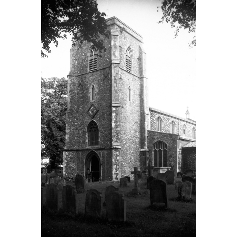
Copyright Statement: Image copyright © George Plunkett, 2014
Image Source: B&W photograph taken 28 August 1977 by George Plunkett [www.georgeplunkett.co.uk/Norfolk/H/Holt St Andrew's church tower [5834] 1977-08-28.jpg] [accessed 23 January 2014]
Copyright Instructions: Standing permission by Jonathan Plunkett
view of church exterior - northeast view
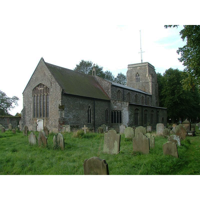
Copyright Statement: Image copyright © Simon Knott, 2004
Image Source: digital photograph taken November 2004 by Simon Knott [www.norfolkchurches.co.uk/holt/holt.htm]
Copyright Instructions: Standing permission
view of font in context
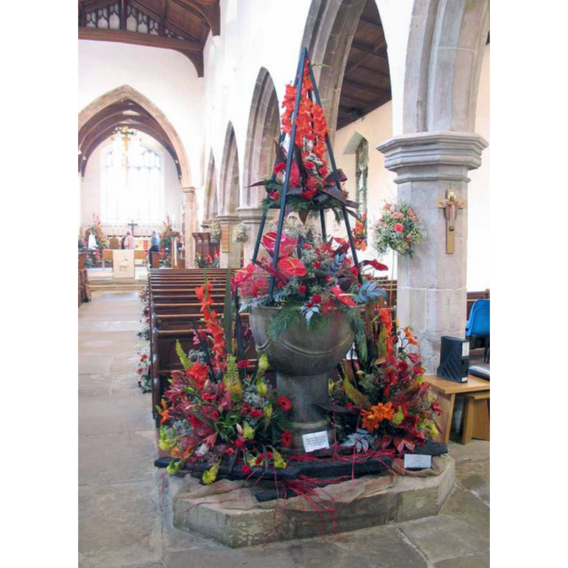
Scene Description: all decked up for the May Flower Festival
Copyright Statement: Image copyright © John Salmon, 2008
Image Source: digital photograph taken 4 May 2008 by John Salmon [www.geograph.org.uk/photo/816235] [accessed 23 January 2014]
Copyright Instructions: CC-BY-SA-3.0
view of font and cover in context
Copyright Statement: Image copyright © Simon Knott, 2004
Image Source: digital photograph taken November 2004 by Simon Knott [www.norfolkchurches.co.uk/holt/holt.htm]
Copyright Instructions: Standing permission
view of church interior - nave - looking west
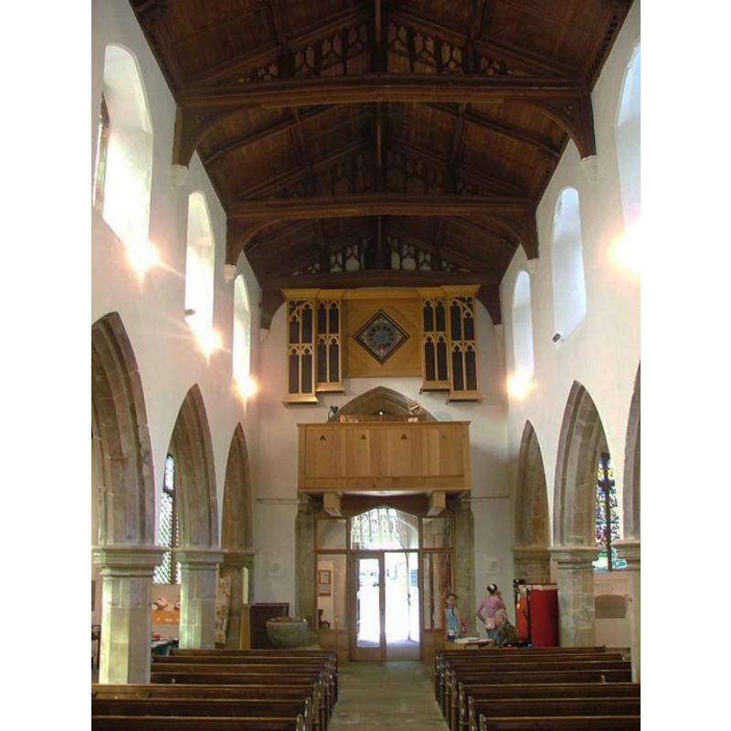
Scene Description: the font at the west end, to the south side of the west doorway
Copyright Statement: Image copyright © Simon Knott, 2004
Image Source: digital photograph taken November 2004 by Simon Knott [www.norfolkchurches.co.uk/holt/holt.htm]
Copyright Instructions: Standing permission
design element - motifs - moulding - graded
Copyright Statement: Image copyright © Janice Tostevin, 2011
Image Source: digital photograph taken 8 April 2011 by Janice Tostevin for BSI
Copyright Instructions: Standing permission
INFORMATION
Font ID: 12484HOL
Object Type: Baptismal Font1
Font Century and Period/Style: 12th - 13th century, Late Norman / Early English?
Church / Chapel Name: Parish Church of St. Andrew the Apostle, Holt
Font Location in Church: Inside the church, at the W end of the nave, on the S side
Church Patron Saint(s): St. Andrew
Church Address: 11 Church Street, Holt, Norfolk, NR25 6B, UK
Site Location: Norfolk, East Anglia, England, United Kingdom
Directions to Site: Located off the A148, about halfway, 15 km, between Cromer (ENE) and Fakenham (WSW), 37 km N of Norwich
Ecclesiastic Region: Diocese of Norwich
Historical Region: Hundred of Holt
Font Notes:
Click to view
There is an entry for Holt in the Domesday survey [http://domesdaymap.co.uk/place/TG0738/holt/] [accessed 23 January 2014], but it mentions neither church nor cleric in it. Blomeield (1805-1810) writes: "The Church of Holt is a rectory dedicated to St. Andrew [...] On May day, 1708, great part of the town was destroyed by a dreadful fire [...] Before the fire it had a nave, north and south isle, a square tower, with a spire so high as to be a sea-mark; the chancel, after this, was fitted up for the reception of the parishioners". The earliest reference to a church in Blomefield (ibid.) is to the date of the institution of "Thomas de Schotesham" as rector in 1305, although a church here must have existed prior to then, to judge by the font. The present font here is noted in Tyrrell-Green (1928) as a Norman font decorated with fleur-de-lys motif. In Pevsner & Wilson (1997) with date probably in the 13th century. Illustrated in Knott (2004). The font consists of a roughly hemispherical basin decorated with (four?) large scallop-like semi-circles the joints of which have the fleur-de-lis motif; raised on a plain cylindrical base and a round moulded lower base; on an irregular polygonal plinth. The octagonal wooden cover is modern.
Credit and Acknowledgements: We are grateful to Simon Knott, of Norfolk Churches, and to Janice Tostevin for their photographs of church and font; we are also grateful to Jonathan Plunkett for the photograph of this church taken by his father, George Plunkett, in August 1977
COORDINATES
UTM: 31U 371794 5863569
Latitude & Longitude (Decimal): 52.906483, 1.093647
Latitude & Longitude (DMS): 52° 54′ 23.34″ N, 1° 5′ 37.13″ E
MEDIUM AND MEASUREMENTS
Material: stone
Font Shape: hemispheric, mounted
Basin Interior Shape: round
Basin Exterior Shape: round
LID INFORMATION
Date: modern
Material: wood, oak?
Apparatus: no
Notes: [cf. FontNotes]
REFERENCES
- Blomefield, Francis, An essay towards a topographical history of Norfolk, 1805-1810, vol. 9: 394-400 / [www.british-history.ac.uk/report.aspx?compid=78576] [accessed 23 January 2014]
- Knott, Simon, The Norfolk Churches Site, Simon Knott, 2004. [standing permission to reproduce images received from Simon (February 2005]. URL: www.norfolkchurches.co.uk.
- Pevsner, Nikolaus, Norfolk 1: Norwich and North-East [2nd ed.], Harmondsworth: Penguin Books, 1997, p. 555
- Tyrrell-Green, E., Baptismal Fonts Classified and Illustrated, London: Society for Promoting Christian Knowledge: The Macmillan Co., 1928, p. 83