Y Ferwig / Ferwig / Verwic / Verwicke / Verwig / Y Verwig
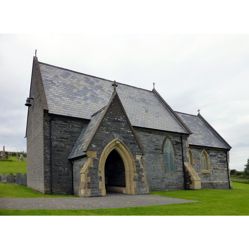
Image copyright © Rude Health, 2015
CC-BY-SA-2.0
Results: 1 records
view of church exterior - southwest view
Scene Description: "The church dates from 1842 [...] It was built in 1853-4 [...] The church was built against the tower of a medieval church. The tower became unsafe and was completely demolished in 1976" [COFLEIN, cf. FontNotes]
Copyright Statement: Image copyright © Rude Health, 2015
Image Source: edited detail of a digital photograph taken 9 September 2015 by Rude Health [www.geograph.org.uk/photo/4668557] [accessed 22 January 2020]
Copyright Instructions: CC-BY-SA-2.0
INFORMATION
Font ID: 12453YFE
Object Type: Baptismal Font1
Font Century and Period/Style: Medieval
Cognate Fonts: [cf. FontNotes]
Church / Chapel Name: Parish Church of St. Pedrog
Font Location in Church: reported inside the church ca. 1808 [cf. FontNotes]
Church Patron Saint(s): St. Petroc [aka Pedrog, Perreux, Petrock]
Church Address: Unnamed Rd, Ferwig, Cardigan SA43 1PX, UK
Site Location: Ceredigion, Wales, United Kingdom
Directions to Site: Located off (E) the B4548, 4 km N of Cardigan
Ecclesiastic Region: Diocese of St Davids
Historical Region: Hundred of Troedyraur -- formerly Cardiganshire
Additional Comments: disappeared font? (the one reported in in the church ca 1808)
Font Notes:
Click to view
Meyrick (1808) writes: "Within the church is the font, highly ornamented; which is a square bason on a a pillar". Lewis' Dictionary edition of 1849 notes of the Parish Church of St. Pedrog: "the font is elaborately ornamented". Evans (1914) reports that "the highly ornamented" font mentioned in Meyrick [cf. supra] was gone by his time and nothing was known of its whereabouts. The entry for this church in COFLEIN [https://coflein.gov.uk/en/site/400330/details/st-pedrogs-church-y-ferwig] [accessed 22 January 2020] notes: "The church dates from 1842 [...] It was built in 1853-4 [...] The church was built against the tower of a medieval church. The tower became unsafe and was completely demolished in 1976"; it mentions no font in it.
COORDINATES
UTM: 30U 386884 5775116
MEDIUM AND MEASUREMENTS
Material: stone
Font Shape: square, mounted
Basin Exterior Shape: square
REFERENCES
- Evans, J.T., The Church Plate of Cardiganshire, Stow-in-the-Wold: James H. Halden, 1914, p. 101
- Lewis, Samuel, A Topographical Dictionary of England, Comprising the Several Counties, Cities, Boroughs, Corporate and Market Towns, Parishes, Chapelries, and Townships, and the Islands of Guernsy, Jersey, and Man, with Historical and Statistical Descriptions [...], London: S. Lewis, 1831, [www.british-history.ac.uk/report.asp?compid=47890] [accessed 23 December 2006]
- Meyrick, Samuel Rush, The History and Antiquities of the County of Cardigan [...], London: Longman, Hurst, Rees, and Orme, 1808, p. 172