Nevern / Nanhyfer
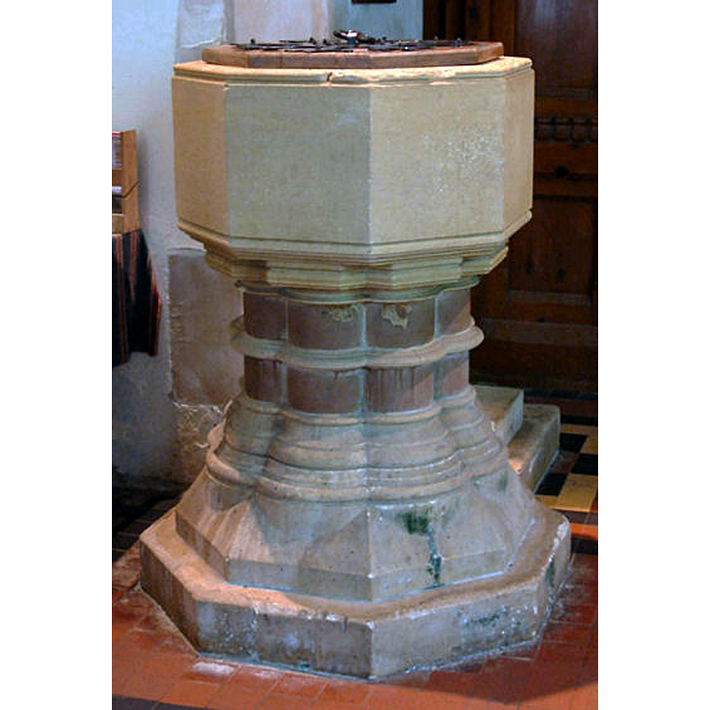
Image copyright © John Ball, 2003
CC-BY-SA-2.0
Results: 9 records
view of font and cover
Scene Description: the modern font
Copyright Statement: Image copyright © John Ball, 2003
Image Source: digital photograph taken 1 June 2003 by John Ball [www.jlb2011.co.uk/walespic/churches/nevern1.htm] [accessed 8 May 2019]
Copyright Instructions: CC-BY-SA-2.0
view of font and cover in context
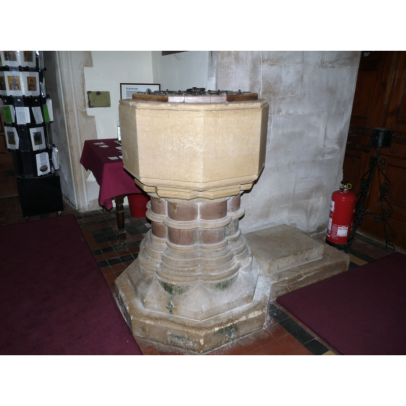
Scene Description: the 19th-century font
Copyright Statement: Image copyright © Mike Berrell, 2010
Image Source: digital photograph taken 21 June 2010 by Mike Berrell for BSI
Copyright Instructions: Standing permission
view of church exterior - churchyard, cemetery - cross
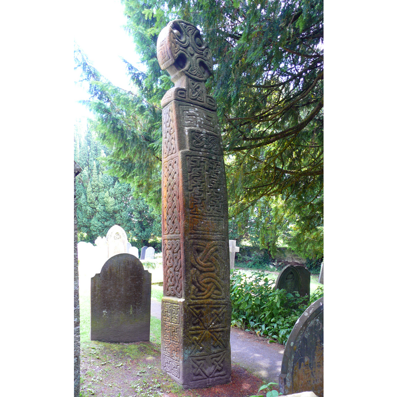
Scene Description: Source caption: "Mynwent Eglwys Nanhyfer / Nevern Church Cemetery. Croes Geltaidd Nanhyfer / Celtic Cross Nevern."
Copyright Statement: Image copyright © Ian Medcalf, 2014
Image Source: digital photograph taken 14 June 2014 by Ian Medcalf [www.geograph.org.uk/photo/4026603] [accessed 8 May 2019]
Copyright Instructions: CC-BY-SA-2.0
view of church exterior - tower - northwest view
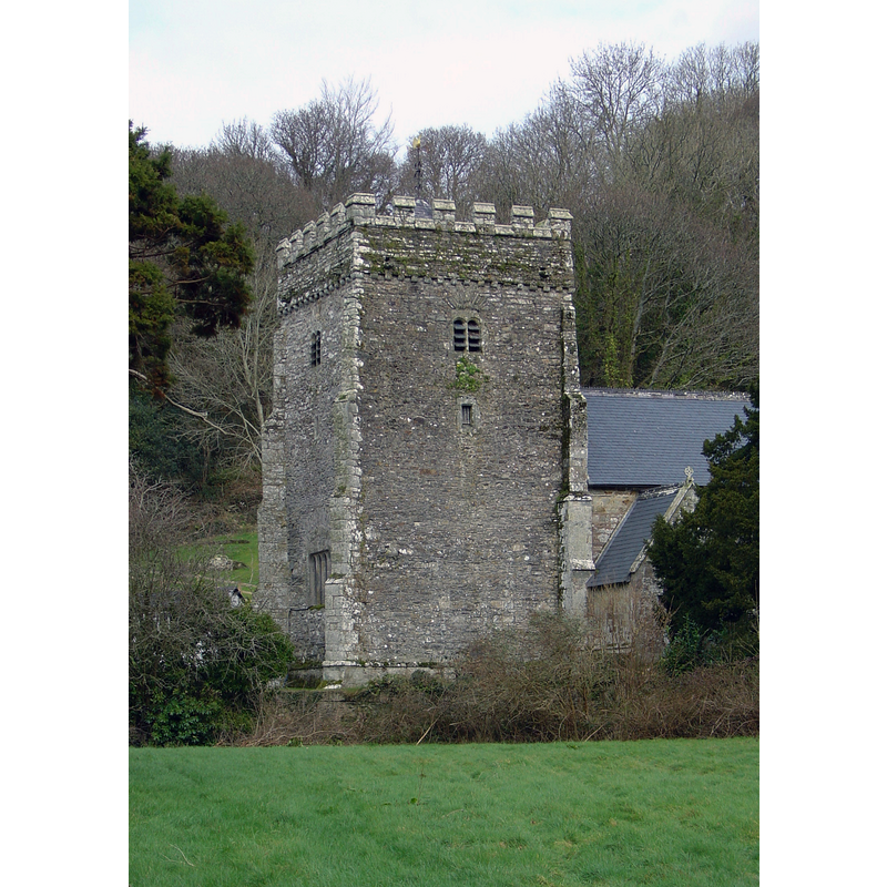
Copyright Statement: Image copyright © LinguisticDemographer, 2005
Image Source: digital photograph taken 21 February 2007 by LinguisticDemographer [https://commons.wikimedia.org/wiki/File:NevernChurchSW.jpg] [accessed 8 May 2019]
Copyright Instructions: CC-BY-SA-3.0
view of church exterior - northeast view
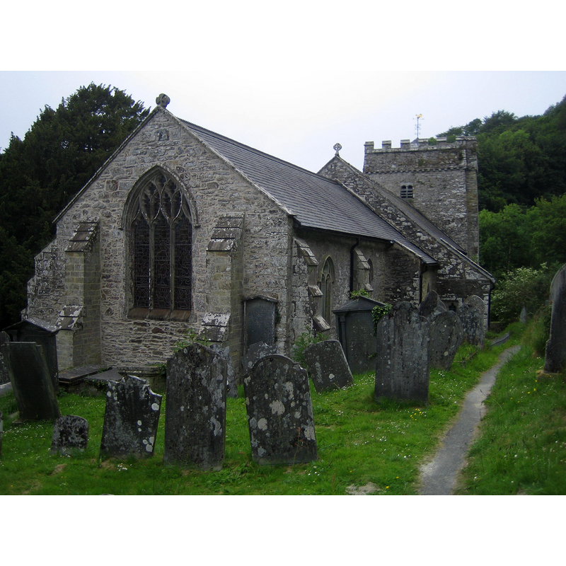
Copyright Statement: Image copyright © Chris Andrews, 2011
Image Source: digital photograph taken 2 June 2011 by Chris Andrews [www.geograph.org.uk/photo/2451892] [accessed 8 May 2019]
Copyright Instructions: CC-BY-SA-2.0
view of church exterior - southeast view
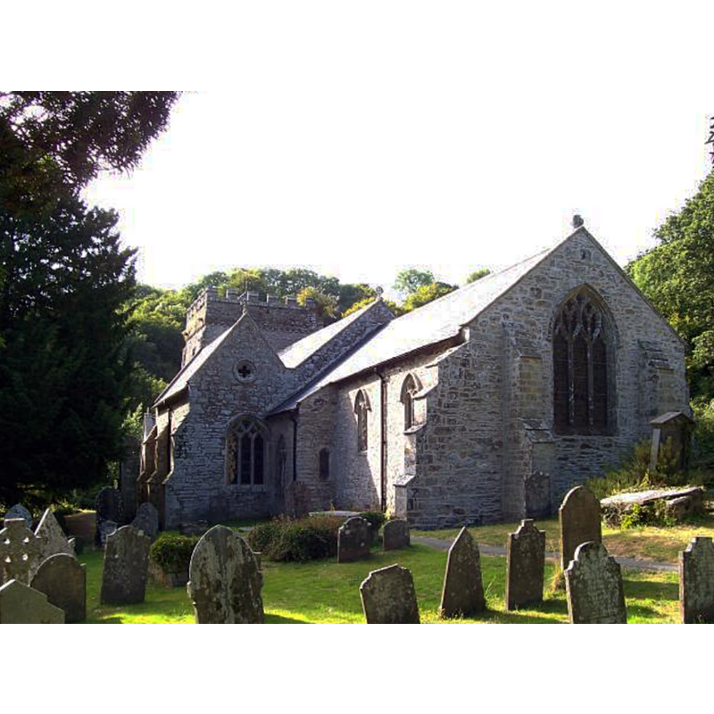
Scene Description: Source caption: "Church of St. Brynach, Nevern. The Church of St.Brynach at Nevern traces its origins back to the early Celtic Christians and contains several 5th-6th century engraved stones. In both church and the churchyard there are five of these stones. One of them is a pillar-stone that is inscribed both with Ogam and Latin script."
Copyright Statement: Image copyright © Cered, 2005
Image Source: digital photograph taken 21 July 2005 by Cered [www.geograph.org.uk/photo/29467] [accessed 8 May 2019]
Copyright Instructions: CC-BY-SA-2.0
view of church interior - tombstone
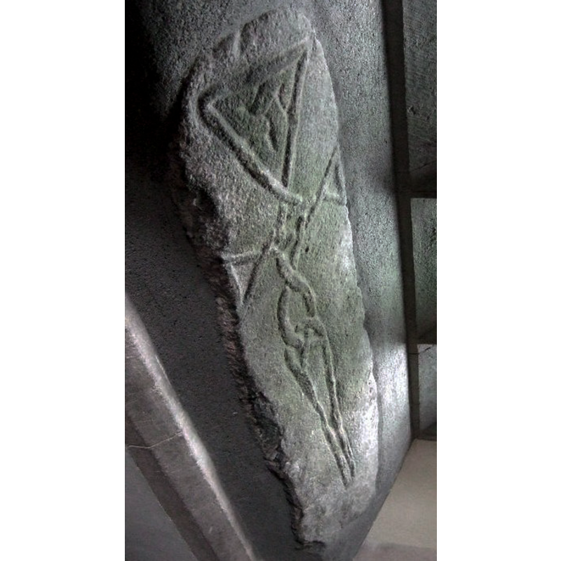
Scene Description: Source caption: "The Cross Stone at Nevern church. The image has been deliberately rotated to show the carving in an upright position.. The (unascribed) booklet obtainable within the church describes the complex interlacing of the cords running along the limbs of the cross as unusual and suggestive of an advanced date. Dillwyn Miles in A Book on Nevern quotes Dr Nash-Williams as stating that the pattern is typically Irish in form and dates from the C10. (To my eye the motif has a decidedly humanoid shape.)"
Copyright Statement: Image copyright © ceridwen, 2010
Image Source: digital photograph taken 17 February 2010 by ceridwen [www.geograph.org.uk/photo/1969827] [accessed 8 May 2019]
Copyright Instructions: CC-BY-SA-2.0
view of church interior - tombstone
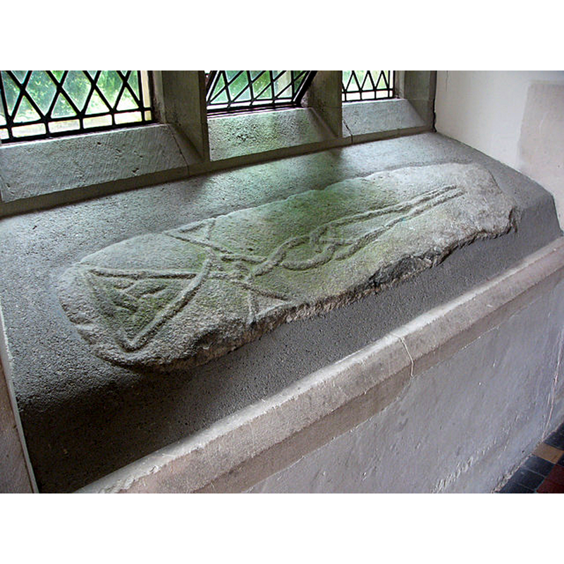
Copyright Statement: Image copyright © Chris Gunns, 2007
Image Source: digital photograph taken 10 August 2007 by Chris Gunns [www.geograph.org.uk/photo/544229] [accessed 8 May 2019]
Copyright Instructions: CC-BY-SA-2.0
design element - motifs - scallop
![[cf. Font notes]](/static-50478a99ec6f36a15d6234548c59f63da52304e5/others/image_not_available.jpg)
Scene Description: [cf. Font notes]
![[cf. Font notes]](/static-50478a99ec6f36a15d6234548c59f63da52304e5/bsi-testing-site/others/image_not_available.jpg)
INFORMATION
Font ID: 12446NEV
Object Type: Baptismal Font1
Font Century and Period/Style: 12th - 13th century, Late Norman / Transitional?
Church / Chapel Name: Parish Church of St. Brynach / Eglwys Nanhyfer
Font Location in Church: Inside the church, at the SW end of the nave, by the S side of the tower arch
Church Patron Saint(s): St. Brynach
Church Notes: 12-13 feet high ancient cross in the churchyard
Church Address: Coed Castell, Nevern, Newport, UK -- Tel.: +44 29 2034 8200
Site Location: Pembrokeshire, Wales, United Kingdom
Directions to Site: Located off (N) the A467, 3 km ENE of Newport, 8 km ENE of Fishguard, 13-14 km NE of Cardigan
Ecclesiastic Region: Diocese of St Davids
Additional Comments: disused font (the medieval one -- the font in use is 19thC)
Font Notes:
Click to view
The article 'St Brynach’s Church, Nevern, Pembrokeshire, Wales' in The Journal of Antiquities (February 21, 2014 by sunbright57 ) [https://thejournalofantiquities.com/2014/02/21/st-brynachs-church-nevern-pembrokeshire-wales/] [accessed 8 May 2019] notes: "There was quite probably a monastery here c 540 AD, and maybe even some sort of ecclesiastical centre, but then in the 12th century a Norman church was built on the site, today only the tower of that building remains, the rest being from the 14th and 15th centuries onwards through to 1864 when restoration took place"; [no font mentioned in it]. A font here is noted in Thurlby (2006) in a long "List of scalloped table-top fonts in Pembrokeshire". The entry for this church in British Listed Buildings [https://britishlistedbuildings.co.uk/300012746-church-of-st-brynarch-nevern#.XNLmeIp7lrQ] [accessed 8 May 2019] notes: "C15 Anglican parish church with earlier tower, much restored 1864 [...] Fine 1864 Bath stone font and pulpit. Dismantled medieval font, square shallow basin chamfered to circular base." The font in use at this church now [June 2010] is the modern one of 1864 [cf. supra], consisting of an almost plain octagonal basin with moulded underbowl, raised on clustered columns with moulded bases, and an octagonal plinth with kneeling stone. The wooden cover is octagonal and flat, with metal decoration and ring handle, also Victorian.
COORDINATES
UTM: 30U 376861 5765409
Latitude & Longitude (Decimal): 52.02563, -4.7948
Latitude & Longitude (DMS): 52° 1′ 32.27″ N, 4° 47′ 41.28″ W
MEDIUM AND MEASUREMENTS
Material: stone
Font Shape: square, mounted
Basin Exterior Shape: square
REFERENCES
- Thurlby, Malcolm, Romanesque architecture and sculpture in Wales, Little Logaston, Woonton, Almeley, Herts.: Logaston Press, 2006, p. 188