Wroxton / Werochestan
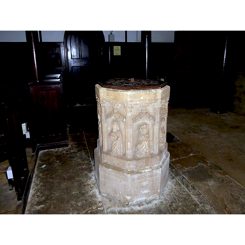
Image copyright © Basher Eyre, 2016
CC-BY-SA-2.0
Results: 5 records
view of font and cover in context
Copyright Statement: Image copyright © Basher Eyre, 2016
Image Source: digital photograph taken 31 August 2016 by Basher Eyre [www.geograph.org.uk/photo/5098755] [accessed 7 November 2017]
Copyright Instructions: CC-BY-SA-2.0
view of font and cover
![19th-century re-carving [cf. Font notes]](/static-50478a99ec6f36a15d6234548c59f63da52304e5/compressed/1090913047_compressed.png)
Scene Description: 19th-century re-carving [cf. Font notes]
Copyright Statement: Image copyright © John Ward, 2009
Image Source: digital photograph taken 19 July 2009 by John Ward
Copyright Instructions: Standing permission
view of church exterior - southwest view
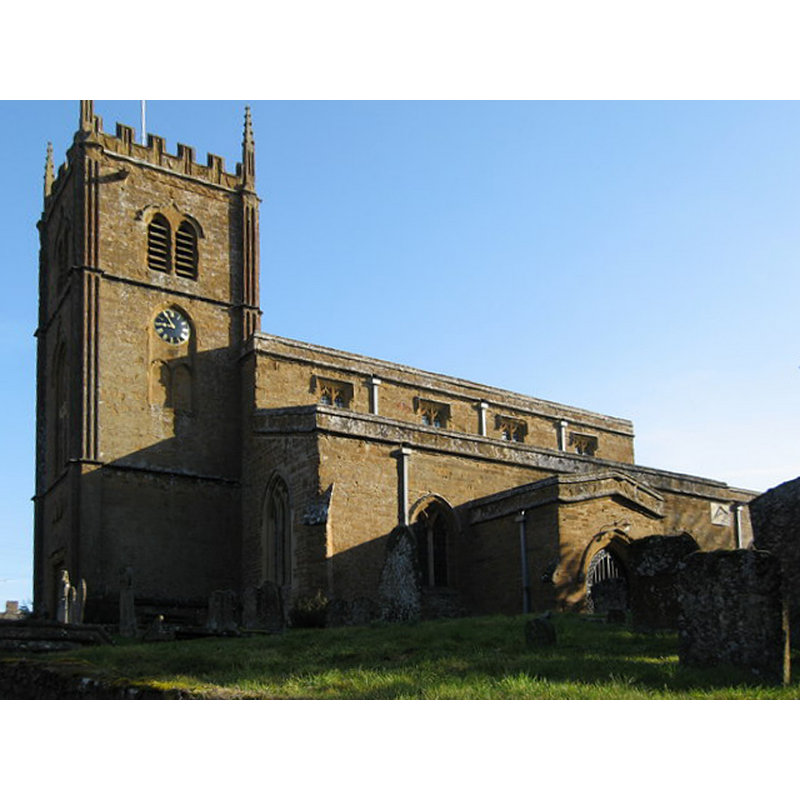
Scene Description: Source caption: "All Saints Church, Wroxton. Although there is documented evidence of Wroxton church from 1217, the present All Saints appears to be chiefly 14th and 15th century. There are, however, traces of a medieval wall painting above the chancel screen. The tower was designed by Sanderson Miller and begun in 1748".
Copyright Statement: Image copyright © Richard Rogerson, 2010
Image Source: digital photograph taken 13 March 2010 by Richard Rogerson [www.geograph.org.uk/photo/1771681] [accessed 7 November 2017]
Copyright Instructions: CC-BY-SA-2.0
view of church exterior - north view
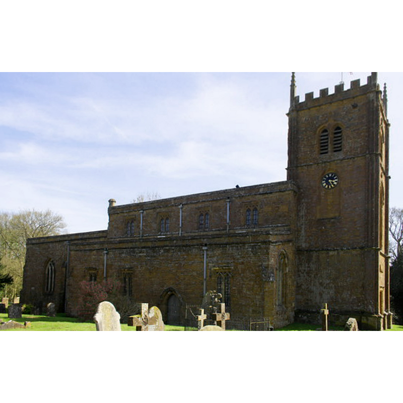
Copyright Statement: Image copyright © Roger Templeman, 2016
Image Source: digital photograph taken 20 April 2016 by Roger Templeman [www.geograph.org.uk/photo/4916640] [accessed 7 November 2017]
Copyright Instructions: CC-BY-SA-2.0
view of church interior - nave - looking west
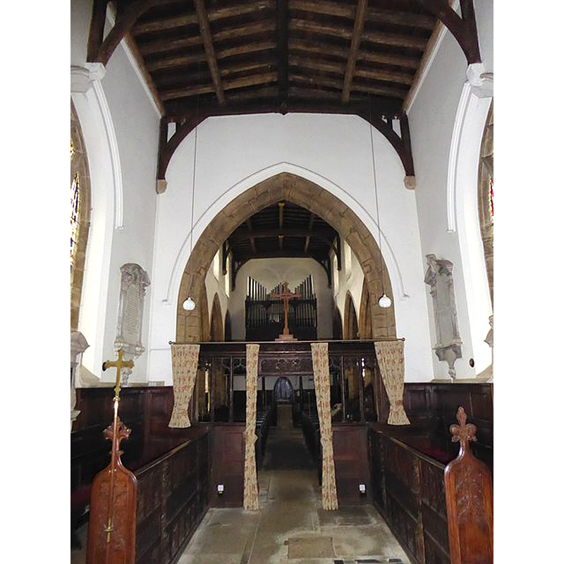
Copyright Statement: Image copyright © Basher Eyre, 2016
Image Source: digital photograph taken 31 August 2016 by Basher Eyre [www.geograph.org.uk/photo/5098891] [accessed 7 November 2017]
Copyright Instructions: CC-BY-SA-2.0
INFORMATION
Font ID: 12441WRO
Object Type: Baptismal Font1
Font Century and Period/Style: 14th century [re-carved in 1845-1846], Decorated [altered]
Church / Chapel Name: Parish Church of All Saints
Font Location in Church: Inside the church, in the W end of the nave
Church Patron Saint(s): All Saints
Church Address: Church Street, Wroxton, Oxfordshire, OX15 6QE, UK
Site Location: Oxfordshire, South East, England, United Kingdom
Directions to Site: Located 5 km WNW of Banbury
Ecclesiastic Region: Diocese of Oxford
Historical Region: Hundred of Bloxham
Additional Comments: altered font? (re-carved in the 19thC)
Font Notes:
Click to view
There is an entry for Wroxton [variant spelling] in the Domesday survey [http://opendomesday.org/place/SP4141/wroxton/] [accessed 7 November 2017], but it mentions neither priest nor church in it. Lewis' Dictionary of 1848 reports: "at the west end of the nave is an ancient stone font ornamented with sculpture and figures of six of the Apostles." The Ecclesiastical and Architectural Topography of England: Oxfordshire (1850) mentions "a good font" in this Decorated church. The Victoria County History (Oxford, vol. 9, 1969) notes: "Structurally there is no sign of anything earlier than the 14th century, when the whole fabric appears to have been refashioned or altogether rebuilt [...] In 1845–6 the font was entirely recarved."
Credit and Acknowledgements: We are grateful to John Ward, of Oxfordshire Churches [http://homepage.mac.com/john.ward/oxfordshirechurches], for his photograph of this font
COORDINATES
UTM: 30U 610139 5770276
Latitude & Longitude (Decimal): 52.072104, -1.393026
Latitude & Longitude (DMS): 52° 4′ 19.57″ N, 1° 23′ 34.9″ W
MEDIUM AND MEASUREMENTS
Material: stone
Font Shape: octagonal, mounted
Basin Interior Shape: round
Basin Exterior Shape: octagonal
LID INFORMATION
Date: 19th-century?
Material: wood, oak?
Apparatus: no
Notes: octagonal and flat, with metal decoration and ring handle
REFERENCES
- Victoria County History [online], University of London, 1993-. URL: https://www.british-history.ac.uk.
- Lewis, Samuel, A Topographical Dictionary of England, Comprising the Several Counties, Cities, Boroughs, Corporate and Market Towns, Parishes, Chapelries, and Townships, and the Islands of Guernsy, Jersey, and Man, with Historical and Statistical Descriptions [...], London: S. Lewis, 1831, [www.british-history.ac.uk/report.asp?compid=51434] [accessed 20 December 2006]
- Parker, John Henry, The Ecclesiastical and architectural topography of England: Oxfordshire, Oxford, London: Published under the sanction of the Central Commitee of the Archaeological Institute of Great Britain and Ireland [by] John Henry Parker, 1850, [unpaged -- entry 153] / [http://books.google.ca/books?id=maikb1i3wSUC&pg=PT144&lpg=PT144&dq=longcot+church+font&source=web&ots=p3k5tJJE6J&sig=KYjkm8H5wOoAuH7BvnLp7JqMPus&hl=en&sa=X&oi=book_result&resnum=6&ct=result#PPA17,M1] [accessed 31 December 2008]