South Croxton / Crochestone / Crockefstone / Crofton / Vroptone / Crowfon
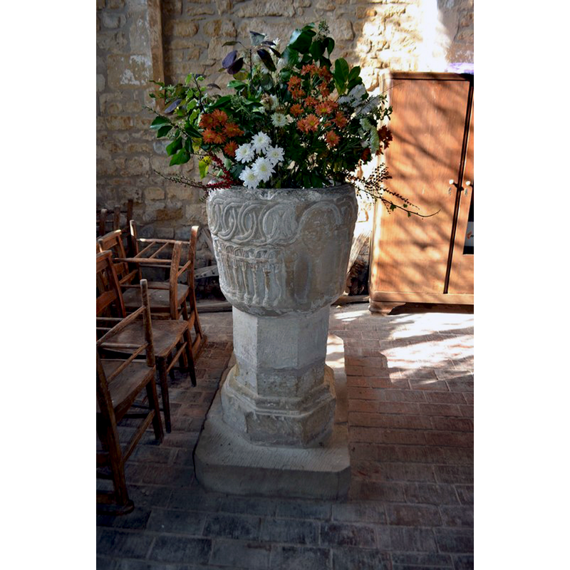
Image copyright © Ashley Dace, 2011
CC-BY-SA-2.0
Results: 10 records
view of font in context - east side
Scene Description: [NB: orientation is approximate] -- the font at the west end of the south aisle
Copyright Statement: Image copyright © Ashley Dace, 2011
Image Source: digital photograph taken 15 October 2011 by Ashley Dace [www.geograph.org.uk/photo/2650131] [accessed 4 March 2015]
Copyright Instructions: CC-BY-SA-2.0
view of basin - east side
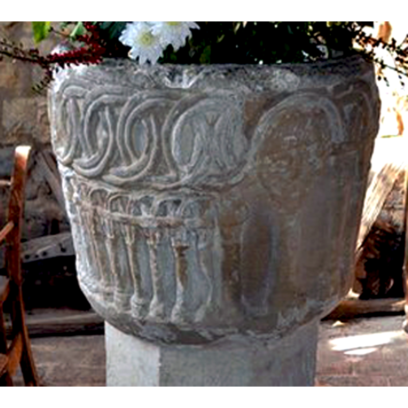
Scene Description: with the human mask, face or head on the northeast side
Copyright Statement: Image copyright © Ashley Dace, 2011
Image Source: deteil of a digital photograph taken 15 October 2011 by Ashley Dace [www.geograph.org.uk/photo/2650131] [accessed 4 March 2015]
Copyright Instructions: CC-BY-SA-2.0
design element - motifs - interlace - linked rings
![double rings [cf. Font notes]](/static-50478a99ec6f36a15d6234548c59f63da52304e5/compressed/1150304017_compressed.png)
Scene Description: double rings [cf. Font notes]
Copyright Statement: Image copyright © Jonathan Billinger, 2009
Image Source: digital photograph taken 28 January 2009 by Jonathan Billinger [www.geograph.org.uk/photo/1139900] [accessed 4 March 2015]
Copyright Instructions: CC-BY-SA-2.0
design element - architectural - arcade - blind - round arches - double arches - intersecting arches - columns with capitals and bases
Scene Description: [cf. Font notes]
Copyright Statement: Image copyright © Jonathan Billinger, 2009
Image Source: digital photograph taken 28 January 2009 by Jonathan Billinger [www.geograph.org.uk/photo/1139900] [accessed 4 March 2015]
Copyright Instructions: CC-BY-SA-2.0
view of church exterior - northeast view
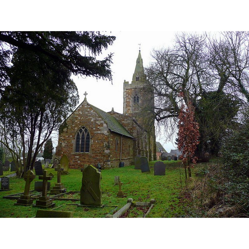
Copyright Statement: Image copyright © Jonathan Billinger, 2009
Image Source: digital photograph taken 28 January 2009 by Jonathan Billinger [www.geograph.org.uk/photo/1139895] [accessed 4 March 2015]
Copyright Instructions: CC-BY-SA-2.0
view of church exterior - southwest view
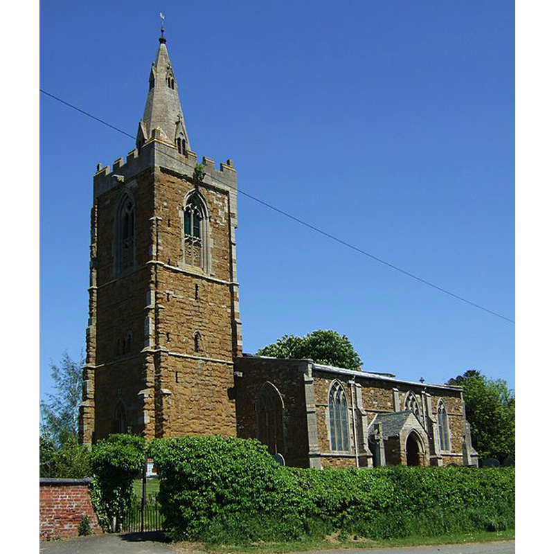
Copyright Statement: Image copyright © JThomas, 2012
Image Source: digital photograph taken 26 May 2012 by JThomas [www.geograph.org.uk/photo/2963087] [accessed 4 March 2015]
Copyright Instructions: CC-BY-SA-2.0
view of church interior - nave - looking east
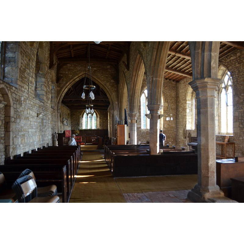
Copyright Statement: Image copyright © Ashley Dace, 2011
Image Source: digital photograph taken 15 October 2011 by Ashley Dace [www.geograph.org.uk/photo/2650135] [accessed 4 March 2015]
Copyright Instructions: CC-BY-SA-2.0
view of church interior - nave - looking southwest
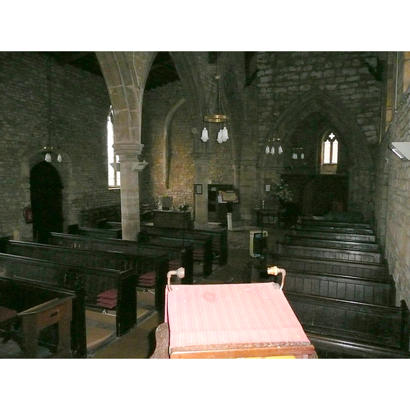
Scene Description: view across to the west end, with the font visible at the west end of the south aisle, left across the arcade
Copyright Statement: Image copyright © Jonathan Billinger, 2009
Image Source: digital photograph taken 28 January 2009 by Jonathan Billinger [www.geograph.org.uk/photo/1139899] [accessed 4 March 2015]
Copyright Instructions: CC-BY-SA-2.0
human figure - head, face or mask
![on the northeast side of the basin [NB: orientation is approximate] [cf. Font notes]](/static-50478a99ec6f36a15d6234548c59f63da52304e5/others/permission_not_available.jpg)
Scene Description: on the northeast side of the basin [NB: orientation is approximate] [cf. Font notes]
Copyright Statement: Image copyright © Tina Manthorpe, 2007
Image Source: digital photograph by Tina Manthorpe, April 2007 [http://www.flickr.com/photos/84265607@N00/2209130622/in/pool-68878292@N00] [accessed 12 April 2008]
Copyright Instructions: PERMISSION NOT AVAILABLE -- IMAGE NOT FOR PUBLIC USE
view of basin - north side
Copyright Statement: Image copyright © Tina Manthorpe, 2007
Image Source: digital photograph by Tina Manthorpe, April 2007 [http://www.flickr.com/photos/84265607@N00/2209130622/in/pool-68878292@N00] [accessed 12 April 2008]
Copyright Instructions: PERMISSION NOT AVAILABLE -- IMAGE NOT FOR PUBLIC USE
INFORMATION
Font ID: 12424CRO
Object Type: Baptismal Font1
Font Century and Period/Style: 12th century [basin only] -- 14th-century (?) [base only] [composite font], Medieval / composite
Church / Chapel Name: Parish Church of St. John the Baptist
Font Location in Church: Inside the church, at the W end of the S aisle
Church Patron Saint(s): St. John the Baptist
Church Address: 17 Main Street, South Croxton, Leicestershire LE7 3RJ, UK
Site Location: Leicestershire, East Midlands, England, United Kingdom
Directions to Site: Located off (S) the B674, 7 km NE of Leicester, 11 km SW of Melton-Mowbray
Ecclesiastic Region: Diocese of Leicester
Historical Region: Hundred of Goscote [in Domesday]
Additional Comments: altered font: composite font -- village name (traditionally pronounced "crow-sun" [ˈkroʊsən])
Font Notes:
Click to view
There are two entries for [South] Croxton [variant spelling] in the Domesday survey [http://domesdaymap.co.uk/place/SK6910/south-croxton/] [accessed 4 March 2015], neither of which mentions cleric or church in it. Pevsner (1984) writes: "Font. Norman, of tub shape. Coarsely decorated. A tier of closely-set intersected arches and above this another of intersected rings." Described in the South Croxton web page [www.south-croxton.co.uk/church_history.htm] [accessed 21 October 2007] :"The present church replaced that original building, and dates mostly from the early 14th.century [...] There is evidence of some Norman foundations in the north aisle, which was not built; and the Norman font was placed in the new church, given a 14th. century octagonal base, and is still in use." The bucket-shaped basin has a combination of decorative motifs; the upper basin side has a pattern of linked rings on one side, above a narrow blind arcade of intersecting round arches below; around the back from that, the upper side has the round arches of a much larger and wider arcade similar in design to the other one, but the last arch-head contains a large rounded human face or mask; the lower rim appears to have been decorated with a rope moulding, but it is too worn to be discerned with any certainty. It is a pity that, whereas the other sides, though damaged at the upper rim, have managed to retain the crispness and detail of the original carving, the side with the mask or head, which one would associate with the 'main' side of the font, has lost some its sharpness. The polygonal pedestal base is a later [14th-century?] replacement.
COORDINATES
UTM: 30U 636670 5839298
Latitude & Longitude (Decimal): 52.686343, -0.978015
Latitude & Longitude (DMS): 52° 41′ 10.84″ N, 0° 58′ 40.85″ W
MEDIUM AND MEASUREMENTS
Material: stone
Font Shape: bucket-shaped, mounted
Basin Interior Shape: round
Basin Exterior Shape: round
Drainage Notes: lead-lined
REFERENCES
- Pevsner, Nikolaus, Leicestershire and Rutland, Harmondsworth: Penguin Books, 1984, p. 382